Continued snowfall expected in Cascades
Published 4:00 am Friday, March 10, 2006
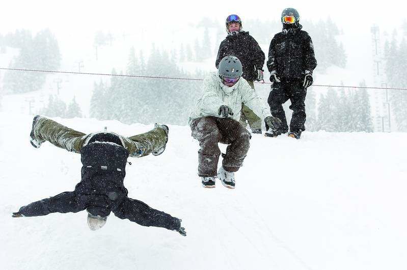
- Max Burke, left, 15, and Josh Young-Smith, 17, leap off a 15-foot snowbank into the soft powder below on Thursday afternoon in the Mt. Bachelor parking lot. On top of the bank, Tanner Brooks, left, 13, and James Myers, 17, watch.
Spring might be right around the corner, but it’s not time to put away the snow shovel yet.
A winter storm warning for the Cascades was continued through 4 a.m. today, according to the National Weather Service.
The warning included Government Camp, Detroit, Santiam Pass, McKenzie Bridge, Oakridge and Willamette Pass. Six to 12 inches of snow were expected overnight, and an additional 3 to 6 inches could fall in the mountains today.
In Central Oregon, meteorologist Diann Coonfield with the National Weather Service said a pattern of weather including rain and snow showers is expected to continue through Tuesday. Temperatures will range from the teens at night to the upper 30s during the day.
”An upper level, off-shore front went through (Wednesday) night and gave a lot of wind and rain everywhere,” Coonfield said Thursday.
That storm dumped almost 30 inches of fresh snow at Mt. Bachelor Ski Area, according to its Web site, in a 24-hour period. Mt. Hood Meadows Ski Resort received 24 new inches of snow in the same amount of time, according to its Web site.
Both ski areas are reporting significant snowpacks with Mt. Hood having a midmountain base of 22 feet and Mt. Bachelor having a midmountain base of about 16 feet.
The storm also impacted travel in Oregon, causing Highway 58 to be conditionally closed east of Oakridge to the Crescent Lake Junction, according to the Oregon Department of Transportation. The conditional closure means that all vehicles are required to use chains.
In a prepared statement, ODOT advised motorists not travel over the Central and Northern Oregon Cascades while the winter storm warning continues.
For road reports, visit www .tripcheck.com or call 511.
More Local News


Best of the Best of Bend 2025

-
-
-