Haystack Reservoir
Published 4:00 am Friday, December 7, 2007

- Haystack Reservoir
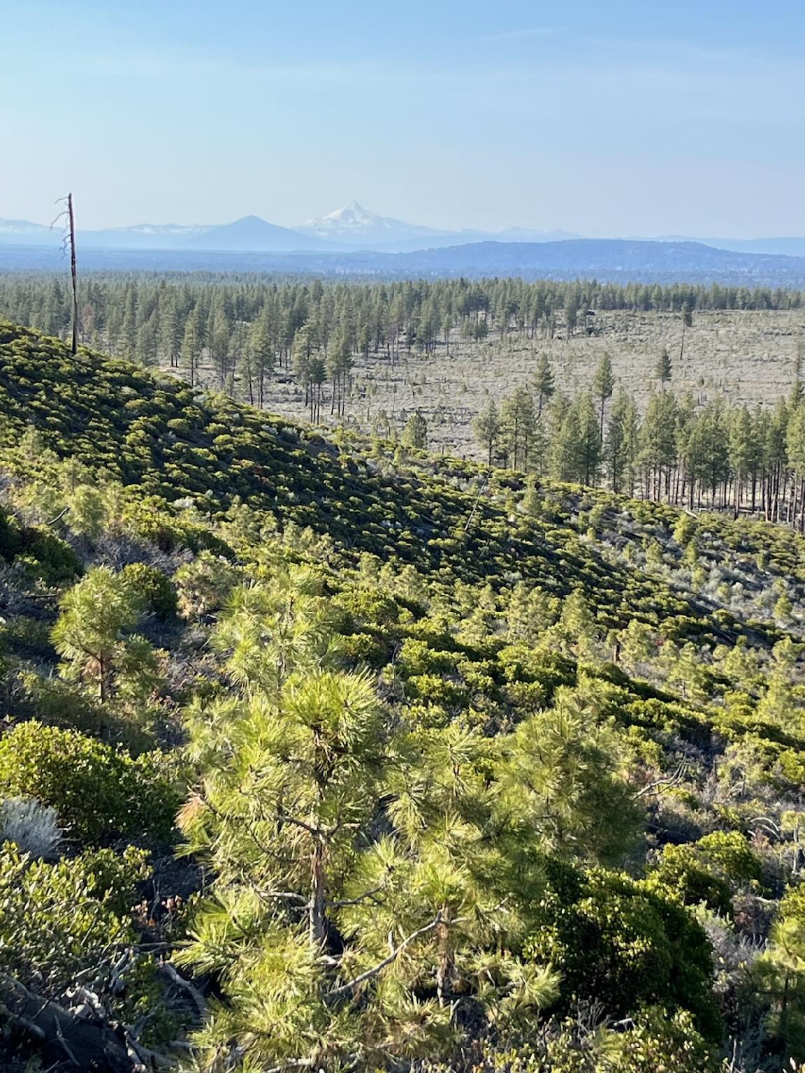
The Crooked River National Grassland is at the epicenter of Central Oregon’s banana belt.
Around here, that means juniper and sagebrush instead of mangoes, papayas and plantains. Banana belt is a relative term.
Quite often, the undulating plains and canyons north of Redmond are snow free while most higher elevation spots are locked in a wintry grip.
I’d blown by the turn off to Haystack Reservoir countless times headed for Madras or other points north. I’d always pictured loud ski boats and personal watercraft and anglers fishing for bass.
A fairly accurate perception — for August. But Haystack Reservoir this time of year is an entirely different kind of place. Gone are the sun seekers of summer. All that mechanized fun is replaced by a quiet beauty, a brisk breeze and a fisherman or two bundled against the cold trying for one of the big stocker trout the Oregon Department of Fish and Wildlife releases periodically. This time of year it’s a good place to spot birds and wildlife or walk the shore contemplating whatever it is people contemplate while watching wind-whipped wavelets ripple against the beach.
There’s a campground on the east shore of the reservoir, but it’s closed for the winter. A little paved road leads past several sites along the shore that come with picnic tables and fire rings. There are restroom facilities.
Anglers ply these waters for largemouth bass, catfish and crappie during the warmer months and rainbow trout in winter.
Haystack Reservoir is a relatively new development on the Central Oregon landscape.
According to the Bureau of Reclamation, the countryside around present-day Culver was lush and tropical some 40 million years ago. About that time, volcanoes were exploding, spewing rapidly moving rivers of lava. About 15 million years ago, a complex of volcanoes erupted to the south, building a large mountain that’s since eroded into nearby Smith Rock and Gray Butte. Even more recently, Mount Mazama to the south erupted 7,000 years ago, coating this region with a foot-and-a-half of volcanic ash.
That ash increased soil productivity and made the area around Culver and Madras prime for agriculture. First, the homesteaders came and grazed their livestock and established orchards.
Then came the farmers.
The Bureau of Reclamation built Haystack Reservoir in 1956 as a 62,000 acre-feet storage facility for the surrounding agricultural interests. The project waters thousands of acres of garlic, beets, potatoes and seed crops.
If your late fall/winter’s drive takes you to Haystack, another point of historical interest is just 3.5 miles east along the road that skirts the reservoir. Gray Butte Cemetery, in the shadow of its namesake, dates back to the 19th century and contains the graves of some of the earliest settlers to the area. Their homesteads are long gone but their headstones remain, some dating back to the late 1800s.
From Redmond, drive about 15 miles north on U.S. Highway 97 and turn right at the turnoff to Haystack Reservoir. Another right turn takes you to the west shore of the impoundment. Gas engines are allowed on the water. See the Oregon Sport Fishing Regulations for fishing restrictions. No Northwest Forest Pass is required.
— Jim Witty


Best of the Best of Bend 2025

-
-
-