Horse Butte
Published 5:00 am Friday, April 17, 2009
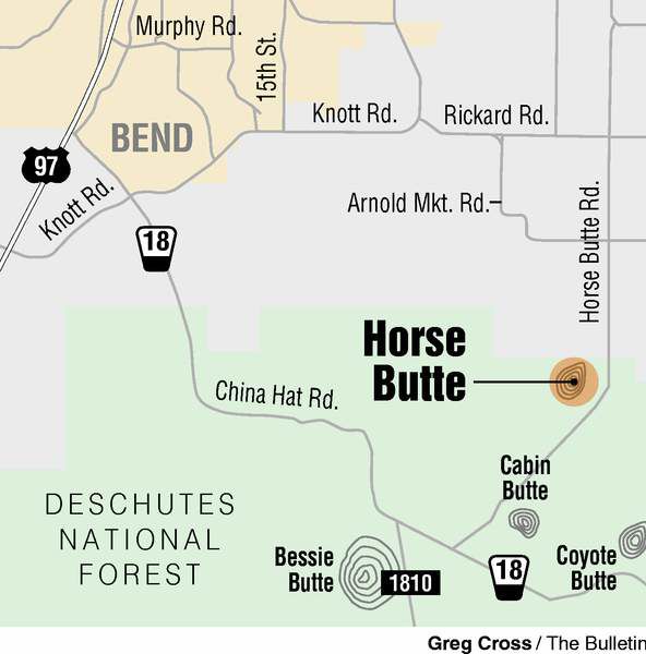
- Horse Butte
Horse Butte is known for, well, horses. And it often is confused with Horse Ridge, which is also located southeast of Bend.
While Horse Ridge is a popular mountain-biking destination, Horse Butte is not.
Trending
But perhaps it should be.
On a crisp, partly sunny evening this week I biked the Horse Butte area for the first time — and I’ve lived in Central Oregon for eight years.
The singletrack trails are only about five miles from Bend, yet they are somehow remote. And they are fairly easy to ride, yet somehow adventurous.
Near Horse Butte, mountain bikers are more likely to cross paths with a horse rider or a trail runner than with one of their own.
“If you see people, they probably won’t be on bikes,” said Chris Kratsch, trail maintenance coordinator for the Central Oregon Trail Alliance (COTA). “It’s definitely an under-used resource for mountain bikers. We (COTA) would like to see people get out and use other areas, and not just use the same old, same old.”
Kratsch, who is familiar with the Horse Butte area, accompanied me on my ride.
Trending
After a 10-minute drive to the trailhead, we hopped on our bikes and were immediately immersed in vast expanses of sage brush and burned, dead trees. It doesn’t sound particularly eye-pleasing, but the area is beautiful in its own way.
The High Desert stretched before us to the east, and snow-covered Cascade Mountain peaks rose behind us to the west. We chose to ride the Coyote Loop, an 11-mile intermediate ride that took us around and through an area known as the Skeleton Burn.
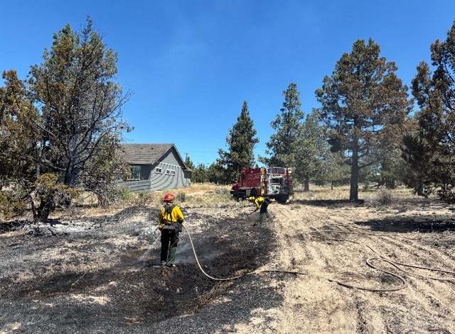
The 1996 Skeleton Fire burned 17,000 acres and 21 homes in the nearby Sundance neighborhood.
Trails near Horse Butte, all on Forest Service land, offer wide-open riding and broad, breathtaking views, a nice break from the tucked-into-trees riding typically found west of Bend.
The trails were mostly flat and relatively easy, but bikers should not be overconfident. My pedal rammed into an occasional surprise rock along the trail. A few technical sections require maneuvering over rocky hills, but Horse Butte seems to be the perfect place to start the season.
“Early season, you don’t want to get too beat up,” Kratsch said.
We found the trails in superb condition. Recent cold temperatures had hardened the dirt, making for smooth, fast riding.
Kratsch said the area should stay ridable through about mid-June, when horse riders come in full force. The horses leave ruts from hoof marks, and the trails become soft and sandy.
“We get enough rain and thunderstorms (in the spring) that it keeps everything packed down pretty well,” Kratsch said.
From the Horse Butte area mountain bikers can connect to the Swamp Wells trail and, if they really want to, ride south nearly 30 miles all the way to Newberry Crater, depending on snow conditions.
The Coyote Loop took us about 1½ hours to complete, including time to stop for photos. The ride was never challenging physically, but it did offer a sense of solitude and adventure not always found on trails choked with other users. We did not see another person during our entire ride.
“It’s intermediate (riding), but you have to be willing to be a little more adventurous,” Kratsch said. “It’s nice to get away from everybody out there.”
Some of the trails near Horse Butte cross China Hat Road, an area popular for shotgun-target practice, and notorious for the unauthorized dumping of trash and a variety of criminal activities.
We heard a few harmless shotgun blasts during our ride, but we saw no trash.
“The trail was in great condition,” Kratsch said, “and it’s a great time of year.”
Breaking down the trail: Horse Butte
DIRECTIONS
From Bend, travel south on 27th Street or east on Knott Road to Rickard Road. Travel two miles east on Rickard Road, then turn right (south) on Billadeau Road, which turns into Horse Butte Road. The road becomes gravel, marked by a Deschutes National Forest sign. Continue along the road, and park near the Horse Butte Trailhead sign. Trails start from here. The Coyote Loop singletrack begins a half-mile south down the gravel road, on the left, marked by a Forest Service sign. Map: Treadmaps, Central Oregon, Part 2.
TRAIL FEATURES
Rolling, open singletrack through sagebrush and a burn area, just five miles southeast of Bend. Views of the High Desert to the east and the Cascade Mountains to the west. The area is best to ride in the winter and spring. By summertime, the trails can be soft and dusty and marred by horse hooves.
LENGTH
There are several loop options. Coyote Loop is a good intermediate choice, about 11 miles of rolling terrain, with a few short technical spots. The loop is marked by white diamond markers.
RATING
Aerobically easy and technically intermediate.
Marketplace


Best of the Best of Bend 2025

-
eEdition

-

-