Lava Butte is more than it seems
Published 5:00 am Thursday, September 23, 2010
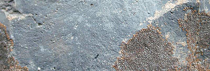
- Rocks created by the Lava Butte lava flow come in an amazing array of textures, from pitted to smooth to delicate-looking.
Sometimes a rainy day is just a rainy day, squelching plans and dampening spirits all around.
Sometimes, though, a rainy day is an opportunity to see something ordinary in an entirely new way.
Lava Butte and its adjacent, nine-square-mile lava flow becomes a study in textures when viewed through the damp drizzle of a Saturday in September.
Normally home to impressive vistas of the Cascade peaks and a 360-degree view of Central Oregon, Lava Butte withdraws in the rain, its usually expansive views constrained by drifting clouds. Socked in by a low, gray sky, the lava flow that emerged from its flank 7,000 years ago seems never more alien and otherworldly than when covered by mists, its borders masked.
My eye pulled inward in reaction to these circumstances, its focus shifted from the mountain views I expected to the immediacy of the rock and the stunted trees and shrubs that dot the lava flow. Instead of a sweeping arch of black lava girding Lava Butte, I saw the delicate surfaces of each individual rock, and noted the beauty of the contrasting textures.
Velvety green moss blanketed one chunk of rock. Lime lichen created a lacy pattern on another. The feathery yellow flowers of gray rabbitbrush oscillated in the faint wind next to the smooth, gleaming trunk of a juniper, long weathered and polished by the vicissitudes of the weather.
It’s remarkable what you can see when not distracted by postcard visions and bluebird skies.
Lava Butte is a 500-foot cinder cone rising in the northwest portion of the 500-square-mile shield volcano known as Newberry Volcano. Newberry — one of the largest shield volcanoes in the U.S. — includes hundreds of cinder cones and volcanic vents, in addition to several lakes and many large and small lava flows (the youngest of these, the Big Obsidian Flow, poured out of the Earth as recently as 1,300 years ago). But the flow at Lava Butte is certainly one of the most impressive. It creates a jagged moonscape of black rock, occasionally interrupted by trees or bushes that have managed a precarious grip on life.
The origins of the Lava Butte flow are obvious even to the non-geologically minded. High walls of a lava “gutter” line the channel through which lava poured through a vent on the butte’s south side (this after spewing volcanic foam — cinders — into the air, where they fell back to create the butte itself). The lava flow traveled five miles north and three miles west, damming the Deschutes River and changing its channel.
My family and I walked the three-quarter-mile Trail of the Molten Land through the flow. A narrow strip of asphalt that makes for easy walking, though may be too steep for wheelchairs, the trail includes many interpretive signs explaining how the flow took place and why. We read each one, but spent more time studying the amazing variety of rocks — smooth and jagged, black and moss-covered, solid and riddled with air-bubble holes. Every turn in the loop trail brought into focus a new and interesting aspect of the lava flow. A short side trail leads to a viewpoint named for the late local writer (a former Bulletin reporter) and amateur geologist Phil Brogan. The view is probably magnificent on sunny days, but on this day is was a window onto an alien landscape covered with creeping mists and undulating rock.
After this short walk, we drove to the top of Lava Butte, where a fire lookout overlooks the summit crater and commands an impressive view of the surrounding land. A pleasant quarter-mile trail circumnavigates the crater.
Before exploring Lava Butte, we had stopped at the Lava Lands Visitor Center, an informative (and indoor!) series of plaques, kiosks, maps and screens that provided welcome respite from the drizzle, not to mention a television that showed endless footage of real-life lava flowing at different locations all over the globe. This video coverage was a huge draw for the kids on site. If you want to check out the visitor center or the Lava Butte trails, do so before Oct. 16, when the center will be closed for the season. The nearby Lava River Cave is already closed due to the U.S. Highway 97/Cottonwood Road construction project.
If you go
What: Lava Butte and Lava Lands Visitor Center
Getting there: 10 miles south of Bend on U.S. Highway 97
Cost: $5 day-use fee or Northwest Forest Pass required; visitor center open 9 a.m. to 5 p.m., Wednesdays through Sundays, through Oct. 15
Contact: 541-593-2421
More Local News


Best of the Best of Bend 2025

-
-
-