Gearhart Mountain beckons
Published 5:00 am Thursday, October 13, 2011
- A broad plateau leading to the summit of Gearhart Mountain is already covered in snow.
Winter’s coming.
You know how I know? I saw at least two dozen people cutting wood on my way to Gearhart Mountain in the Fremont National Forest in southern Oregon.
That was my first clue. The second was the snow at the Lookout Rock trailhead at 6,340 feet. Apparently all that rain we got in town last week was snow at the upper elevations. Soon, I’ll enter my seasonal depression that comes each fall once there’s too much snow for hiking and climbing but not enough for skiing.
I had a sneaking suspicion my jaunt up Gearhart on Saturday might be a last hurrah. It’s only a matter of time till I trade my hiking shoes in for ski boots, my bike for a set of snowshoes. Snow or no snow, I had to make the most of it.
Gearhart Mountain is located in the middle of the Gearhart Mountain Wilderness, within the Fremont National Forest. It’s a heck of drive just to get there — count on about 3.5 hours from Bend — although the final approach to the town of Bly follows the scenic Sprague River, which is worth the trip on its own.
Past Bly, the driving route follows Forest Road 34 past the Mitchell Monument — a marker commemorating the only people killed in the continental U.S. during World War II as a result of enemy action. A pregnant woman and her five Sunday school students were killed there by a Japanese balloon bomb in 1945.
The trailhead is at the end of a 2-mile unpaved forest road that’s rough, but passable even for small cars if you take it slowly.
From the trailhead, it’s about a mile to Palisade Rocks, a veritable sculpture garden of rock formations. The rocks look as if someone had stacked thin slabs to create all sorts of wonderful creations. Some of the sculptures are as big as houses, and not just old mill bungalows, but some of those huge Awbrey Butte houses.
The whole area has a playground-like feel to it, and could probably entertain kids of all ages for hours.
On the far end, the trail passes through a natural gate in the rocks, that — save for a turnstile — looks and acts very much like the exit to this stone amusement park.
Past this exit, the trail continues through old growth ponderosa pines, reaching a huge monolith of vertical rock known as The Dome. According to my guidebook, “75 Scrambles in Oregon” by Barbara Bond, you can scamper up the ridge at about the 2.5-mile mark and get an up-close look at The Dome. But there’s no easy route to the top of the monolith.
I continued along the Gearhart Mountain Trail, ascending to a saddle at nearly 8,000 feet. From the saddle, the trial drops down in the basin below Gearhart to Blue Lake.
At the saddle I met a more seasoned hiker from Klamath Falls whom I queried on the route to the top of Gearhart. He wasn’t sure how to get to the true summit, but he had been to the top of the southern summit, a subpeak of Gearhart that loomed just above us.
“It’s a very spiritual place,” he warned me. He claimed to have heard voices on the top, telling him it was fine to step off the summit rocks into thin air. “You can step off,” he said the voices told him, “But then you can’t come back.”
Duly warned, I headed up the slope, kicking steps into the now foot-deep snow. Near the top of the slope, I found a weakness in the cliffs that allowed for a little easy rock climbing to gain the summit. I stood on the rocks described by the old codger and listened. Nothing. The only thing calling to me was the true summit, another mile across the broad rocky top of the mountain.
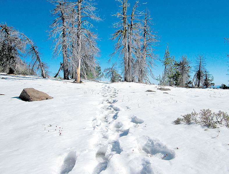
The mountain slopes up more reasonably on its west side, but then falls away dramatically on its eastern edge in 100-foot-high cliffs. The temptation is to walk right along the cliff’s edge from the southern summit all the way to the true summit on its northern end, but there are several major drop-offs along the way. Instead I dropped down to the western side of the mountain, to pass below these difficulties, eventually gaining a broad snow-covered plateau that led to the summit rocks.
The plateau continues on interminably, at least a mile, before a short scramble leads to the top. The summit could have been any of a half dozen different spots, none looking any higher than the others. I settled on a flat-topped rock formation as my summit and enjoyed the wide open views as I ate my lunch.
For the most part, I followed my tracks in the snow back down to the saddle, avoiding the south summit rocks lest I did hear the siren call on my return.
It’s a 12-mile round trip to the top of Gearhart, and by my late afternoon return, the snow was melting into rivers along the trail. My hiking shoes and socks were soaking wet when I reached the car. But then again, they may have another six months to dry out.
If you go
Getting there: From Bend, head south on U.S. Highway 97 to Chiloquin, exit onto state Highway 422 eastbound. Turn left on Sprague River Road and drive about 33 miles to the junction with state Highway 140. Turn left and continue through the town of Bly. Just past the town, take a left on Campbell Road, and then the first right onto Forest Road 34. After 15 miles, turn left at a sign for the Gearhart Mountain Trail and follow unpaved Forest Road 12 about two miles to the trailhead.
Difficulty: Strenuous
Cost: Free
Contact: Bly Ranger District, Fremont National Forest, 541-353-2427.
More Local News


Best of the Best of Bend 2025

-
-
-