Remote lake offers swims in solitude
Published 12:00 am Wednesday, July 15, 2015
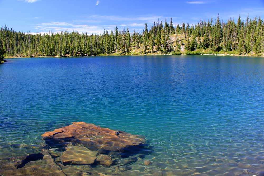
- Zach Urness / The (Salem) Statesman JournalGifford Lake sits in the backcounty of Olallie Lake Scenic Area, in Oregon’s Cascade Range.
DETROIT — In this summer of endless heat, when the very ground seems to have transmuted from rock into molten lava, the question I’ve heard most from readers involves the best places to go swimming in Oregon’s outdoors.
Between frustration with the overcrowded swimming holes on the Little North Santiam River and the low water of Detroit Lake, my inbox has been packed with people crying out for a place they can dip in cool blue waters with some measure of peace.
I know of such a place.
At the end of a rough gravel road northeast of Detroit, on a trail not found on any map, sits a glorious pool of sapphire water just waiting for you to dive in.
Gifford Lake resides in the backcountry of Olallie Lake Scenic Area, in Oregon’s Cascade Range. Perhaps the coolest thing about it, besides the temperature of the water, is that it doesn’t require a very difficult hike to reach.
The Olallie is dotted with a plethora lakes on its pancake-flat plateau, many of which are unusual by mountain lake standards.
Yet Gifford is special, with the orange cone of Olallie Butte and Twin Peaks rising overhead, water as clear as Crater Lake and a peninsula jutting into the middle.
Breitenbush residents Michael Donnelly and Alea Brager brought me to this lake for the first time on an off-trail “lake bagging” expedition last summer. Since then, it has become one of my favorite places to spend the day or camp with my family.
(I’ve been told that mosquitoes get very bad here, though on my trips I haven’t gotten hit. Take it for what it’s worth.)
But, how exactly do you get there?
I knew I’d have to answer that question eventually.
One of the great curses of being an outdoors writer is the betrayal of your favorite spots.
So here it is, but remember, treat it well if you decide to go.
The trip begins with a drive to Detroit, and then a northeast trek on Breitenbush Highway 46 until you swing right onto gritty roads 4690 and 4220 toward Olallie Lake. The trailhead is Lower Lake Campground.
The hike begins with 0.6 miles on Fish Lake Trail (hash)717 to Lower Lake — a very nice pool in its own right. At a junction on the top side of the lake, turn left onto Lodgepole Trail No. 706 and follow it roughly 0.4 miles to an unmarked way trail (if you reach small Middle Lake, you’ve gone too far). Follow the unmarked trail to Gifford Lake (GPS coordinates: 44.820612, -121.808730.)
The peninsula that juts into the lake has an outstanding campsite, although some might say it’s too close to the water’s edge. It also makes a great base for swimming.
If you get tired of Gifford, there are numerous lakes within a very short distance, both on trail and off, and the whole area is full of wild blue huckleberries you can pluck and eat as you hike.
The only problem is that at some point you’ll have to leave. The drive, over awful roads and into the molten lava temperatures of the Willamette Valley, will leave you dreaming of the next time you can visit Gifford Lake.

Best of the Best of Bend 2025

-
-
-