Mountain Bike Trail Guide: Catch and Release/Deschutes River Trail loop
Published 12:00 am Thursday, August 30, 2018
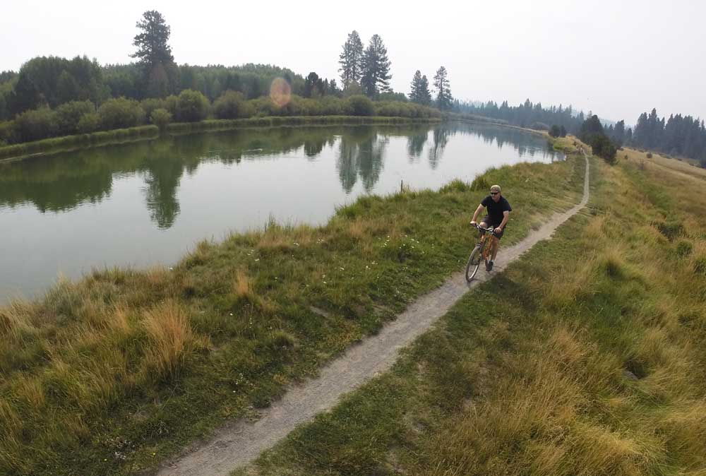
- A biker navigates his way down a section of the Deschutes River Trail near Dillon Falls.
Finding new mountain bike loops in Central Oregon is never that difficult considering the seemingly endless miles of trails that exist here.
Every now and then I will take some trails that I have ridden countless times and combine them for a completely different ride.
Trending
Earlier this week I put together a relatively new trail (Catch and Release) with an old-time favorite (the Deschutes River Trail) for an intermediate 12-mile ride that showcased some of the best of our High Desert singletrack.
Catch and Release was built just three years ago, designed as a connector trail between the new Forest Service welcome station on Century Drive and the bottom of lower Storm King and Tyler’s Traverse trails in the Wanoga system southwest of Bend. The 4.6-mile addition allows mountain bikers to ride a variety of singletrack loops out of the Wanoga and Phil’s Trail areas.
The Catch and Release trail parallels Conklin Road (Forest Service Road 41), and also roughly parallels the Deschutes River Trail from Lava Island Falls south to Slough recreation site, making the 12-mile loop easily accessible.
But not only is Catch and Release a key connector, it is also just a great trail — period.
Parking is available at the welcome station, where hiking and mountain biking maps for areas in Central Oregon are available for purchase.
After parking at the welcome station, I crossed Century Drive and turned onto Catch and Release, which begins at a trailhead at the junction of Century Drive and Road 41.
Trending
The trail starts out downhill, and it took me through a variety of rocky sections, including one long, smooth boulder that seemed like it was straight out of the famous Slickrock Trail in Moab, Utah. The trail eventually took us across Road 41, where the path began to sort of parallel the road.
I looped through the forest along the rolling trail, which included some natural jump features.
A few rocky sections make Catch and Release a blue (intermediate) trail, but most of the trail is suitable for beginner mountain bikers.
At its south end, Catch and Release connects to Tyler’s Traverse. Near this intersection, I crossed Conklin Road and took Forest Road 100 about half a mile to the Slough Recreation Site near Benham Falls and turned north on the Deschutes River Trail.
The Deschutes River Trail southwest of Bend is one of the most popular trails in Central Oregon. Hikers, bikers, rafters, kayakers, equestrians, anglers and bird-watchers all make use of it.
I made my way north along the river, skirting Dillon Falls then climbing high above the river before a steep downhill section with a couple of switchbacks. Grueling climbs and technical sections are rare on the river trail, making it a perfect ride for most skill levels.
I continued along the smooth trail to the Big Eddy Rapids. On the far side of the river, dark, jagged lava rock stretched all the way to Lava Butte, 5 miles to the southeast. Bright-colored plants poked out of the dark lava field, making for an otherworldly landscape.
The trail led me to the edge of the river along Lava Island Falls, where I made a left turn onto Road 700 then a right turn back onto the Catch and Release Trail to complete the loop. The 12-mile ride required about two hours and included about 600 feet of elevation gain.
The Deschutes River Trail and Catch and Release Trail — which should remain accessible for two to three more months before the snow settles in — are well-traveled paths. Mountain bikers should ride with caution and yield to hikers, especially along the Deschutes River Trail, which is popular with hikers well into fall.
Combining popular trails to create a new loop is always an option on the plethora of singletrack in Central Oregon.
— Reporter: 541-383-0318,
mmorical@bendbulletin.com
Marketplace


Best of the Best of Bend 2025

-
eEdition

-

-