Mountain Bike Trail Guide: Storm King-Tyler’s Traverse loop
Published 12:00 am Thursday, May 23, 2019
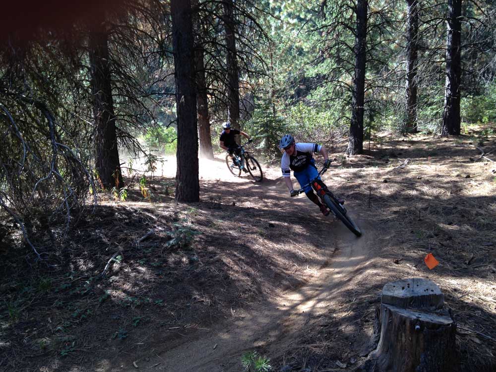
- Mountain bikers descend the Tyler’s Traverse Trail southwest of Bend.
This is certainly an exciting time of year for Central Oregon mountain bikers.
As the snow continues to melt at higher elevations, more and more trails are becoming accessible for riders. West of Bend, the Phil’s Trail area has been snow-free and accessible for weeks now.
Trending
But trails at even higher elevations toward the Cascades are opening up as well, including those in the Wanoga network southwest of Bend.
Before the tourists arrive en masse this summer, now is the perfect time for locals to venture out on these trails, which are in prime condition after rainfall over the past week.
The website bendtrails.org offers trail conditions reports for most singletrack in Central Oregon. When I logged on and saw that one of my favorite loops was snow- and mud-free, I jumped at the chance to hit the trails this past Sunday.
I drove to the Storm King Trailhead off Conklin Road just a few miles southwest of Bend. The plan was to ride a loop of about 12 miles that included the Storm King, Larsen, Tyler’s Traverse, and Catch and Release trails.
Over the last few years, this has become one of my go-to loops west of Bend. It’s fairly close to town, it requires only a couple of hours to ride, and it has just the right mix of climbing, flat stretches and downhill.
The Storm King Trail has been around for many years, but Larsen, Tyler’s Traverse, and Catch and Release are all fairly recent additions to the Wanoga trail network.
Trending
The climb up Storm King to start was somewhat challenging, but it made for a nice warm-up in the somewhat chilly conditions.
After riding up Storm King, I turned onto Tiddlywinks for a brief, steep climb, which led me up to a left turn onto the Larsen Trail, situated at about 4,800 feet in elevation.
The trail conditions were ideal after all the rain: firm and tacky, but not muddy at all.
The Larsen Trail is mostly flat and rolling as it runs south toward Kiwa Springs, a small pond along a dirt road. I turned left onto lower Tyler’s Traverse, which has become a favorite of mountain bikers due to its fun, free-ride flavor that is approachable for riders of most skill levels. The downhill-only trail, designed by Mountain Bike Hall of Famer and Bend resident Paul Thomasberg, features several twisting jumps and banked corners through a remote section of the Deschutes National Forest.
The jumps were just big enough for me to catch some air but not get carried away.
The east end of Tyler’s Traverse merges onto Conklin Road near a small parking area, but I turned north onto the Catch and Release Trail. This 4.6-mile trail parallels Conklin Road and runs north all the way to the Forest Service Welcome Station along Cascade Lakes Highway, but I rode it just to its connection with Storm King where I started the loop.
Catch and Release is a fun trail in its own right, as it includes some rocky, technical areas as well as some fast, jumpy sections. One particularly rock-strewn portion lasts for about a quarter of a mile before the trail connects back to Storm King.
Catch and Release was designed as a connector trail between the welcome station on Century Drive and the bottom of lower Storm King and Tyler’s Traverse trails. The Central Oregon Trail Alliance is currently planning and building singletrack trails from Sunriver that will connect to Tyler’s Traverse and Catch and Release.
The Storm King-lower Tyler’s loop is one ride of many that are currently snow-free and accessible for mountain biking in the Wanoga system. But according to bendtrails.org, much of the upper half of the system — including the upper sections of Tyler’s Traverse and Tiddlywinks — was still obstructed by snow patches and some downed trees as of Monday.
Riders should always ride with care and avoid muddy trails — but more and more opportunities are opening up as we move toward summer in our mountain biking mecca.
—Reporter: 541-383-0318,
mmorical@bendbulletin.com
Marketplace


Best of the Best of Bend 2025

-
eEdition

-

-