Top picks east of Bend
Published 12:30 am Friday, January 15, 2021
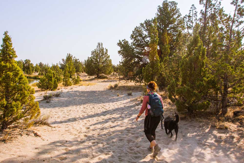
- Makenzie Whittle/Bulletin file photoHeather Whittle and her dog Django walk along the Tumulus Trail next to an irrigation canal.
Barnes Butte — The moderate 2.7-mile trail just east of Prineville rarely gets large amounts of snow, but there can be frigid wind gusts at the top of the 567 foot trail. However, once you’ve climbed the steady incline up, the butte offers views of Prineville and the valleys surrounding.
Chimney Rock — Another 2.7-mile moderate trail, is this one in the Crooked River Canyon near Prineville Reservoir. It has a higher elevation gain — 623 feet — but climb is more gradual, this trail ends at the basalt rock plinth above the river. The trail up is wider allowing for more room to socially distance, and there are benches to rest and enjoy the view.
Hole in the Ground — The aptly named hole is actually a volcanic maar hidden in the woods off Oregon Highway 31 near Fort Rock. It was formed when magma met the water of the ancient lake that covered the valley area thousands of years ago. There is technically a road down to the center of the hole, but it should only be attempted if your car has good ground clearance and you know what you’re doing. Otherwise, hike the 2-mile out and back trail that gently descends into the bowl.
Tumulus Trail — Tucked away on the backside of the Oregon Badlands Wilderness area with the trailhead located off of Dodds Road, the Tumulus Trail hugs an irrigation canal for about a half-mile before turning southward into the Badlands area. Here it connects to many other trails including the Black Lava and Dry River trails. With many sections more exposed, this is a great section to do during the winter when the ground is less sandy and the temperatures cooler.


Best of the Best of Bend 2025

-
eEdition

-

-
Go! eEdition