Conditions report for high desert areas, sno-parks
Published 12:00 am Friday, March 12, 2021
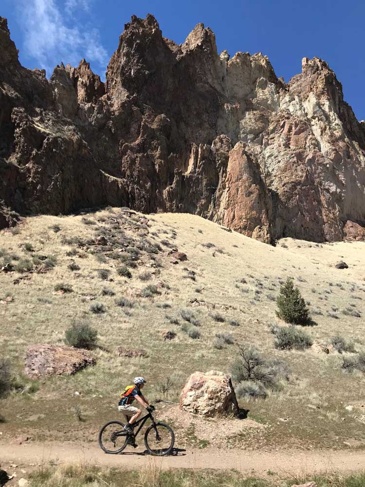
- A mountain biker rides along the River Trail at Smith Rock State Park.
Central Oregon is warming up and what better place to soak up some rays than by heading to the open vistas of the High Desert areas.
Many of these places have sprawling openness with little shade making them perfect for a later winter stroll. Plus, this weekend we spring forward with daylight saving time beginning early Sunday morning, giving us all a little more sunshine to explore in.
Remember, March weather can change quickly so always go prepared.
For a full list of conditions updated regularly, please visit centraloregonexplore.com
Hiking and Day Use Sites
NOTE: Many of the trails along seasonally closed highways and forest service roads remain open, but can only be accessed by hike, snowshoe, cross country ski or snowmobile due to accumulating snowfall. See Forest websites for more details and restrictions.
Deschutes National Forest
Bessie Butte Trail: Open
Boyd Cave Day Use Area: Open
Horse Butte Trailhead: Open; mostly snow free and clear
Pine Mountain: Open
Ochoco National Forest
Alder Springs Trailhead: Open; access road closed to motor vehicles
Cyrus Trailhead: Open
Gray Butte Trailhead: Open
Hammer Creek Trailhead: Open
Rimrock Springs Trailhead: Open
Scales Corral Trailhead: Open
Skull Hollow Trailhead: Open
Tam-A-Lau Trailhead: Open
Bureau of Land Management
Badlands Rock Trail: Open
Black Hills ACEC: Open; climbing and geocaching are prohibited
Chimney Rock Trail: Open
Christmas Valley Sand Dunes: Open
Cline Buttes Recreation Area: Portions of Deep Canyon, Fryrear, Maston and Jaguar Road are closed through Aug. 31
Crack-in-the-Ground: Open
Derrick Cave: Open
Flatiron Rock Trail: Open
Fossil Lake ACEC: Open; motor vehicles and fossil collecting prohibited
Green Mountain: Open
Huntington Wagon Road: Open
Lost Forest: Open, vehicles restricted to designated roads only
Lower Crooked River: Open
North Fork: Open
Oregon Badlands Wilderness Tumulus Trail: Open
Redmond Caves Recreation Site: Open
Scout Camp Trail: Open
Steelhead Falls Trail: Open
Trout Creek Trail: South side of trail, including Trout Creek climbing walls is closed through Aug. 31
Oregon State Parks
Cline Falls State Scenic Viewpoint: Open; expect reduced services; restrooms are closed, portable toilet is on site; maintain social distancing and wear a mask
Cove Palisades State Park: Open for day-use and lake access; Crooked River Campground (E Loop) is open, Deschutes Campground and moorage slips will open May 14.
Fort Rock State Natural Area: Open; day-use hours 8 a.m,-8 p.m.; rock scrambling closed in southeast area to protect nesting falcons
Jasper Point: Open; boat ramp closed due to low water conditions; camping is closed for the season
Peter Skene Ogden State Scenic Viewpoint: Open
Prineville Reservoir State Park: Open; expect reduced services
Smith Rock State Park: Open — limited services; no camping; climbing closures to protect nesting raptors in place until August; park-wide drone ban is in effect.
Ski areas and snow parks
Updated 8 a.m. March 11
Hoodoo: Open; 96.7 inch base; Hodag lift and Autobahn Tubing Park are closed
Mt. Bachelor: Open; 109 inch base; First Rays lift is closed
Willamette Pass: 65 inches at lodge; rentals and tickets must be reserved online in advance
Deschutes National Forest
Crescent Lake Sno-park: Open; 10-12 inches; fair conditions with low snow
Crescent Junction: Open; 10-12 inches; fair conditions with low snow
Dutchman Sno-park: Open; 72-96 inches; good conditions, limited parking and no overnight camping; 40-foot max length limit for vehicle/trailer combination; expect heavy use
Edison Butte Sno-park: Open; 30-48 inches; fair conditions; area roads closed to highway vehicles through March 31, 2021
Kapka Butte Sno-park: Open; 42-66 inches; good conditions; area roads closed to highway vehicles through March 31, 2021
Meissner Sno-park: Open; 24-36 inches; good conditions; area roads closed through April 1, 2021; no dogs; lodge currently closed
Skyliner Sno-park: Open; unknown snow depth, access road closed for the season, road is now a ski/snowshoe trail
Swampy Sno-park: Open; 42-66 inches; good conditions; no dogs; area roads closed through March 31, 2021
Vista Butte Sno-park: Open; 42-60 inches; good conditions; area north of parking area closed to snowmobiles, use Kapka Butte or Wanoga
Wanoga Snow Play: Open; 36-48 inches; good conditions; expect heavy use; pack out broken sleds and all trash; shelter is closed
Wanoga Snowmobile: Open; 36-48 inches; good conditions; area roads closed to highway vehicles through March 31, 2021; shelter is closed
Newberry (Six Mile Sno-park): Open; 2-6 inches; poor conditions due to low snow.
Newberry (10 Mile Sno-park): Open; 18-30 inches; fair conditions, low snow around sno-park; road beyond park closed to vehicles for the season
Three Creek Sno-park (Lower): Open; 2-6 inches; marginal conditions due to low snow
Three Creek Sno-park (Upper): Open; 14-18 inches; good conditions; Forest Service Road 16 is plowed by may have icy ruts
Walt Haring Sno-park: 8-10 inches; good conditions
Ochoco National Forest:
Bandit Springs Sno-park: Open
Mark’s Creek Sno-park: Open
Ochoco Divide Sno-park: Open
Walton Sno-park: Open
Willamette National Forest
Gold Lake Sno-park: Open
Ikenick Sno-park: Open
Little Nash Sno-park: Open
Maxwell Sno-park: Open; Mountain View and South Maxwell shelters are closed
Potato Hill Sno-park: Open
Ray Benson Sno-park: Open; 54-66 inches; good conditions, expect heavy use
Salt Creek Sno-park: Open
Santiam Sno-park: Open
Waldo Lake Sno-park: Open
Camping
BLM — Prineville District
Barr Road North Staging Area: Open
Big Bend Campground: Open
Buckhorn Staging Area: Open
Castle Rock Campground: Open
Chimney Rock Campground: Open
Cobble Rock Campground: Open
Lone Pine Campground: Open
Macks Canyon Recreation Site: Open
Palisades Campground: Open
Post Pile Campground: Open
Steelhead Falls: Open; no potable water
Stillwater Campground: Open
Cycling
Fatbike and winter trails:
Ben’s-MTB-Kent’s, Horse Butte Loop, Horse Ridge Area: Muddy
Wanoga — 3 PSI, Wanoga — Outer Loop: Rideable snow
Madras East Hills, Maston, The Radlands: Riding well
East of Bend trails
Dry River Canyon: Closed through Aug. 31
Coyote Loop, Has No Horse, Horse Butte Loop, Horse Ridge Area, Sand Canyon, Swamp Wells: Muddy
All other trails riding well
Maston complex
All trails riding well
Redmond trails
Cole Loop, Gray Butte: Muddy
All other trails riding well
Madras East Trails
Coyote Run, Valley of the Bones: Winter mix
Peek A Boo — Berm Mountain, Wide Open: Muddy
All other trails riding well
Fishing
Updated at 8 a.m. March 11
Lower Deschutes (Pelton Dam to Columbia River): 4,900 cfs; redband trout, steelhead, whitefish; trout will continue to be less active through the winter but can be caught on something slow and tasty, steelhead fishing is done as most fish are entering spawning grounds in closed waters.
Middle Deschutes (Benham Falls to Lake Billy Chinook): 3,910 cfs; brown trout, rainbow trout; water is higher and clarity is good with decent trout fishing; open year-round for trout, artificial flies and lures only; no limit on brown trout
Crooked River (below Opal Springs): 1,292 cfs; rainbow trout and mountain whitefish; only fish downstream of Bowman Dam to Lake Billy Chinook; fishing has been good but water remains low; any trout over 20 inches are considered steelhead and must be released, bull trout must be released unharmed and reported to the USFW at crookedbulltrout@fws.gov
Metolius River: 1,410 cfs; bull trout, rainbow trout; consistent fishing reported between Allingham Bridge and Bridge 99 but access may be difficult depending on snow; fly fishing only upstream of Bridge 99, artificial lures and flies permitted below; catch and release only; public access to Wizard Falls Hatchery remains closed; river is closed to fishing above Allingham Bridge until May 22, 2021
Prineville Reservoir: 40% full; rainbow trout, small and largemouth bass, catfish, crappie, crayfish; trout fishing has been fair, good for warm weather species
Ochoco Reservoir: 19% full; rainbow trout, black crappie, smallmouth bass; trout fishing should start increasing with lower temperatures; ramp still likely unusable due to low water levels
Haystack Reservoir: 83% full; rainbow and brown trout, kokanee, largemouth bass, black crappie, bluegill and bullhead catfish; west side boat ramp is open
Lake Billy Chinook: Bull, brown and rainbow trout, kokanee, smallmouth bass; Metolius arm is now open but tribal fishing permit required, kokanee fishing has been excellent
Fire danger is currently listed as moderate in the Deschutes National Forest. Fire danger is listed as Low in the Ochoco and Willamette National Forests.
Industrial Fire Precaution Level is currently at Level 1 for the Deschutes and Ochoco national forests and the Prineville District — Bureau of Land Management.
As of July 22, Deschutes River access is closed due to safety concerns and to prevent further erosion to the river bank. The access point will be closed until further notice. For more information visit bendparksandrec.org
To protect nesting raptors, the following climbing routes are closed: Cajun Cliff, Victoria Tower, Little Three Fingered Jack, Puddy’s Tower, The Monument, Anglin’s Buttress, French Tent Rock, First Kiss Area north of Monkey Face and Smith Rock Group NE Face (both towers, above 100 feet).
The Canyon Trail near the bald eagle nest is restricted to groups of four or less and noise must be kept to a minimum.
See smithrock.com/seasonal-closures for more information.
Beginning Jan. 28 the following trails are closed from Monday to 3 p.m. Fridays (except for federal holidays) due to timber harvesting and forest restoration work:
- Lower Whoops
- Pine Drops
- EXT
- Storm King from the junction with Forest Road 4615 and the junction with Phil’s Trail
- Phil’s Trail between the junction with EXT and it’s western terminus at the junction with Pine Drops
- Upper Whoops
- Lower Whoops
- Skyliners
The following Bureau of Land Management trails are now closed through Aug. 31 to protect nesting raptors:
- Millican Plateau OHV Trail System (Route 95 only)
- South side of Trout Creek Trail including climbing walls
- Cline Buttes Recreation Area (portions of Deep Canyon, Fryrear, Maston, Jaguar Road)
- Horny Hollow Trail
- Dry River Canyon
For more information visit blm.gov


Best of the Best of Bend 2025

-
-
-