Conditions report for hiking, fishing, camping east of Bend
Published 12:00 am Friday, April 9, 2021
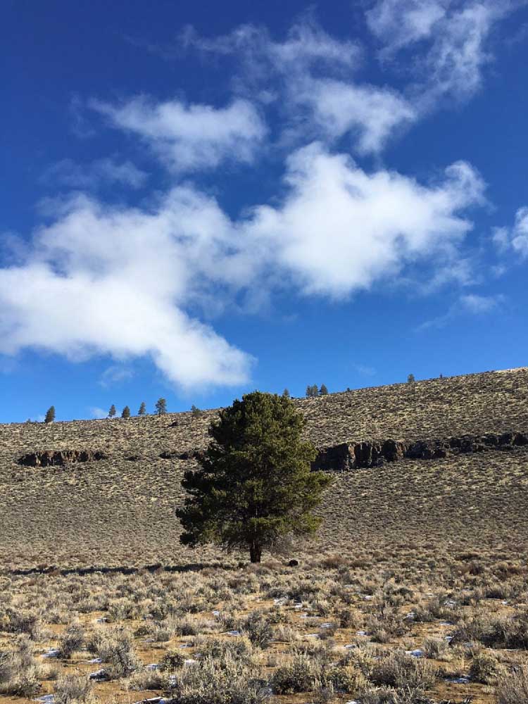
- Clouds hover in the blue sky above one of the few trees in the bottom of Hole-in-the-Ground. Interestingly, the bottom is too cold for the ponderosas of the forest surrounding Hole-in-the-Ground to find purchase, according to “Bend, Overall.”
We’re getting some very slight relief from the high temps this weekend, so steal yourself away toward exploring areas east of Bend.
It’ll still be hot out there, so bring lots of water and sunscreen. And let the heat remind you that there is extreme fire danger in many areas, so don’t drive through or park on dry vegetation, don’t light any fires, smoke in your car and above all, be vigilant wherever you venture this weekend.
For a full list of conditions updated regularly, please visit centraloregonexplore.com.
Hiking and Day Use Sites
Deschutes National Forest
Pine Mountain: Open
Ochoco National Forest
Alder Springs Trailhead: Open
Antelope Flat Reservoir: Open
Baneberry Trailhead: Open
Barnhouse Trailhead: Open
Black Canyon East (Formerly South Fork) Trailhead: Open
Black Canyon West (Formerly Dusty Camp) Trailhead: Open
Boeing Field Trailhead: Open
Coffeepot Trailhead: Open
Cottonwood Trailhead: Open
Cougar East Trailhead: Open
Cougar West Trailhead: Open
Fry Trailhead: Open
Green Mountain North Trailhead: Open
Hammer Creek Trailhead: Open
Keeton Trailhead: Open
Kelsey Trailhead: Open
Line Butte East (Formerly Fawn Creek) Trailhead: Open
Line Butte West Trailhead: Open
Lookout Mountain Lower Trailhead: Open
Lookout Mountain Upper Trailhead: Open
Mascall Corral (Formerly Apple West) Trailhead: Open
Mother Lode Mine Trailhead: Open
Payten Trailhead: Open
Potlid North Trailhead: Open
Potlid South Trailhead: Open
Rim (Formerly Apple Middle) Trailhead: Open
Rock Creek Trailhead: Open
Round Mountain North Trailhead: Open
Round Mountain South Trailhead: Open
Scales Corral Trailhead: Open
Scotty Creek Trailhead: Open
South Prong Trailhead: Open
Steins Pillar Trailhead: Open
Trail Crossing Corrals Trailhead: Open
Twin Pillars North Trailhead: Open
Twin Pillars South Trailhead: Open
Walton Lake Trailhead: Closed
Wildcat North Trailhead: Open
Wildcat South Trailhead: Open
Bureau of Land Management
Badlands Rock Trail: Open
Black Hills ACEC: Open; climbing and geocaching are prohibited
Chimney Rock Trail: Open
Christmas Valley Sand Dunes: Open
Cline Buttes Recreation Area: Portions of Deep Canyon, Fryrear, Maston and Jaguar Road are closed through Aug. 31
Crack-in-the-Ground: Open
Derrick Cave: Open
Flatiron Rock Trail: Open
Fossil Lake ACEC: Open; motor vehicles and fossil collecting prohibited
Green Mountain: Open
Huntington Wagon Road: Open
Lost Forest: Open, vehicles restricted to designated roads only
Lower Crooked River: Open
North Fork: Open
Oregon Badlands Wilderness Tumulus Trail: Open
Redmond Caves Recreation Site: Open
Scout Camp Trail: Open
Steelhead Falls Trail: Open
Trout Creek Trail: South side of trail, including Trout Creek climbing walls is closed through Aug. 31
Oregon State Parks
Fort Rock State Natural Area: Open; day-use hours 8 a.m,-8 p.m.; rock scrambling closed in southeast area to protect nesting falcons; cave tours canceled for 2021
Jasper Point: Open; boats with motors are not advised due to low water; no campfires including wood, charcoal briquettes, candles, tiki torches, propane fire rings and other devices that emit flames. Stoves and other cooking devices that use propane are allowed for cooking purposes
Prineville Reservoir State Park: Open; boats with motors are not advised due to low water; no campfires including wood, charcoal briquettes, candles, tiki torches, propane fire rings and other devices that emit flames. Stoves and other cooking devices that use propane are allowed for cooking purposes
Camping
NOTE: All campfires are prohibited within the Deschutes and Ochoco national forests and lands managed by the BLM
Ochoco National Forest
Allen Creek Horse Camp: Open
Antelope Flat Reservoir Campground and Day Use: Open
Barnhouse Campground: Open
Big Spring Campground: Open
Biggs Springs Campground: Open
Bingham Springs Campground: Open
Cold Springs Guard Station: Open
Cottonwood Campground: Open
Cottonwood Pit Campground: Open
Deep Creek Campground: Open
Dry Creek Horse Camp: Open
Elkhorn Campground: Campground: Open
Frazier Campground: Open
Mud Springs Horse Camp: Open
Ochoco Divide Campground: Open
Ochoco Divide Group Site: Open
Ochoco Forest Campground: Open
Ochoco Forest Camp Group Pavillion: Open
Ochoco Ranger Rental House: Open
Salters Cabin Horse Camp: Open
Scotts Campground: Open
Sugar Creek Campground and Day Use Area: Open
Walton Lake Campground: Open
Walton Lake Group Campsites: Open
Whistler Campground: Open
White Rock Campground: Open
Wildcat Campground and Day Use Area: Open
Wildwood Campground: Open
Wiley Flat Campground: Open
Wolf Creek Campground: Open
Wolf Creek Industrial Campground: Open
BLM — Prineville District
Barr Road North Staging Area: Open
Big Bend Campground: Open
Buckhorn Staging Area: Open
Castle Rock Campground: Open
Chimney Rock Campground: Open
Cobble Rock Campground: Open
Lone Pine Campground: Open
Palisades Campground: Open
Post Pile Campground: Open
Steelhead Falls: Open; no potable water
Stillwater Campground: Open
Cycling
East of Bend trails
Dry River Canyon: Closed through Aug. 31
Arnold Ice Cave, Crooked Arm, Holy Loop, Sand Canyon: Sandy and loose
All other trails riding well
Prineville and Ochoco trails
Cougar Creek: Riding well, deadfall reported
All other trails riding well
Fishing
NOTE: Conditions as of July 13.
Crooked River (below Opal Springs): 1,152 cfs; rainbow trout and mountain whitefish; water level is higher but will be lower than average this summer; more whitefish than rainbows, fair fishing for rainbows; any trout over 20 inches are considered steelhead and must be released, bull trout must be released unharmed and reported to the USFW at crookedbulltrout@fws.gov
Prineville Reservoir: 39% full; rainbow trout, small and largemouth bass, catfish, crappie, crayfish; bass and trout fishing has been good
Ochoco Reservoir: 14% full; rainbow trout, black crappie, smallmouth bass; water level is still extremely low and bank access is limited to walk-in only
Walton Lake: Rainbow trout
Fire danger is currently listed as Extreme in the Deschutes and Ochoco National Forests. Fire danger is listed as High in the Willamette National Forest.
Industrial Fire Precaution Level is currently at Level 3, Partial Shutdown for the Deschutes and Ochoco national forests and the Prineville District — Bureau of Land Management.
Campfires are banned with the Deschutes and Ochoco national forests and areas managed by BLM
As of July 22, Deschutes River access is closed due to safety concerns and to prevent further erosion to the river bank. The access point will be closed until further notice. For more information visit bendparksandrec.org
To protect nesting raptors, the following climbing routes are closed: Cajun Cliff, Victoria Tower, Little Three Fingered Jack, Puddy’s Tower, The Monument, Anglin’s Buttress, French Tent Rock, First Kiss Area north of Monkey Face and Smith Rock Group NE Face (both towers, above 100 feet).
The Canyon Trail near the bald eagle nest is restricted to groups of four or less and noise must be kept to a minimum.
See smithrock.com/seasonal-closures for more information.
As of June 16 the following trails are closed from Mondays to 3 p.m. Fridays (except for federal holidays) due to timber harvesting and forest restoration work:
- Lower Whoops
- Pine Drops
- EXT
- Storm King from the junction with Forest Road 4615 and the junction with Phil’s Trail
- Phil’s Trail between the junction with EXT and it’s western terminus at the junction with Pine Drops
The following Bureau of Land Management trails are now closed through Aug. 31 to protect nesting raptors:
- Millican Plateau OHV Trail System (Route 95 only)
- South side of Trout Creek Trail including climbing walls
- Cline Buttes Recreation Area (portions of Deep Canyon, Fryrear, Maston, Jaguar Road)
- Horny Hollow Trail
- Dry River Canyon
For more information visit blm.gov


Best of the Best of Bend 2025

-
-
-