Conditions report for hiking, fishing, camping east of Bend
Published 12:00 am Friday, August 20, 2021
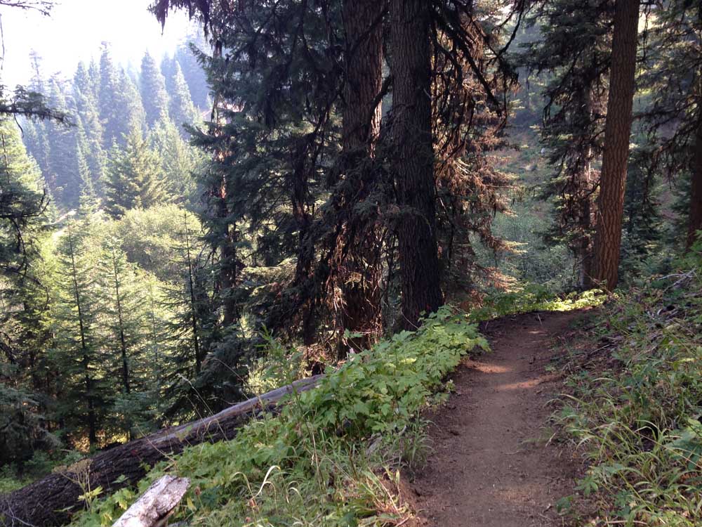
- Pristine singletrack along the climb up Lookout Mountain in 2015.
It looks like we’re in a cool-down period for a while, so get out and enjoy everything that eastern Central Oregon has to offer.
The wide-open, typically sparsely treed areas are great for exploring in milder temperatures, but still bring plenty of water, sunscreen and a hat.
For a full list of conditions updated regularly, please visit centraloregonexplore.com.
Hiking and Day Use Sites
Deschutes National Forest
Horse Butte Trailhead: Open; light deadfall above Swamp Wells Horse Camp near junction with Crater Rim
Pine Mountain: Open
Ochoco National Forest
Antelope Flat Reservoir: Open
Baneberry Trailhead: Open
Barnhouse Trailhead: Open
Black Canyon East (Formerly South Fork) Trailhead: Open
Black Canyon West (Formerly Dusty Camp) Trailhead: Open
Boeing Field Trailhead: Open
Coffeepot Trailhead: Open
Cottonwood Trailhead: Open
Cougar East Trailhead: Open
Cougar West Trailhead: Open
Fry Trailhead: Open
Giddy-Up Go Trailhead: Open
Gray Butte Trailhead: Open
Green Mountain North Trailhead: Open
Green Mountain South Trailhead: Open
Hammer Creek Trailhead: Open
Keeton Trailhead: Open
Kelsey Trailhead: Open
Line Butte East (Formerly Fawn Creek) Trailhead: Open
Line Butte West Trailhead: Open
Lookout Mountain Lower Trailhead: Open
Lookout Mountain Upper Trailhead: Open
Mascall Corral (Formerly Apple West) Trailhead: Open
Mother Lode Mine Trailhead: Open
Payten Trailhead: Open
Potlid North Trailhead: Open
Potlid South Trailhead: Open
Rim (Formerly Apple Middle) Trailhead: Open
Rock Creek Trailhead: Open
Round Mountain North Trailhead: Open
Round Mountain South Trailhead: Open
Scotty Creek Trailhead: Open
South Prong Trailhead: Open
Steins Pillar Trailhead: Open
Twin Pillars North Trailhead: Open
Twin Pillars South Trailhead: Open
Walton Lake Trailhead: Closed
Wildcat North Trailhead: Open
Wildcat South Trailhead: Open
Bureau of Land Management
Badlands Rock Trail: Open
Black Hills ACEC: Open; climbing and geocaching are prohibited
Chimney Rock Trail: Open
Christmas Valley Sand Dunes: Open
Cline Buttes Recreation Area: Portions of Deep Canyon, Fryrear, Maston and Jaguar Road are closed through Aug. 31
Crack-in-the-Ground: Open
Derrick Cave: Open
Flatiron Rock Trail: Open
Fossil Lake ACEC: Open; motor vehicles and fossil collecting prohibited
Green Mountain: Open
Huntington Wagon Road: Open
Lost Forest: Open, vehicles restricted to designated roads only
Lower Crooked River: Open
North Fork: Open
Oregon Badlands Wilderness Tumulus Trail: Open
Oregon State Parks
All campfires and any devices that emits flames or embers are prohibited within any state park or state-managed forest until conditions improve. Propane cook stoves and lanterns are allowed, propane fire pits are not
Fort Rock State Natural Area: Open; day-use hours 8 a.m.-8 p.m.; rock scrambling closed in southeast area to protect nesting falcons; cave tours canceled for 2021
Jasper Point: Open; boats with motors are not advised due to low water
Prineville Reservoir State Park: Open; boats with motors are not advised due to low water
Camping
All campfires are prohibited within the national forests and lands managed by the BLM
Deschutes National Forest
China Hat Campground: Open
Ochoco National Forest
Allen Creek Horse Camp: Open
Antelope Flat Reservoir Campground and Day Use: Open
Barnhouse Campground: Open
Big Spring Campground: Open
Biggs Springs Campground: Open
Bingham Springs Campground: Open
Cold Springs Guard Station: Open
Cottonwood Campground: Open
Cottonwood Pit Campground: Open
Deep Creek Campground: Open
Dry Creek Horse Camp: Open
Elkhorn Campground: Campground: Open
Frazier Campground: Open
Mud Springs Horse Camp: Open
Ochoco Divide Campground: Open
Ochoco Divide Group Site: Open
Ochoco Forest Campground: Open
Ochoco Forest Camp Group Pavillion: Open
Ochoco Ranger Rental House: Open
Salters Cabin Horse Camp: Open
Scotts Campground: Open
Sugar Creek Campground and Day Use Area: Open
Walton Lake Campground: Open
Walton Lake Group Campsites: Open
Whistler Campground: Open
White Rock Campground: Open
Wildcat Campground and Day Use Area: Open
Wildwood Campground: Open
Wiley Flat Campground: Open
Wolf Creek Campground: Open
Wolf Creek Industrial Campground: Open
BLM — Prineville District
Barr Road North Staging Area: Open
Big Bend Campground: Open
Buckhorn Staging Area: Open
Castle Rock Campground: Open
Chimney Rock Campground: Open
Cobble Rock Campground: Open
Lone Pine Campground: Open
Palisades Campground: Open
Post Pile Campground: Open
Steelhead Falls: Open; no potable water
Stillwater Campground: Open
Cycling
East of Bend trails
Dry River Canyon: Closed through Aug. 31
Arnold Ice Cave, Crooked Arm, Holy Loop, Horse Ridge Area, Sand Canyon: Sandy and loose
All other trails riding well
Prineville and Ochoco trails
Cougar Creek: Riding well, deadfall reported
All other trails riding well
Fishing
Updated at 8 a.m. Aug. 19
Crooked River (below Opal Springs): 1,179 cfs; rainbow trout and mountain whitefish; water level is higher but will be lower than average this summer; more whitefish than rainbows, fair fishing for rainbows; any trout over 20 inches are considered steelhead and must be released, bull trout must be released unharmed and reported to the USFW at crookedbulltrout@fws.gov
Prineville Reservoir: 30% full; rainbow trout, small and largemouth bass, catfish, crappie, crayfish; bass and trout fishing has been good
Ochoco Reservoir: 12% full; rainbow trout, black crappie, smallmouth bass; water level is still extremely low and bank access is limited to walk-in only
Walton Lake: Rainbow trout, stocked this week with 800 legal-sized trout
Fire danger is currently listed as Extreme in the Deschutes and Ochoco National Forests. Fire danger is listed as Very High in the Willamette National Forest.
Industrial Fire Precaution Level is currently at Level 4, General Shutdown meaning all operations are prohibited for the Deschutes and Ochoco national forests and the Prineville District — Bureau of Land Management.
Campfires are banned with the Deschutes and Ochoco national forests, areas managed by the BLM and Oregon State Parks and state-managed forests east of Interstate 5.
The following Bureau of Land Management trails are now closed through Aug. 31 to protect nesting raptors:
- Millican Plateau OHV Trail System (Route 95 only)
- South side of Trout Creek Trail including climbing walls
- Cline Buttes Recreation Area (portions of Deep Canyon, Fryrear, Maston, Jaguar Road)
- Horny Hollow Trail
- Dry River Canyon
For more information visit blm.gov

Best of the Best of Bend 2025

-
-
-