Cline Buttes near Redmond has hills to climb
Published 3:50 am Friday, April 29, 2022
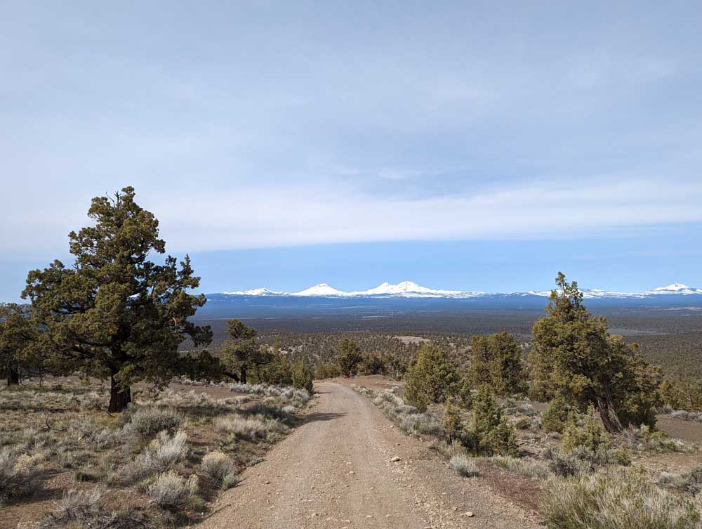
- A view of the mountains at Cline Buttes.
This time of year, many runners and hikers set big goals. For a lot of adventurers, those aspirations include exploring the high country once the snow recedes either in our local mountains or some destination alpine paradise. Getting to these sublime landscapes often requires gaining significant elevation, which means getting in shape to take on some serious hills.
It can be challenging to find decent terrain to train on while deep snow still covers the higher-altitude trails. Cline Buttes west of Redmond has all kinds of hills to climb. Some of them are on singletrack trail, some on a gravel road. Others are steep, rocky swaths. It is usually snow-free during the spring shoulder season and even for much of the winter, too.
Trending
The area has its own beauty with unique views and early season wildflowers blooming along the trails and roads. Migrating birds pause on the juniper branches, including Clark’s nutcracker and raptors.
Cline Buttes has undergone several changes in the last few years, for better or worse. Be sure to stay up to date on the latest closures, access points and trail locations. It can also be confusing since there are several roads, unauthorized trails, and power line corridors that crisscross the more established routes. Always be prepared with a map and communication at the very least when heading out on any adventure, but especially when exploring a new place.
The area has a patchwork of private and public land, so heed all signs indicating private property boundaries.
Parking for the trails is now off of the “Quarry Road.” Trails cannot be accessed from the old parking area at the base of the FAA road right on Cline Falls Highway because of the construction and development on private land.
From the “Quarry Road,” park on the dirt turn off the left side with signs prohibiting motorized use on the trails. Take care not to block the road. Park only in locations that have already been disturbed and are bare dirt to avoid crushing vegetation or sparking dry grasses with the heat of a vehicle. Go through the pedestrian gate at the end of the dirt spur road to get to the trails. An active grazing allotment exists on Cline Butte, making it critical to keep the gate closed so that cattle don’t wander out of the permitted area.
From here, there are several options to find an uphill burn. There are a few steep trails on the southeast side of Cline Butte that are rocky and technical, making them a challenge to run and more like a wild stair stepper workout. If future goals require power hiking and moving over loose rocks, these will get you ready. Another steep option is the Saddle Trail, but it is currently closed to protect nesting raptors.
Trending
The very summit of Cline Butte is fenced off to protect the communication site, but several viewpoints have expansive vistas of the surrounding landscape.
From the summit, the main gravel road leads all the way down to the construction site on private property. However, the first few switchbacks are excellent for hill repeats with sprawling views; steeper sections alternate with lengths to catch your breath a little. The XC Cline Butte Trail connects to the road off of the highest switchback. Head down this trail, which loops around the butte at a fairly gentle grade on smooth singletrack. Going up or down the XC Trail is actually a pretty pleasant grind. A trail map can be found on bendtrails.org.
The last hill to climb at Cline is a metaphorical one: It’s up against change and time. A section of state land on the northwest side of the butte that the XC Trail crosses through is proposed to be sold to a private developer.
The land would become part of a golf course and luxury home community. It would segment the XC Trail and further change the access and trail opportunities on Cline Butte. To learn more about the sale and proposed development, read this letter from the Department of State Lands: tinyurl.com/clibutte.
For additional information visit Central Oregon Landwatch’s website: centraloregonlandwatch.org/clinebuttes.
Marketplace

Best of the Best of Bend 2025

-
eEdition

-

-