Central Oregon outdoors and trail conditions
Published 12:00 am Friday, October 28, 2022
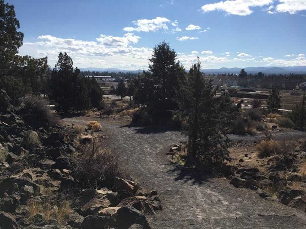
- Bessie and other buttes to the south can be seen from the high point in Stone Creek Park.
As November approaches, chances to hike Central Oregon trails are becoming fewer. Many campgrounds have closed at this point in the year, and come Tuesday, the sno-parks begin requiring a permit. Don’t forget to snag one on your way up to enjoy the recent snowfall in the mountains.
Don’t forget to bring your coat as temperatures are dropping, especially at elevation. If you aren’t ready for snow yet, head to the High Desert, where trails tend to stay snow-free much longer.
For a full list of conditions updated regularly, please visit centraloregonexplore.com
Hiking and Day Use Sites
Deschutes National Forest
- Bessie Butte Trail: Open
- Boyd Cave Day Use Area: Open
- Horse Butte Trailhead: Open; light deadfall above Swamp Wells Horse Camp near junction with Crater Rim
- Pine Mountain: Open
Ochoco National Forest
- Alder Springs Trailhead: Open
- Cyrus Trailhead: Open
- Giddy-Up Go Trailhead: Open
- Gray Butte Trailhead: Open
- Henderson Flat OHV Trail System: Open
- Henderson Flat Staging Area: Open
- Rimrock Springs Trailhead: Open
- Scales Corral Trailhead: Open
- Skull Hollow Trailhead: Open
- Tam-A-Lau Trailhead: Open
- Trail Crossing Corrals Trailhead: Open
Bend Park & Recreation Trails
- Riley Ranch Nature Reserve Trails: Open
- Rockridge Park Trail: Open
Bureau of Land Management
- Badlands Rock Trail: Open
- Black Hills ACEC: Open; climbing and geocaching are prohibited
- Chimney Rock Trail: Open
- Christmas Valley Sand Dunes: Open
- Cline Buttes Recreation Area: Open
- Crack-in-the-Ground: Open
- Dry River Canyon Trail: Open
- Derrick Cave: Open
- Flatiron Rock Trail: Open
- Fossil Lake ACEC: Open; motor vehicles and fossil collecting prohibited
- Green Mountain: Open
- Horny Hollow Trail: Open
- Huntington Wagon Road: Open
- Lost Forest: Open, vehicles restricted to designated roads only
- Lower Crooked River: Open
- North Fork: Open
- Oregon Badlands Wilderness Tumulus Trail: Open
- Redmond Caves Recreation Site: Open
- Scout Camp Trail: Open
- Steelhead Falls Trail: Open
- Tumalo Reservoir: Open
- Trout Creek Trail: Open
Oregon State Parks
- Cline Falls State Scenic Viewpoint: Open
- Cove Palisades State Park: Open; ABC (Deschutes) Campground, South and Middle Loops of E (Crooked River) are open, Lower Deschutes Day Use open, marina open
- Fort Rock State Natural Area: Open; rock scrambling closed in southeast area to protect nesting falcons; cave tours canceled
- Jasper Point: Open; boats with motors are not advised due to low water
- Peter Skene Ogden State Scenic Viewpoint: Open
- Prineville Reservoir State Park: Open; boats with motors are not advised due to low water
- Smith Rock State Park: Open
Camping
Deschutes National Forest
- China Hat Campground: Open; no campfires
- Pine Mountain Campground: Open; no campfires
Ochoco National Forest
- Cyrus Horse Camp: Open; no campfires; no campfire Creek Campground: Open
- Dry Creek Horse Camp: Open; no campfires
- Haystack Reservoir Campground and Day Use Area: Open
- Haystack Reservoir Group Site: Open
- Haystack West Shore Campground and Day Use Area: Open
- Skull Hollow Campground: Open
BLM — Prineville District
- Barr Road North Staging Area: Open
- Big Bend Campground: Open; no campfires
- Buckhorn Staging Area: Open
- Castle Rock Campground: Open
- Chimney Rock Campground: Open
- Cobble Rock Campground: Open
- Lone Pine Campground: Open
- Macks Canyon Recreation Site: Open; no campfires
- Palisades Campground: Open
- Post Pile Campground: Open
- Steelhead Falls: Open; no potable water; no campfires
- Stillwater Campground: Open
Cycling
East of Bend trails
- Dry River Canyon: Sandy/loose
- All other trails riding well
Prineville and Ochoco trails
- Scotty Creek: Variable
- All other trails riding well
Maston complex
- All trails riding well
Redmond trails
- All trails riding well
Madras East Trails
- E-Bikes allowed on all trails
- All trails riding well
Fishing
Updated at 10 a.m. Oct. 27
- Lower Deschutes (Pelton Dam to Columbia River): 4,710 cfs; redband trout, steelhead, whitefish; trout fishing and retention remains open, and fishing reports suggest pretty good fishing out of Maupin; no spring Chinook season in 2022 due to another year of predicted poor returns of both wild and hatchery fish
- Middle Deschutes (Benham Falls to Lake Billy Chinook): 3,960 cfs; brown trout, rainbow trout; no recent report; artificial flies and lures only, no limit on brown trout
- Crooked River (below Opal Springs): 1,190; rainbow trout and mountain whitefish; any trout over 20 inches are considered steelhead and must be released; bull trout must be released unharmed and reported to the USFW at crookedbulltrout@fws.gov, the water is currently low and dirty with plenty of aquatic vegetation in the channel
- Prineville Reservoir: 10% full; rainbow trout, small and largemouth bass, catfish, crappie, crayfish; trout fishing has been good near the dam, all boat ramps are closed due to low water
- Ochoco Reservoir: 0% full; rainbow trout, black crappie, smallmouth bass; water level is still extremely low and bank access is limited to walk-in only
- Haystack Reservoir: 11% full; rainbow and brown trout, kokanee, largemouth bass, black crappie, bluegill and bullhead catfish
- Lake Billy Chinook: Bull, brown and rainbow trout, kokanee, smallmouth bass; anglers in the Deschutes arm are seeing bull, brown and rainbow trout, while a few bull trout are being caught in the Metolius arm; for the remainder of the reservoir, harvest is limited to one bull trout over 24 inches under the daily trout limit; anglers can now keep five kokanee in addition to daily trout limit; no bag or size limits on brown trout and bass
Fire danger is listed as High in the Deschutes and Ochoco National Forests and the Crooked River Grasslands. It is listed as low in the Willamette National Forests.
Industrial Fire Precaution Level has been lowered to Level 1 as of Sept. 23 in the Deschutes, Ochoco, Willamette National Forests and the Crooked River Grasslands.
The Deschutes National Forest expanded the temporary emergency closure area implemented as a result of the increased fire activity on the Cedar Creek Fire. Check inciweb.nwcg.gov/incident/8307/ for updates.
As of July 22, 2020, Deschutes River access is closed due to safety concerns and to prevent further erosion to the riverbank. The access point will be closed until further notice. For more information visit bendparksandrec.org
• Peregrine and Prairie Falcon climbing closures have been lifted as of July 16, 2022. The parkwide ban on drones has also been lifted.


Best of the Best of Bend 2025

-
eEdition

-

-
Go! eEdition