Strong winter storm batters mountains, southern Deschutes County
Published 10:06 am Friday, March 10, 2023
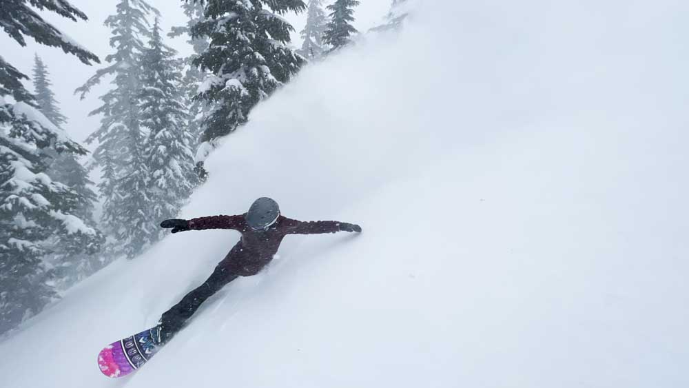
- Corrie Bernard, of Bend, slashes a toe-side turn while riding deep powder near the Outback chairlift at Mt. Bachelor ski area last March.
Bend, La Pine, Sunriver, and other parts of southern Deschutes County woke up to winter weather conditions Friday, with reports of deep snow and blizzard-like conditions at higher elevations, and a winter storm warning in effect until Friday night for areas above 4,000 feet.
The amount of snow that fell in Bend overnight Thursday to Friday ranged from 2 to 5 inches, with western parts of the city seeing the highest snowfall, said Brandon Lawhorn, a meteorologist at the National Weather Service in Pendleton.
Lawhorn said the Sisters area received 4 to 5 inches of snow. La Pine and Sunriver received up to a foot of fresh snow, and mountain areas saw 18 inches. The Ochoco Mountains have received 5 to 9 inches of snow.
“An atmospheric river event began impacting much of California on Thursday, which is also providing some storm impacts to western and into Central Oregon,” said Matt Warbritton, a Portland-based hydrologist with the Natural Resources Conservation Service.
“The storm from Thursday into today brought some added snowpack in these regions.”
Bend-La Pine Schools delayed the start of school by two hours in La Pine and Sunriver. Schools in Bend started on time, but traffic backups around town caused delays on some bus routes.
Mt. Bachelor ski area has reported 18 inches of new snow in 24 hours and 25 inches in the last 72 hours. The ski area posted a tree-well hazard on its website to warn skiers of the danger of skiing in deep snow conditions. The Central Oregon Avalanche Center is also warning of a high likelihood of avalanches in the region.
A winter storm warning was in effect until 10 p.m. Friday for the east slopes of the Cascades, including Sunriver and La Pine, according to the National Weather Service. Heavy snow was expected above 4,000 feet in elevation, with accumulations of 4-10 inches and gusting wind. The weather service said travel could be difficult or impossible.
ODOT spokesperson Kacey Davey advised drivers to exercise caution on the roadways due to slippery conditions and low visibility.
“Many roads that may appear just wet may be slick and covered with black ice,” said Davey. “Our crews are out there plowing and sanding, but ice is one of the tougher road conditions to combat.”
“If you decide to travel today, make sure you are prepared for a wide range of wintry conditions on the roads. Snow, ice and low visibility are all things that you may encounter, especially if you travel over any mountain passes. Make sure you leave with a full tank of gas and pack supplies like food, water and warm clothes in case your trip is delayed along the way.”
Davey advises drivers to use tripcheck.com before traveling to check conditions. Public transportation is also a good idea, she said, due to hazardous conditions for drivers.
The fresh snow has helped boost snowpack totals in the Upper Deschutes and Crooked River basin. Snowpack is now 108% of normal, compared to just 103% of normal earlier this week.
Lawhorn said some areas of Bend could expect another inch of snow during the day on Friday, with the snow tapering off by Friday night. Mt. Bachelor could receive another 6-12 inches on Friday. Temperatures in Bend and lower elevations are expected to be in the mid-50s by Monday, with Mt. Bachelor expected to have temperatures in the high 30s.


Best of the Best of Bend 2025

-
-
-