Central Oregon braces for yet another round of winter weather
Published 4:15 pm Monday, March 27, 2023
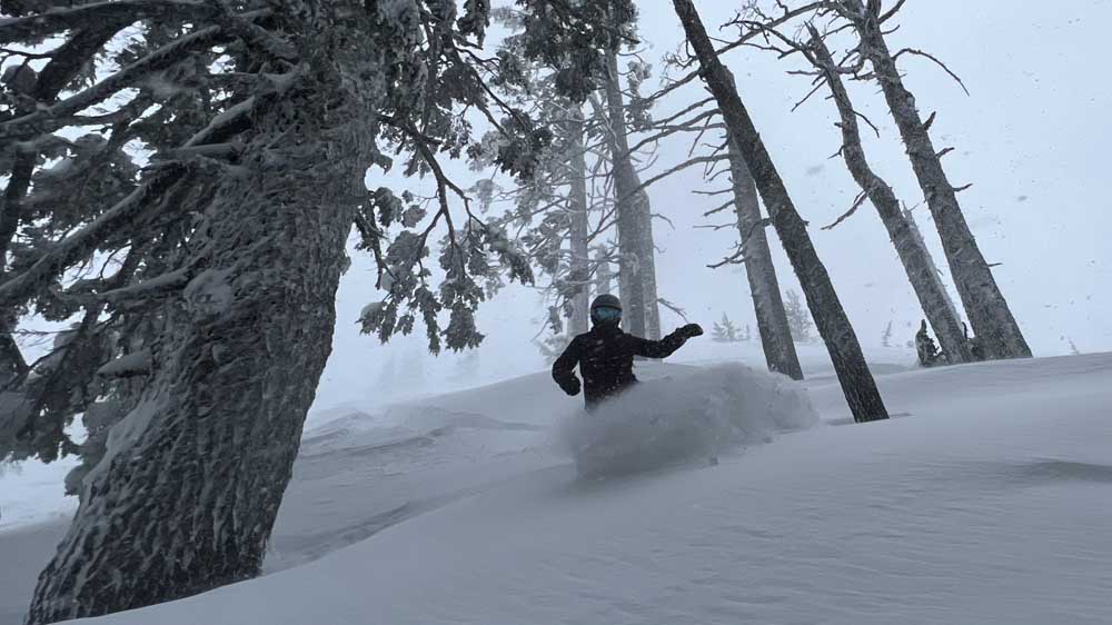
- Corrie Bernard, of Bend, rides deep powder near the Outback chairlift at Mt. Bachelor ski area last March.
A winter storm warning is in effect for most of Central Oregon beginning at 5 p.m. Monday and lasting until 8 p.m. on Tuesday. The warning affects areas from Bend south to Klamath Falls, with high elevations and mountain passes expected to see more than a foot of snow and strong winds.
Matt Callihan, a meteorologist with the National Weather Service in Pendleton, said areas over 4,000 feet could receive 8 to 14 inches of snow.
Trending
The Mount Bachelor area was forecasted to have wind gusts of 30 mph Monday night, according to the National Weather Service. While Mount Bachelor could receive up to 14 inches of snow, the Santiam Pass area was expected to see less accumulation overnight, around 6 to 8 inches.
High winds are also expected in Bend, but snow accumulation is forecast to be under 2 inches. La Pine and Sunriver could see 4 inches of snow.
The Oregon Department of Transportation advises caution when driving along high mountain passes and says travel could be “very difficult to impossible.” The Department advises carrying an extra flashlight, food, and water in your vehicle in case of emergency. The latest road conditions are available by calling 511 or checking tripcheck.com.
The expected snow is the latest round in a series of winter storms that hammered Central Oregon in late March. Snowpack in the Upper Deschutes and Crooked River basins have increased to 126% of normal as of Monday, up from 103% of normal three weeks ago.
Mt. Bachelor ski area has received 378 inches of snow this winter and could eclipse 400 inches for the first time since the winter of 2016-2017 (that winter the mountain received 578 inches).
Read more: Avalanche risk in the back country
Trending
Over the past seven days, 7 to 30 inches of snow fell in the central Cascades, according to data compiled by the Natural Resources Conservation Service. The Service operates more than 150 automated snow and weather recording stations in the Cascades, known as SNOTEL sites.
Mount Bachelor received 12 inches of snow in the third week in March and 16 inches in the fourth, according to data from a nearby SNOTEL station, said Callihan.
Several sites in the central Cascades have recorded their second-highest snowpack on record. The Irish Taylor SNOTEL site (117 inches, 9.7 ft) between Waldo and Cultus lakes ranks among the highest snow depths along the spine of the Central Cascades.
While the snowpack has been strong in recent weeks, total precipitation in Central Oregon is lagging at just 86% of normal.
“There was a lack of early season rain, the majority of the (precipitation) that did fall was snow and very little rain. We started out the season dry,” says Kyle Gorman, Central Oregon regional manager of the Oregon WaterResources Department.
Marketplace

Best of the Best of Bend 2025

-
eEdition

-

-