City advances new crosstown bike routes to improve safety, reduce vehicle traffic
Published 5:45 am Sunday, July 2, 2023
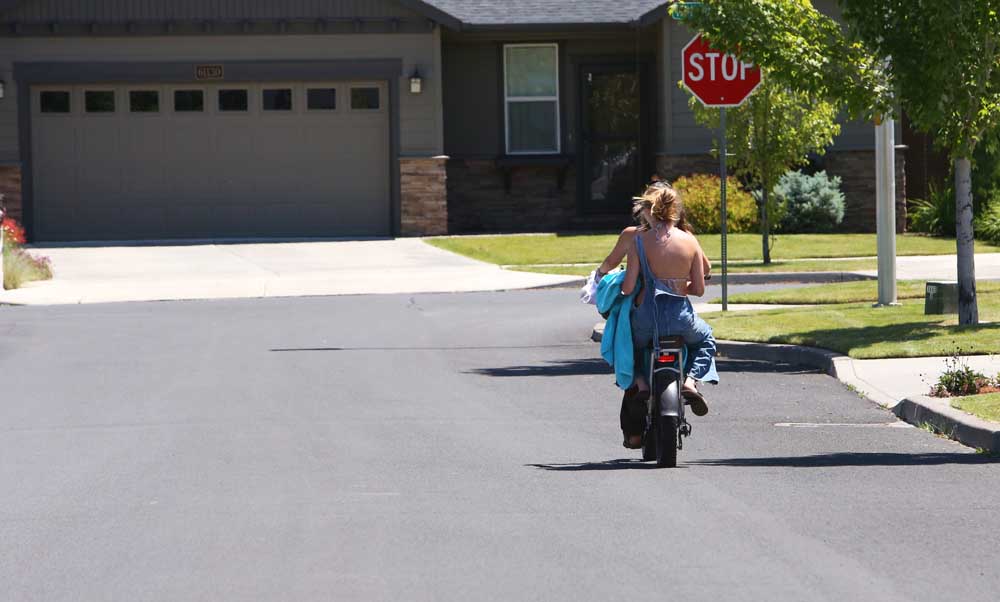
- Two young women without helmets ride an electric bike on the streets of Bend in late June.
For many Bend residents, cycling across town on a safe and separated bike path has been a pipe dream.
Now the city is advancing plans to make it a reality. A plan to build a city-spanning bike path has been set on a two-year trajectory for completion and even has a new name: Crosstown Bikeways.
The new name and timeline, described at a recent Bend City Council meeting, will feature around 15 miles of bike lanes and paths — an east-west route and a second north-south route.
Bike accidents requiring a paramedic response are ticking higher each year in Bend and creating safer bike routes is one part of the solution. Environmental concerns also play a role — encouraging bike use reduces vehicular traffic and greenhouse gas emissions. Bend ranks among the least bikeable cities in Oregon, according to walkscore.com.
The crosstown route is designed to provide riders with a more comfortable and safe route compared to traveling nearby busy roads. The city’s plan is to utilize existing bike paths, shared streets, and safety improvements at intersections. The city plans to refine its treatment decisions over the next few months.
“Imagine being able to safely walk, bike, or roll from one end of the city to the other without worrying about being hit by a car,” said Ariel Mendez, a city council member. “We’re going to make that happen.”
Current and future routes
How the crosstown route will be configured is still a work in progress but generally, the east-west route would connect Northwest Crossing with eastern neighborhoods beyond Pilot Butte.
The north-south configuration would connect Pine Nursery Park and the Caldera High School area, with the preferred route skirting the west side of Pilot Butte.
The two routes would intersect for a short stretch near Juniper Park before diverging again. The downtown section of the route crosses Hwy 97 at Franklin Ave. Some sections utilize the city’s urban trail network, such as the Larkspur Trail in east Bend. Back streets will be given priority over main boulevards.
For inspiration and modeling, Bend officials are looking to Northern Europe, specifically Denmark, The Netherlands, and Norway, countries that have a cycling-centric transportation network.
Connecting a low-stress network of streets and paths gives the crosstown route a zig-zag configuration, which makes the trip longer, but will ultimately be safer for all riders, planners say. Utilizing trails and existing protected bike lanes also helps to keep project costs down.
Kevney Dugan, president and CEO of Visit Bend, expects the Crosstown Bikeway to be used mainly by locals rather than out-of-town visitors but said he welcomes anything the city can do to get cars off the road as traffic in Bend worsens.
“We are always in favor of alternative, non-motorized transportation that helps people navigate the city streets in a safe and sustainable way,” said Dugan.
Wayfinding project
While the crosstown bikeway is in progress, city staff are also working on a “wayfinding” and branding project — the placement of signs along bike routes that let bike riders know the safest routes to a variety of destinations within the city.
The goal of the project is to give riders a low-stress network of bike routes spaced a half mile apart, making every household within a quarter mile of a bike path. The network is designed to get bike riders traveling through higher-density developments and near schools, parks, and destination or activity centers, according to city planning documents.
The Crosstown Bikeway project has a budget of $1.3 million to tie together the bike routes. Some portions of the route are already separated from the road or only need minor improvements. Other areas will need more costly upgrades.
Apart from that budget, there are funds from a bond passed by voters in 2020. The bond dashboard states that $42 million is set aside for pedestrian and bike-friendly road projects. A sample project includes $11.4 million to upgrade the Bear Creek Corridor, with $7.9 million coming from the bike and pedestrian funding category.
Future routes
The Crosstown Bikeway won’t serve all corners of the city but officials say the route is just one of several they hope will eventually cover the majority of Bend’s neighborhoods. The city has identified 12 key walking and bicycling routes that together form the initial implementation of a low-stress network linking key destinations.
“The Crosstown Bikeway Project is just one of many ongoing or planned bicycle and pedestrian infrastructure projects around town,” said Kevin Howard, a Bend project engineer.
Mendez says he frequently hears from city residents that they need safer bike paths in their neighborhood and he emphasized that planning the network of routes includes utilizing equity mapping to give priority to underserved neighborhoods, utilizing demographic information.
“I don’t want to leave anyone behind at all, so let’s do the planning so we have a robust, future plan to connect everyone up,” he said.
Mendez called the crosstown route “just the beginning” and said more bike router expansion can occur based on demand and needs.
“Basically we had to start somewhere,” he said. “It is not intended to be the final step.”
According to the website walkscore.com Bend is a “car-depedent city” with a walk score of 32 and a bike score of 53, ranking it among Oregon’s least bikable cities. “Most errands require a car in Bend,” according to the website. A sample ranking of Oregon’s biggest cities:
- Portland: walk score 67, bike score 83
- Eugene: walk score 46, bike score 72
- Hillsboro: walk score 44, bike score 72
- Gresham: walk score 47, bike score 62
- Ashland: walk score 55, bike score 62
- Salem: walk score 42, bike score 60
- Medford: walk score 38, bike score 53
- Bend: walk score 32, bike score 53
- Redmond: walk score 29, bike score 46
- Klamath Falls: walk score 40, bike score 44
More Bend


Best of the Best of Bend 2025

-
-
-