El Niño means a warmer winter, but coming storms may help start of ski season
Published 6:30 am Friday, November 17, 2023
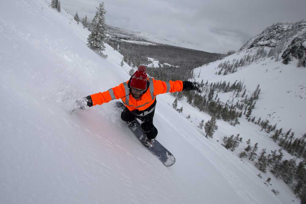
- A snowboarder riding on the Crater run off the top of Hoodoo.
Despite the El Niño weather pattern that could bring warmer-than-average conditions to Central Oregon this winter, a series of storms during the next couple of weeks could help the start of ski season at Mt. Bachelor.
“Next couple weeks we have a good signal, suggesting we’ll be getting a series of storms coming through,” said Larry O’Neill, director of climate services at Oregon State University’s College of Earth, Ocean and Atmospheric Sciences. “They’ll be warmer than normal storms, so the freezing level will be somewhere around the base of Bachelor. They could bring some snow, especially above 7,000 feet. It might be the heavier variety, definitely not a powder signal. It’s not looking that bad, actually, for getting a good base. That could be in the cards. Hopefully that’s what we get.”
Heavy, wet snow is ideal for building a snow base in the early season, as Mt. Bachelor ski area is tentatively scheduled to open Nov. 24, the day after Thanksgiving.
A wet El Niño?
El Niño is a seasonal weather pattern driven by sea surface temperatures in the Pacific Ocean. This El Niño could be a strong one, O’Neill said, which could actually lead to wetter-than-normal conditions.
With a base elevation of 6,300 feet, Bachelor can pretty much count on getting decent snow every winter. But that is no longer the case for smaller ski resorts like Willamette Pass (base elevation 5,128 feet) and Hoodoo (base elevation 4,668 feet). Those resorts typically try to open by early to mid-December, before the winter holidays.
“During strong El Niños, we can get atmospheric river events that are really warm, so the freezing level will go way up over pass level,” O’Neill said. “So places like Hoodoo or Willamette Pass, they’re very vulnerable since they are down around 5,000 feet. Someplace like Bachelor probably isn’t going to be quite as affected, because there will be at least SOME snow.”
An atmospheric river is a plume of moisture that helps carry saturated air from the tropics to higher latitudes, delivering sustained rain or snow. This can be a problem for the smaller, lower-elevation ski resorts like Hoodoo and Willamette Pass. Both resorts were forced to close midseason in 2015-16, the last time a strong El Niño hit the Pacific Northwest.
While El Niños usually make for warmer and drier Northwest winters, they make for cooler and snowier winters in the Southwest. The dividing line is in southern Oregon, according to O’Neill.
Bachelor’s location helps
Bachelor’s location farther south and east often help protect it from getting the worst of a low-snow El Niño winter.
“In Central Oregon, there is not much signal one way or the other for wet or dry, although El Niños are usually warmer,” O’Neill said. “Being farther east definitely helps Bachelor.”
Last winter the Northwest experienced a weak La Niña that ended up making for one of the cooler winters on record in Oregon and a consistent snowpack.
“The snowpack was great,” O’Neill said. “When precipitation did come, it came as snow, and we didn’t have any of these midseason days of rain that can melt stuff.
“That’s more likely to happen this winter.”
Climate change means variable snowpack
O’Neill said that the Pacific Northwest can expect more rain-on-snow events in the coming decades, due to climate change.
“It won’t stop snowing at the higher elevations, but the snow level will go up somewhat and then our snowpack will just be more variable,” he said. “Some of these systems and atmospheric rivers will be more intense, with warmer rain. The snow seasons will definitely become more variable.”


Best of the Best of Bend 2025

-
eEdition

-

-
Go! eEdition