Tam-a-láu Trail is the trail that keeps on giving
Published 9:30 am Thursday, December 28, 2023
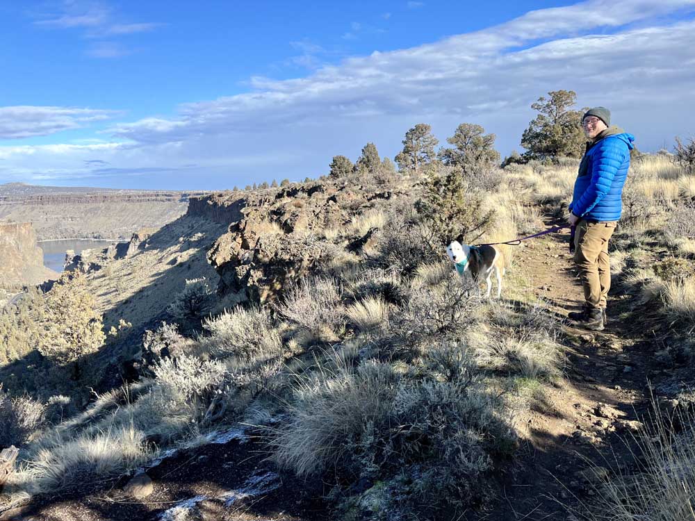
- Dylan Lipke and Juno soak in the views of the Deschutes and Crooked rivers on either side of The Island Research Natural Area from Tam-a-láu Trail.
Tam-a-láu Trail has been on my hiking bucket list for well over a year.
A few days off work around Christmastime allowed the time and energy to hike the 6.6-mile loop trail with over 800 feet of elevation gain. My husband, dog and I celebrated Christmas Eve at an elevation of 2,600 feet surrounded by sweeping views in Cove Palisades State Park.
Tam-a-láu Trail is a moderate hike that steadily gains 600 feet until it reaches a lava plateau named The Peninsula. The initial ascent is 1.6 miles, after which a 5-mile loop hugs the plateau’s edges in a triangle-like shape.
Tam-a-láu means “place of big rocks in the ground” in Sahaptin, a language spoken by the mid-river tribes of the Colombia Plateau.
A dog named Willie
During the initial ascent, the trail narrowed where the ground gave away sharply below. We stood off to the side as a couple passed us, asking if we had seen their black and white border collie.
His name is Willie, said Chinh Le, who was accompanied by her partner, Billy Meeker.
A paper notice pinned to the sign on top of the plateau told us Willie was last seen around noon the previous day. We kept a lookout for him during the remainder of our hike and when we heard barking long off in the distance, we hoped it was Willie. The sharp drop-offs of the plateau are not a forgiving landscape — especially over a 24-hour period for a domestic animal.
The Peninsula is composed of rock and sediment deposited by the Deschutes River over thousands of years, according to “Best Dog Hikes Oregon” by A Falcon Guide. Only the hardiest and most adaptive plants can thrive on the plateau.
Endless views
While some hikes involve elevation gain that leads to a pay-off at the end, Tam-a-láu is the trail that keeps on giving.
We hiked the loop clockwise as suggested by the aforementioned guidebook, but either direction would offer a memorable experience. About 50 feet after embarking on the loop trail, we were treated to a view of the expansive Deschutes River snaking through the canyon below.
The water was still and glass-like, reflecting the clouds overhead. Jordan Road curved alongside the river, with its bright yellow stripe down the center. I snapped a few panoramic shots and assumed we had experienced the best views of the trail.
But it was only the beginning.
The views failed to disappear as the trail progressed to the tip of The Peninsula, at which point both the Deschutes and Crooked Rivers were visible on either side of The Island Research Natural Area.
The Island has been closed to the public since 1997 when it was designated a natural national landmark to protect its fragile native ecosystem, according to the U.S. Forest Service.
Around the corner were views of the deep blue waters of Lake Billy Chinook. The beautiful Jordan Bridge connected the two sides of the gorge deep in the canyon.
I found myself tiring not only from exertion, but from the sheer beauty throughout the length of the 3-hour hike.
A happy ending
In the process of writing, I reached out to Willie’s owners to check if they had any luck with finding their dog.
I received a call back around 1 p.m. on Wednesday — four days after Willie went missing.
Meeker’s voice was fast and excited. He said they’d returned to the trail in search of Willie on Wednesday and when they had a sliver of cell service, they received a phone call.
Willie had been found near Crooked River Ranch.
“We’re on our way to pick him up right now,” Meeker said.
More Information
An Oregon State Park pass or $5 day-use pass is required. A day pass may be purchased at the self-pay station at the park.


Best of the Best of Bend 2025

-
eEdition

-

-
Go! eEdition