Reclaim the Sunday drive on Paulina Highway
Published 4:45 am Friday, December 29, 2023
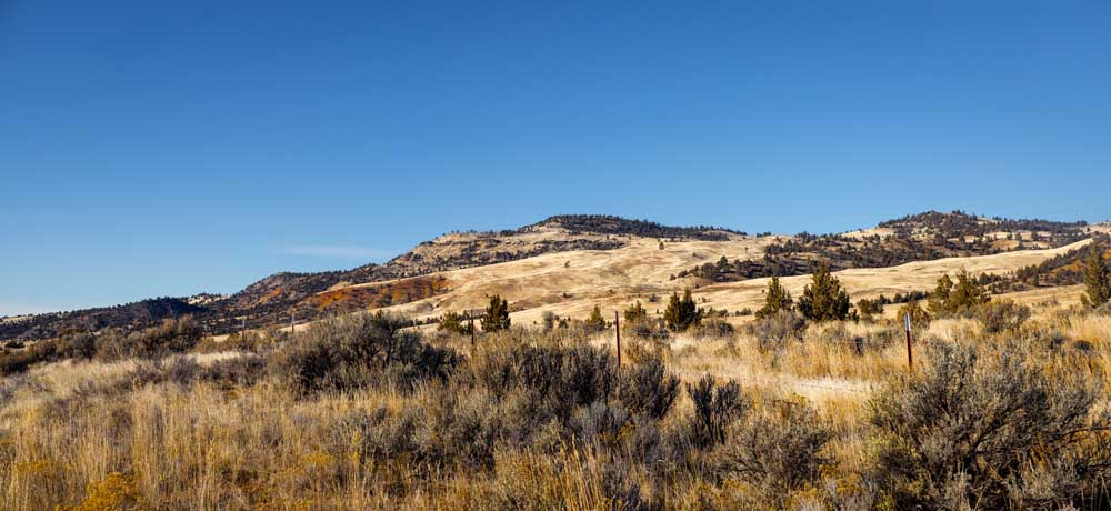
- Rolling, grassy hills along the Paulina Highway break up the typical high lava plateau topography, along with deep red soils scattered on various points.
The Sunday drive seems like a relic of a bygone era, but it doesn’t have to be. All you have to do is charge or fill up the tank, pick a direction and go.
Rediscovering those lonely stretches of road between nowhere and no place in particular, drinking in the often-forgotten scenery of our state, can only deepen an appreciation for the world around us. There are a lot of places to adventure to.
Since 2024 is staring down the barrel of a year that still feels like it should be 2019, my New Year’s resolution is to grab my new camera and head out to explore these lonely roads that spaghetti across Oregon, particularly the routes I’ve either missed entirely in my 35 years on this planet or was too young to remember traversing in my family’s old Bronco.
Kicking off this new year a little early, my sister Heather and I took off east down Paulina Highway (Oregon Route 380) to see what surprises lay down the otherwise quiet-looking road.
We were both struck by the varied landscapes seen from the car windows and the human history laid out before us, not to mention a couple of sweet treats picked up along the way.
Older than the pavement
Paulina Highway stretches about 55 miles east from Prineville to the tiny community of Paulina, and while the cows seem to outnumber the people you’ll see along the way, that’s not what makes this scenic drive something of note.
As the road climbs east up and over a high lava plateau, then down the other side into another valley, you can’t help but be a little impressed with the sights. Ruddy-colored volcanic formations including some that resemble a serpentine backbone dot the sea of berry-filled juniper and light-yellow grasses until you meet the impressive Eagle Rock.
The towering tuff formation (hardened volcanic ash) rises out of a grassy hill and impresses from every angle. With a reddish-orange face and plenty of crags and crannies to spot birds from the spring through fall, the rock is also home to a rockhounding site for agate (private claims surround the area, so check with the Bureau of Land Management maps for exact entry areas and open seasons).
The highway then meets up with the Crooked River and follows it until its split between the North and South forks then continuing until the southern fork meets Beaver Creek near Paulina.
Smack dab in the middle
A little less than halfway down the highway you’ll come across the small community of Post, which has two claims to fame: It’s the geographical center of the state, and the general store has some fantastic milkshakes as well as famous meatloaf sandwiches.
Just beyond Post, nestled within the newly formed Juniper Hills Preserve, a privately owned and managed area open seasonally, which you must call before visiting (visit nature.org for more information) are beautiful examples of paleosols.
A few of these “painted” hills within the boundaries can be spotted by the highway. These areas of deep red and cream-striped soil are astounding to see anyplace, but miles away from the more famous Painted Hills near Mitchell, it is a pleasant and beautiful extra to soak in along the way.
Even in the rain, Borden Beck Wildlife Preserve is a small wonder
Farther along the road is the long-abandoned Maury Stage Station, which remains an interesting subject for photos as it slowly wears away with time and the elements. The pioneer-era structure is a beautiful echo of the past.
The station was a stop on the route between Prineville and Burns, which if you have the time and a good map, you can still make the full route. Route 380 ends in the small community of Paulina, famous for their summer amateur rodeo. The quaint, country town is the terminus for this quiet route through a section of the state often overlooked by the rest of us but that might be what folks around here like about it: It’s quiet.
If you venture out that way, be kind and courteous to those who call this quietly remarkable route home.
More Explore


Best of the Best of Bend 2025

-
-
-