Cottonwood Canyon State Park rocks
Published 6:33 pm Sunday, March 17, 2024
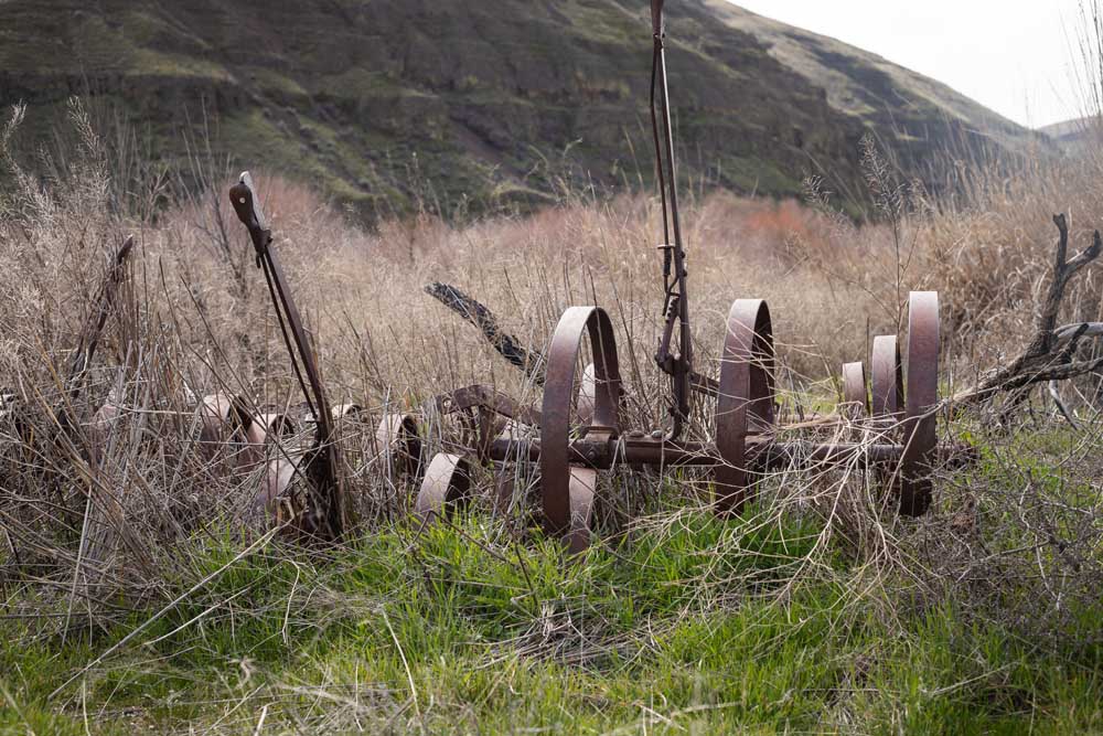
- An old farm plow rusts along the banks of the John Day River and the Hard Stone Trail at Cottonwood Canyon State Park.
By Makenzie Whittle
As I rounded the first corner on the Pinnacles Trail at Cottonwood Canyon State Park (https://stateparks.oregon.gov/index.cfm?do=park.profile&parkId=195) recently, I was flagged down by a couple of grey-haired, binocular-wielding hikers.
“Are you a biologist?” one of them asked me no doubt curious over my incessant stopping to photograph the wild parsley, a rock, a fence post or the river below us.
When I told them about this monthly contribution to the Bulletin, they immediately, yet playfully bemoaned “Don’t tell anyone!”
Apologies to them and everyone else who has a similar sentiment.
I have to admit, I had some hesitation too as I finally made the trip up to the park about 15 miles southeast of the town of Wasco and I saw the incredible scope of the place.
Perched on the banks of the lower John Day River (https://www.oregonencyclopedia.org/articles/john-day-river-n-central-ore/) and towered over by incredible canyon walls showcasing millions of years of geologic history, it’s understandable their want to keep this place under wraps.
Rustic setting
The park is one of the least visited in the state, but it’s also the second-largest (https://www.oregonlive.com/travel/2016/05/the_11_biggest_state_parks_in.html) at over 8,000 acres it is one of the more recent additions to Oregon’s impressive roster of designated park spaces opening in 2013.
The park proper is open year-round and features a small, 21-site campground, 14 walk-in sites, 4 rustic cabins, a group camp, an activity center, both flush and vault toilets, an accessible picnic shelter and over 10 miles of hiking trails. The longest of these trails includes the 4.3-mile aforementioned Pinnacles Trail (closed at the 3-mile mark Feb. 1 through Sept. 30 for upstream golden eagle nesting) and its twin across the water, the Lost Corral Trail accessible by the JS Burres Day Use Area. The two are open to both hiking and biking (Lost Corral is also open to horses) while the shorter trails are only open to foot traffic. But this isn’t a place where you’ll want to rush through on wheels anyway.
The park almost begs you to take a moment and breathe in not only the river and all the recreation that it brings but also the history that is still a part of it, both human and geologic.
The Tenino, the Murthas and the John Day
Cottonwood Canyon State Park seems very proud of its lineage and takes steps to ensure that everyone’s story is told here, including the river’s.
The area is part of the ancestral lands of the Tukspush, a Tenino band of Sahaptain speakers, stretching back thousands of years. The banks of the river here were ripe with roots for spring gathering and for chokecherries and hunting in the fall.
More recently, European-Americans began arriving at the remote canyon around the turn of the 20th century as indicated by the interpretive signage on the fence (https://www.columbian.com/news/2014/jun/19/new-oregon-state-park-tries-for-old-ranch-feel/) surrounding the barn that still stands. On it are diary entries and other words from those early settlers about life out in this wind-driven and sun-ridden land.
The Murtha family owned the ranch here for generations (https://cottonwoodcanyon.wordpress.com/faq/) before selling it to the Western River’s Conservancy who then sold it to Oregon State Parks which has kept the Murtha’s barn, corral, windmill and several fence posts as a view into their lives here in the remote river canyon.
The river also gets a say in the historical conversation with another section of fence where there is its truncated history is told from its perspective. The river reminds us of the millions of years it took for it to carve this deep gulch, of the people who camped on its banks gathering food and game, of the families who built their lives on its banks, and for all of us who continue to come here and explore.
This river rocks
The stunning canyon that rises downstream of the park facilities is really the star of this adventure highlighting the millions of years the river cut through the rock to form this vista that could hold its own with any canyon of the southwest.
It’s highlighted too by the topography seen on the way out here; it’s enough to want to make you stop your car every turn to take a picture.
State Route 206 carves through the gently rolling landscape surrounding the Wasco area full of deposits from ancient floods ( https://geology.teacherfriendlyguide.org/index.php/soils-w/soils-region2-w#:~:text=These%20soils%20tend%20to%20be,these%20soils%20are%20derived%20from.) then dives deep into canyons cut by creeks and time revealing prime examples of columnar basalt faces from the Grand Ronde Columbia Basalt Group (https://www.usgs.gov/observatories/cvo/science/columbia-river-basalt-group-stretches-oregon-idaho) deposited here 16 to 15.6 million years ago.
Once you reach the park, you get a grand look at the river-cut canyon towering over the well-maintained park facilities and the bank of the John Day River. Here are stunning sheer and ziggurat(https://www.merriam-webster.com/dictionary/ziggurat)-like rock faces that rise a thousand feet above the river below, showcasing tan and reddish cliff faces that could hold their own against canyons in the Southwest.
The Pinnacles Trail hugs the river and the sharp cliffs above it allowing hikers to feel the full scope of this canyon. At one point the rock has even been carved out to allow you to almost walk under it and eventually leads you to a view of the trail’s geologic namesake on the opposite bank of the river.
This area is also the perennial home of several critters including elk, deer, antelope, coyotes, jackrabbits and big horned sheep (the largest herd of them in the state) as well as the less-than-welcome ones while you’re on a hike: rattlesnakes and cougars. On my recent trip out, there was a sign at the trail entrance alerting hikers that a mountain lion had been spotted earlier in February, reminding everyone that we are very much in their home.
Away from it all
There is no cell service anywhere at the park or on the hiking trails. There is wind to contend with, scorching temperatures in the summer, cougars on the prowl and the river water levels fluctuate greatly throughout the year. To top it off, Cottonwood Canyon is remote and still pretty rustic — I only found one sign pointing in its direction (westbound traffic coming into Wasco will find one sign at the junction with Route 206).
With all that, it would seem like it’s not worth the tank of gas it’ll take to get there and back again from Bend — but it is.
I sat on a bench near the river, currently swollen thanks to a wet winter, and it was easy to get lost in thought listening to the rushing waters flow past. With no dams along its route, the river probably hasn’t changed much over the centuries, and with little traffic coming from the highway, you are allowed a sensory taste of the past and given a small glimpse of a life away from it all.
Cottonwood Canyon State Park is a hidden gem that can reinvigorate that city-slicker in us all with its immense beauty and history. Just don’t tell anyone.
More Uncategorized


Best of the Best of Bend 2025

-
-
-