Sunriver reduced to Level 1 evacuation orders as Little Lava Fire is slowed
Published 2:15 pm Thursday, September 12, 2024
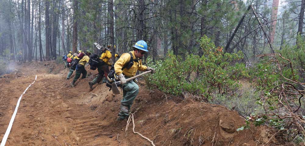
- A group of firefighters marches into an unburned area Sept. 11 to look for hotspots on the Little Lava Fire near Sunriver.
Sunriver was reduced to a Level 1-Be Ready evacuation notice Thursday morning, as rains improved conditions on the 10,332-acre Bachelor Complex Fire.
The Bachelor Complex Fire is a group of about 30 smaller fires ranging in size from one tenth of an acre to more than 1,000 acres near Mount Bachelor and surrounding areas.. Included is the Little Lava Fire, which is burning approximately 2 miles southeast of Little Lava Lake to the west of Sunriver.
The cooler wet weather has slowed the spread of the Little Lava Fire, which had jumped to nearly 10,000 acres by Wednesday before the rains set in, but officials say the rain was not enough to have a lasting effect on the fire. Although crews made “good progress toward securing the fire’s east edge” with dozer lines, fire activity was expected to be moderate throughout Thursday, according to a news release from incident commanders.
Burning north of Fort Rock and east of La Pine are the Firestone and Flat Top fires, which also started on Sept. 6 due to lightning. The Flat Top Fire was 30,643 acres as of Thursday and the Firestone Fire was 8,787 acres. According to fire officials, there was no increase in the size of the Flat Top Fire Wednesday night, and during the day, firefighters were able to get most of the western edge of the Firestone Fire secure.
While temperatures are expected to be lower this week, fire officials warn that the vegetation beneath the tree canopy remains dry and that the Bachelor Complex Fire still has an active perimeter. The rain yesterday had a greater effect on The Backside, 892 and 911 Fires, which are also part of the Bachelor Complex Fire, and officials predict mild activity in those areas. Scattered showers were predicted across all fire areas in Central Oregon for Thursday.
Mt. Bachelor ski area said it would remain closed on Friday due to firefighting activities.
Evacuation levels
The Deschutes County Sheriff’s Office lowered evacuation levels Thursday.
Level 3 -GoNow evacuation levels are in place in the following areas:
• Deschutes National Forest south of Forest Road 46, west of Forest Road 41 and south of Benham Falls, north of Forest Road 40, east of Century Drive excluding Elk and Lava Lake resorts cabins and campgrounds.
• Mount Bachelor, Wanoga Butte, Kappa Sno-Park, Edison Sno-Park, Todd Horse Camp, Sparks Lake, Devil’s Lake, Sitkum Butte, Anns Butte and Pistol Butte.
• Areas west of the Deschutes National Forest boundary, north of South Century Drive, east of Forest Road 4240 and north of Forest Road 40.
Level 1 — Be Ready evacuation levels are in place for the following areas.
• Areas west of the Deschutes River from Fall River Estates north to Spring River Road, including Fall River Estates, River Forest Acres, River Meadows, Stage Stop Meadows and Deschutes River Recreational Homesites.
• Areas north of Spring River Road west of the Deschutes River including Besson Road and Spring River Acres.
• Sunriver
Most areas previously Level 1 are returned to normal. This area includes:
West of U.S. Highway 97 south of Lava Butte and adjacent to Sunriver, south to Vandervert Road including the Sunriver Business Park, Caldera Springs, Crosswater and Vandevert Ranch.
Oregon Water Wonderland and Big River Drive area north of South Century Drive.
More Local News


Best of the Best of Bend 2025

-
-
-