Central Oregon gravel routes to ride this fall or in spring
Published 3:30 pm Thursday, October 3, 2024
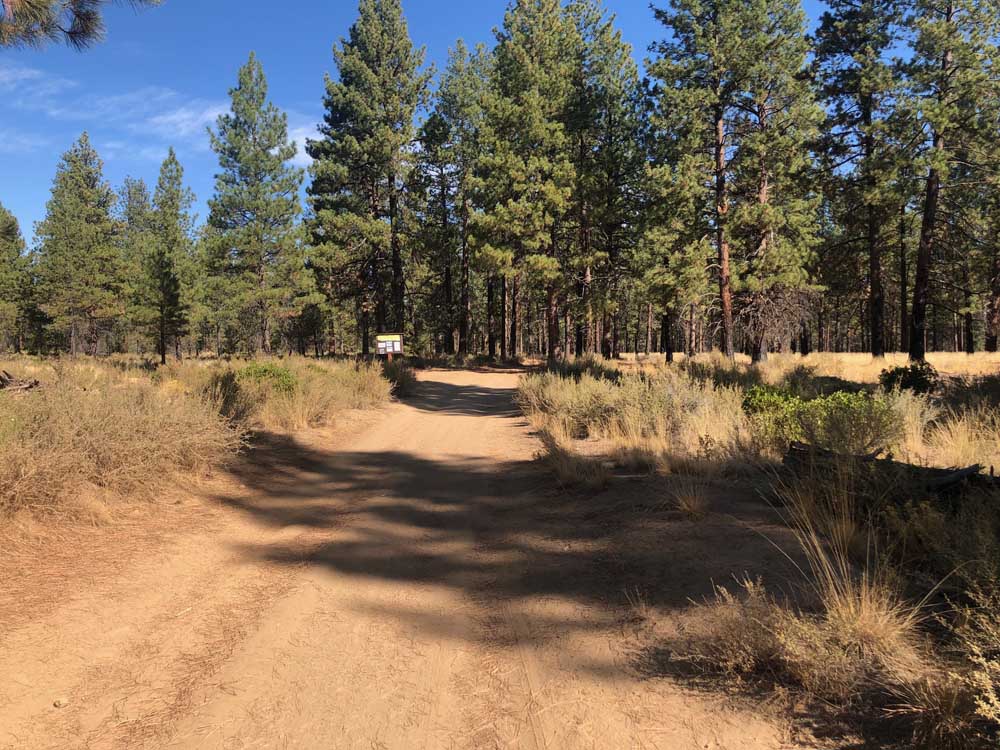
- This Sunriver loop utilizes forest roads and singletrack in the Deschutes National Forest and Phil's trail system.
Gravel riding has become a popular alternative to the past decades’ “opposing sides” — mountain and road — of the bike world, as well as a money-making expansion by the bike industry. With most gravel bikes — and cyclocross bikes — able to perform considerably well on pavement, good “gravel” routes and races often include a mixture of paved, gravel and dirt roads. Some may even have tame singletrack.
When compared to other places in the Pacific Northwest and on the West Coast, Central Oregon’s road bike riding is limited. There are nice road rides from Bend, but little variation. Narrow, lonely, winding roads are rare. But what the area lacks in road options it makes up for in its gravel options.
Trending
From Bend, you can head in any direction and get to gravel or dirt roads worth riding in 20-30 minutes. I typically head west on a normal day out, but over the past month I ventured out to a couple of routes no more than an hour and 20-minute drive away.
Thanks to Dirty Freehub for the inspiration, detailed routes and maps. For more gravel rides statewide and all over the West, check out their website, dirtyfreehub.org.
Whychus Canyon
I rode this loop on a Monday when I had little time to spare. For the sake of efficiency, I started the route backwards as most of the gravel is in the second half of the loop. With luck on my side, despite a lack of preparation, this would turn out to be one of my more astute decisions.
The route starts from downtown Sisters and heads north on Camp Polk Road before heading east. After some lollygagging to avoid riding on McKenzie Highway too much, it eventually turns north onto Goodrich Road before taking a right onto Edmunson Road and a slight left onto Holmes Road, where there’s a decent stretch of open road and no navigating. About 18 miles in, take a left onto Forest Road 6360, where the main gravel section begins. The road drops down into Whychus Canyon and toward Whychus Creek, which you will have to cross 23.5 miles into the route.
When I did the reverse route in the last full week of September, the water level was too high to cross without getting wet. So bring some plastic bags to cover your shoes, an extra pair of socks or be prepared to strip them off to wade across. I turned around and headed back to the car. Luckily, I had already added some cool miles to the north after missing a turn earlier.
Trending
After the creek crossing, the route winds up a rocky climb out of the canyon and through a forest burned in the Grandview Fire in July of 2021. Take a left onto Forest Road 63 (this was the turn I missed in the opposite direction) — for more miles, bang a right and double-back when you’ve had enough. Road 63 becomes Tai Flat Road before merging into Wilt Road. Heading southwest, Wilt Road becomes paved before turning in Camp Polk Road and rolling back into downtown Sisters.
The full loop is 38 miles with 2,100 feet of climbing. It’s 40% gravel.
Green Lakes Trail ideal for hiking in early fall
Sunriver loop
This is a convenient option for Bend residents who wish to ride from their house. About a 40-mile lollipop loop with plenty of variations and a stop in Sunriver possible, this route utilizes Deschutes National Forest roads and trails.
Take the Cascade Highlands Trail to Forest Service Road 4606 to National Forest Development Road 4604. From 4604, take it out to Southwest Century Drive or wind your way through the forest on COD Alternative and Ticket to Ride trails to the Cascade Lakes Welcome Station. Then cross Century Drive and hop on Conklin Road, National Forest Road 41.
After a few miles, it will turn into gravel and you can take it all the way to Spring River Road out of Sunriver. Other options include jumping on Afternoon Delight at Tyler’s Traverse Trailhead or taking the Deschutes River Trail and various trails and roads along the Deschutes River. Cross the river at Cardinal Landing Bridge to make a stop in Sunriver.
I took Forest Road 200, off of Conklin, back. It will briefly turn into a trail along the river before opening back up onto a forest road that can take you back out to Conklin. I finished with 40 miles and nearly 2,400 feet of climbing. Looking for more singletrack? Dirty Freehub has a similar route that is 25% singletrack and 35% gravel.
Black Butte
This is a popular 33-mile loop that starts from downtown Sisters and includes smooth, easy singletrack. Another lollipop loop, it’s 65% singletrack and 35% gravel or dirt road with 1,700 feet of climbing.
Starting from downtown Sisters, take North Pine Street to Sisters Tie Trail, cross Indian Ford Road and continue on Lower Butte Loop. Then take Forest Road 1105 to Forest Road 1430 to Forest Road 1120 to Green Ridge Trailhead. Hop on the Green Ridge Trail heading south and turn left on Upper Butte Loop, taking it back to Forest Road 1105 via switchbacks on the south end of Black Butte. Then follow the way out back into town.
With fun, winding trails, this route also has spectacular views through the trees of the Three Sisters, Three Fingered Jack and the rest of the Cascade Range.
Big Summit Prairie
Probably my favorite, this route circumnavigates privately-owned Big Summit Prairie and climbs through the beautiful and remote Ochoco National Forest. I parked in a small lot near Lookout Mountain Lower Trailhead, about a 75-minute drive from Bend, and rolled up Ochoco Creek Road to Old Ochoco Highway, where the route starts up a paved, winding 8-mile climb.
Before the 5-mile mark, turn onto Howard Creek Road. Keep climbing past Walton Lake and Round Mountain Trailhead until the road starts to descend and turns into gravel. Forest Road 22 will traverse the northern ridge of the prairie. Just after 21 miles in, there’s a right turn onto Forest Road 3010, the last gravel section. That empties out onto Forest Road 42, which heads along the south edge of the prairie and up the final climb where it becomes Canyon Creek Road before turning into Ochoco Creek Road shortly before getting to the parking lot. For some additional climbing and a view, there’s an extra gravel section up a forest road on top of the final climb at Round Mountain South Trailhead.
I finished with just over 50 miles and 4,000 feet of climbing. I’m looking forward to heading back out in the spring, when the flowers are in bloom.
Other options
Some of my favorite rides are using sections of known routes to explore other trails in the area. Two gravel races this month, The Big Lonely and Ashes to Glory, out of Madras, are perfect routes for this. If you live in Bend, various meandering can be done through Deschutes National Forest roads, around Tumalo Reservoir and beyond.
Marketplace


Enter the $5,000 Sweepstakes

-
eEdition

-

-