Horse Ridge area offers challenging winter riding for mountain bikers
Published 12:00 pm Friday, January 31, 2025
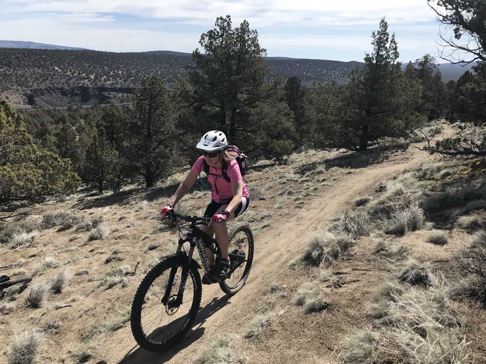
- A mountain biker riding singletrack on Horse Ridge.
Of all the winter mountain biking areas in Central Oregon, Horse Ridge might be the most challenging. A mix of hard climbs, twisting descents and plentiful lava rock highlight the 30 miles of singletrack trails southeast of Bend in the middle of the High Desert.
Located about 16 miles from town just off U.S. Highway 20, Horse Ridge remains consistently rideable, even in the heart of winter. The ridge tops out at about 4,700 feet in elevation and is mostly a wide-open juniper forest.
Trending
From the top of Horse Ridge, one can view the vast High Desert for miles, including the Badlands Wilderness to the north and the snow-covered peaks of the Cascade Range to the west.
The singletrack trails range from technical and rocky to smooth and flowing along the ridge. Loads of lava rock dot the trail on certain stretches, but mountain bikers who want to avoid technical riding can also find rock-free trails.
Perhaps what sets Horse Ridge apart from other winter riding areas in Central Oregon, such as Maston or Horse Butte, is the change in elevation. Several trails wind their way up and down the ridge, making for some arduous climbs and hair-raising downhill.
From the west trailhead last week, I rode singletrack along a barbed-wire fence that paralleled the highway. That trail offered a relatively easier climb to the top of the ridge than other trails in the area.
Trail conditions were nearly perfect, with no signs of snow or mud. (That could change this weekend with rain and snow in the forecast.)
I made a right turn and began a steep climb up the ridge, following a few switchbacks. Before long, I was on a side-hill trail that offered dramatic views of the Badlands to the north and Dry Canyon to the northeast. Mount Jefferson gleamed against a clear blue sky to the northwest.
Trending
The trail continued up through old, twisted juniper trees, sagebrush and several rock gardens.
After I topped out on the ridge, I began a speedy descent that led me to the east Horse Ridge trailhead. I turned around there and climbed back up the way I had come. I eventually turned onto the Sand Canyon Trail, an extremely fast, flowing descent through a gulley all the way back to the west trailhead.
The rocky sections at Horse Ridge have turned me off to the area in the past, but the 10-mile loop of Mad Max Drive (an old, cracked highway), Has No Horse and Sand Canyon trails avoids much of the lava rock and still offers a satisfying ride. I ended up biking about 12 miles in less than three hours.
Changes could be coming soon to Horse Ridge, as the Bureau of Land Management wants to improve mountain biking and other non-motorized recreation in the area. The BLM Prineville District Deschutes Field Office proposes to designate a limited motorized (e-bikes) trail system on new, modified, or existing trails at Horse Ridge. Currently, the trails at Horse Ridge are open only to non-motorized recreation.
The bureau is also proposing an official trail system and may enhance existing trails, build new trails, and close other trails, according to a news release. It also wants to expand the two parking areas that provide access to the area and install ADA-accessible toilets at the trailheads.
The project is designated for a start date of Sept. 1.
For more information, email blm_or_pr_horseridge@blm.gov or call 541-416-4634. Maps of the Horse Ridge area are available at bendtrails.org.
Marketplace


Best of the Best of Bend 2025

-
eEdition

-

-