Miles out of cherry country: A 45-mile gravel ride from The Dalles
Published 11:00 am Wednesday, June 18, 2025


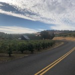


Having rolled out from Sorosis Park, up on a bluff above The Dalles and the Columbia River, 20 minutes earlier, I was pedaling uphill on a lonely, winding paved road through sprawling cherry orchards. Heading away from the river with clear views of both Mt. Hood and Mt. Adams whenever the road turned in their direction, I knew I was in for a treat. And I hadn’t yet hit the gravel.
I did this ride in Oregon’s cherry country on a clear October day last year on my way to visit some college friends in Bellingham, Washington. Not exactly cherry season, which typically starts in mid-June and goes through July. So now’s the time. If you like cherries, this 45-mile gravel ride could pair well with some cherry picking.
My relationship with cherries is similar to my relationship with Woody Harrelson. I like what they come on, or in. Sundaes, red Starbursts and whiskey sours: all great. “Cheers,” “No Country for Old Men” and “True Detective” season 1 too. But the fruit themselves make my face contort as if sucking a lemon, and I’m not really sure why. Luckily, I can offer my cherries to a friend and still admire the beautiful land they come from.
The Dalles is one of the oldest permanently occupied places in Oregon. It was the end of the Oregon Trail and was a popular fur trading destination in the 1800s. French fur traders used the word dalles to refer to areas where a river flows through narrow, rocky channels.
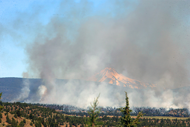
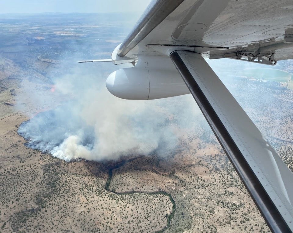
An important note: This story was already in the works before the Rowena Fire started just west of The Dalles. We hope the fire is contained and those affected a speedy recovery.
Turns to take
Out of the Sorosis Park parking lot, I rolled down Scenic Drive to 16th Street. I turned right onto 16th and took a quick right onto Dry Hollow Road, where the climbing would begin. This route starts around 500 feet above sea level and will get to a high point of nearly 3,000 feet. Altogether, I climbed over 4,500 feet in my 45-mile route.
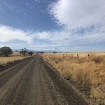
Dry Hollow Road takes you past Omeg Family Orchards, a family-owned cherry farm since 1908. Beyond the orchard, take a left onto 3 Mile County Road for a quick descent to Pleasant Ridge Road. Turn right onto Pleasant Ridge, which will weave its way along the ridge and take you out of the valley. When you see the “Pavement Ends” sign, you’re 200 meters from the top of this first significant climb.
Take it easy overtop. This gravel descent was pretty loose when I rode it, and with a couple switchback turns, I was on the limit. At the bottom, head west on Five Mile Road. If it’s a clear day, the valley should act like a mantelpiece, propping up Mt. Hood in all its glory. Clouds in the way? Don’t worry, more chances to come.
Follow the paved road for about a mile. Shortly after it turns to gravel, take a slight left back onto Pleasant Ridge Road to start what was my favorite climb of the ride. The mix of dirt and gravel road surface winds its way up a tree-covered ridge, ascending about 900 feet in three miles, before opening up onto a prairie plateau.
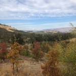
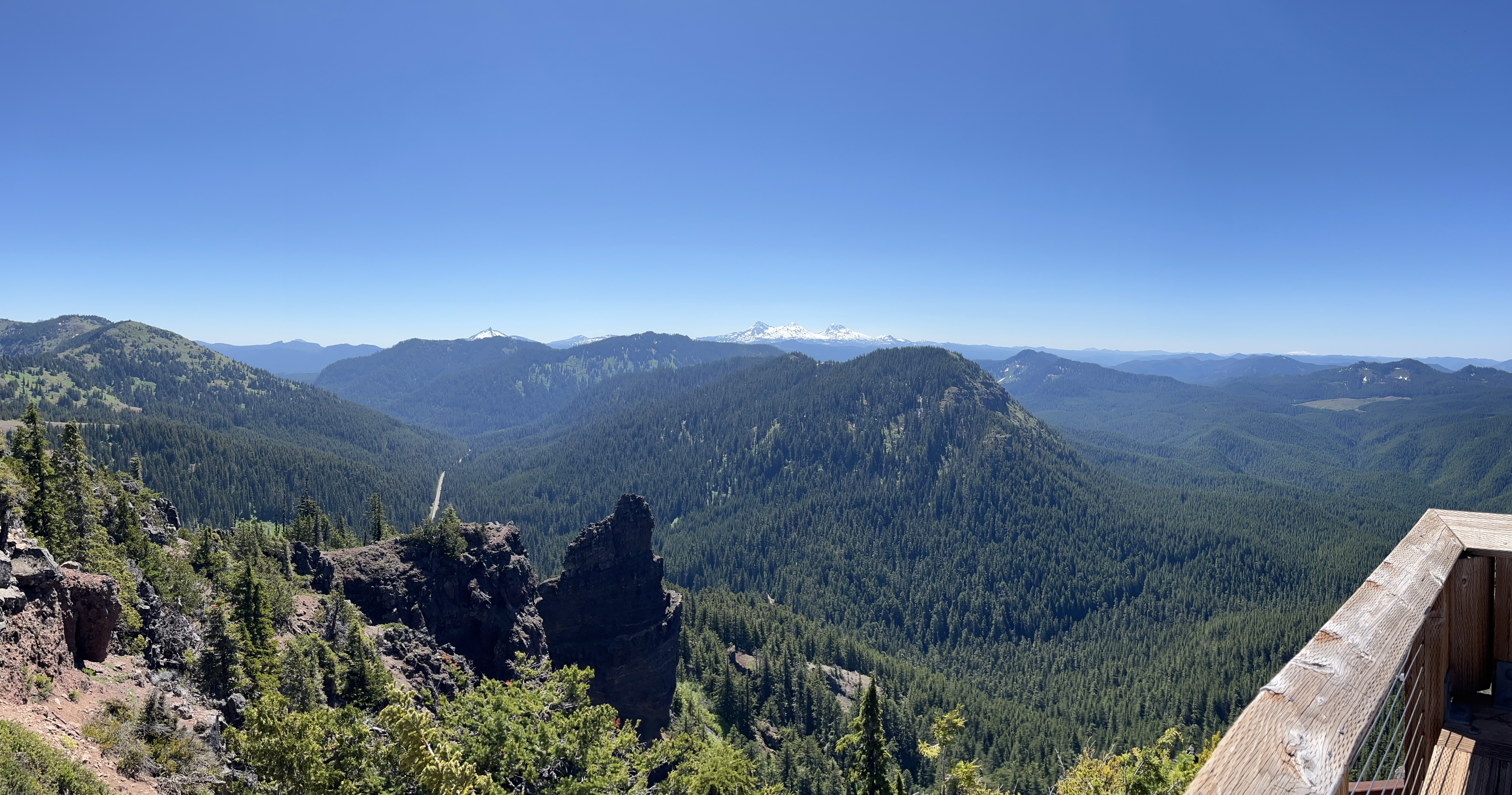
Heavy breathing. Elevated heart rate. Sweat droplets stream down sunglasses. As the road flattens out, a cool breeze off the open landscape welcomes you atop the ridge. It’s a straight shot across the high country with Mt. Hood as a beacon. While there’s plenty of more climbing on the route, the worst of the steep bits is over. From here, the road gradually climbs along the ridge, merging with Jewell Road and Rail Hollow Road, to the ride’s midpoint and high-point in Mt. Hood National Forest.
Turn right on Five Mile Road, or forest service road 1722, to start the descent back into town. Cross South Fork Fivemile Creek and continue down Upper 5 Mile Road, paralleling its namesake. Follow it for nearly five miles — just a coincidence — to North Fork Fivemile Creek and take a left onto Dutch Flat Road to start a short climb up to a rolling section. Stay on Dutch Flat Road past 3 Mile County Road. It will take you to Skyline Road and your over seven mile descent back into town.
With glimpses of the Columbia and cherry orchards scattered across the valley below, the twisty, turny road reminded me of riding in Italy.
Don’t take your eyes off the road too much though. I passed a handful of cars — the most I’d seen all ride — on my way back into town. Watch out around some of the blind corners. Just off Skyline is Orchard View, Inc., another family orchard, established in 1923.
Back in town, Skyline Road will drop you onto Mt. Hood Street. Either roll into downtown for a coffee or slice of cherry pie or turn right on 17th Street and climb back up to Sorosis Park via Scenic Drive.
Getting there
The Dalles is about a two-and-a-half-hour drive from Bend via Highway 97 and 197. It’s a beautiful drive through Maupin and Tygh Valley. A little farther than most of the outings we suggest, this ride could be great to tack onto a trip to Portland or Washington.
Sorosis Park has plenty of parking, picnic areas and public restrooms. The park is open from dawn to dusk.
This route was inspired by Dirty Freehub and Our Mother The Mountain. Thanks to both.
Ian Haupt: 541-617-7821 or ian.haupt@bendbulletin.com.

Best of the Best of Bend 2025

-
-
-