Olympic glory
Published 5:00 am Sunday, May 11, 2008

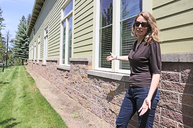
- A doe mule deer and her yearling graze beside the Hurricane Ridge road, which climbs more than 5,000 feet in 18 miles south of Port Angeles. Through shrouded in blizzard conditions in early May, Hurricane Ridge is noted for the colorful wildflowers that adorn its meadows in the summer.
By John Gottberg Anderson • For The Bulletin
PORT ANGELES, Wash. —
I first discovered the high country of Olympic National Park about three decades ago.
I was living in Seattle at the time. With a long weekend in hand, I traveled 100-odd miles by ferry and car to the Sol Duc Hot Springs area in the northwest section of this sterling national park. I parked at a trailhead and spent three days backpacking around the jewel-like Seven Lakes Basin at the foot of Bogachiel Peak, studying the nation’s largest herds of Roosevelt elk and swimming, however briefly, in glacier-fed alpine tarns.
I have rarely returned to this great park, one of the largest in the continental United States with 1,442 square miles (more than 900,000 acres). As no roads cross Olympic National Park, and only a handful of dead-end routes penetrate its fringes, nearly all of the park is rugged wilderness accessible only by foot trail.
When I did go back for a visit a week and a half ago, the park’s alpine reaches were still blocked by spring snow, more than 10 feet at Hurricane Ridge, the highest point that can be reached by car. And several roads were undergoing improvements after a devastating early December storm that uprooted trees and washed out hillsides. So I extended my stay to see parts of Olympic park that I had not visited: its primeval rain forests and memorable seascapes. And I woke up to a whole new Pacific Northwest wilderness.
Hurricane Ridge
Olympic National Park dominates the Olympic Peninsula, a huge thumb of land that divides Puget Sound from the Pacific Ocean. It is a day’s drive from Central Oregon, most of it via Interstate 5 to Olympia, Wash., then by U.S. Highway 101, which circles the park on all sides but the south.
Port Angeles, the largest town on the peninsula with 20,000 residents, is an ideal location from which to explore the mountainous northern section of the park. I based myself in the little timber town of Forks to discover the rain forests and Pacific Ocean region on the west side of the park. Several lovely and historic lodges may be found within the park itself for visitors who want to be a little closer to the action.
The average Olympic traveler makes his first stop at Hurricane Ridge, 18 miles south of Port Angeles and a full mile in elevation higher than the waterfront community. The national park visitor center is at the foot of the Hurricane Ridge road; the park entrance gate is another five miles uphill. From here, a paved road winds along mountainsides, above deep creek valleys and through a series of tunnels to a small, seasonal visitor center.
Before making the drive uphill on May 2, I checked the summit weather at the main park visitor center. The webcam showed high overcast skies but spectacular views across forested stream gorges to a saw-toothed string of distant snow peaks.
The webcam lied. Hurricane Ridge was cloaked in near-whiteout conditions when I arrived. Fresh snow was falling and the wind was howling. Although a small alpine ski area had closed for the season, nordic skiers were still venturing out into the stormy weather and then quickly returning to the unattended lodge.
Photos show a place of great beauty, alpine meadows overflowing with colorful wildflowers nurtured by the winter shows. But few signs of life were visible above 5,000 feet during my visit. Only a nearly tame family of mule deer — a doe and three yearlings grazing beside the road on my return drive to Port Angeles — reminded me that even these alpine climes are home to many creatures.
Rivers and lakes
Off Highway 101, west of Port Angeles, are three national park areas of interest.
About eight miles from “P.A.,” as locals know it, a side road cuts south, up the Elwha River valley. This river was dammed twice in the early 20th century, in 1913 and 1927; now, federal legislation requires the dams be removed, restoring more than 70 miles of salmon habitat. Olympic National Park officials estimate this will take place in early 2012, after a pair of water treatment facilities have been built. Today, visitors can drive up to Lake Mills, created by the upper Glines Canyon Dam. When the dam is removed, the two-mile-long lake will cease to exist.
Eight miles west of the turnoff, 101 reaches Lake Crescent, the largest lake in the park. Twelve miles long and more than 600 feet deep, surrounded by old-growth Douglas fir, this glacial creation is home to two species of trout found nowhere else on Earth: the Beardslee trout and Crescenti trout. There are several picnic areas and other facilities around its banks.
Highway 101 follows the south shore for 11 miles. Traveling westbound, I turned off at Barnes Point, four miles down the lake shore, to visit the Lake Crescent Lodge, the Storm King ranger station and the Olympic Park Institute for science education.
The lodge, built in 1916 and nestled among hemlock and fir trees, maintains a rustic charm in its main building and outlying cabins. Wicker furnishings on a wide sun porch are a great place to relax and watch the boat traffic on the lake. Notables from Frank Sinatra to President Franklin Roosevelt have spent the night here.
The science institute is not generally open to the public, but the historic 1905 log cabin Storm King ranger station welcomes visitors as an information center in summer. It’s the starting point for the one-mile (each way) walk to 90-foot Marymere Falls, arguably the park’s most popular day hike.
Two miles past the end of the lake, another road turns up the Sol Duc Valley. A drive of 14 miles leads to the Sol Duc Hot Springs Resort, an elegant getaway spot after it was established by a local timber baron in 1912. It attracted visitors from as far away as Europe until it burned nearly to the ground four years after its construction. Incorporated into Olympic National Park in 1966, the resort was completely rebuilt in the 1980s, and today its hot-springs pools are once again a prime, if not posh, destination for spa lovers.
Temperate rain forests
The logging town of Forks is 57 miles southwest of Port Angeles, on the west — read “rainy” — side of Olympic National Park. Forks had 158 inches of rain, roughly three times that of the Willamette Valley, in 2007. It had 144 inches in 2006. That was a dry year. It’s no wonder the population is only about 3,200.
Rain, however, contributes to the rapid growth of prime timber, which has always been the foundation of the Forks-area economy. The little town’s excellent Forks Timber Museum is open weekends year-round and daily in summer. And any visitor truly interested in the wood-products industry should leave time for the three-hour Logging and Mill Tour sponsored by the Forks Chamber of Commerce, right next door to the museum on Highway 101 south of town. Starting at 9 a.m. Mondays, Wednesdays and Fridays, the tour is led by retired loggers or mill workers, and it’s free of charge.
Forks is the gateway to the Hoh Rain Forest, an area that has helped to earn Olympic National Park designation as an international biosphere reserve and World Heritage Site. Drive 13 miles south on Highway 101, then 19 miles east on Hoh River Road to a rain forest visitor center and trailhead. A rare coniferous rain forest graciously spared the logger’s blade, the Hoh has been left forever undisturbed.
Wet doesn’t begin to describe the atmosphere: Even the air drips like a saturated sponge, producing more than 30 inches of “fog drip” in summer. Lichen weeps from wiry branches that release steamy vapor wherever the sun filters through the forest canopy. Moss cloaks the trunks of big-leaf maple, alder and black cottonwood trees that rise from a forest floor as soft and thick as a shag carpet. Bracken ferns, licorice ferns, huge fungi and seedlings are nurtured by fallen nurse logs. Above it all, giant evergreens — cedar, hemlock, Sitka spruce and Douglas fir, some as old as 500 years — rise 200 to 300 feet above salmonberry shrubs. The titter of small birds and the chatter of squirrels is almost constant here.
Many describe this environment as cathedral-like. Soft light filters through the foliage as if through stained glass. Arching branches are reminiscent of a vaulted apse. Others just describe the mood as mystical; ancient coastal Indians, who often visited these forests but trod lightly and never stayed long, might have agreed.
Hoh isn’t the only rain forest along the western slopes of Olympic National Park. The area around Lake Quinault, 69 miles south of Hoh at the southwestern extreme of the park, is nearly as dense as Hoh, if not quite as large, but it does feature the only true rain forest lodging on the peninsula.
There’s another less-accessible rain forest in the Queets River valley, off a graded gravel road west of Quinault.
Stunning seascapes
Too often overlooked are Olympic park’s seascapes. Seventy-three miles of stark Olympic Peninsula coastline are contained within the park boundaries. This section’s heart is the tiny community of Kalaloch (pronounced ka-LAY-lock), 36 miles south of Forks on Highway 101. There’s a campground and a lodge with seaside cabins here.
South and north, along 12 miles of Highway 101, stretches a series of driftwood-speckled beaches. Best for tide pooling is Beach 4. Most picturesque is undoubtedly Ruby Beach, where a quiet creek meets the Pacific in front of a monastery-like sea stack known locally as Abbey Island.
There is more stunning ocean scenery west of Forks. Rialto Beach is famed for its giant driftwood logs and memorable sunsets. Just south, across the mouth of the Quillayute River, the hamlet of La Push is the heart of the tiny Quileute Indian Reservation. Hollywood director Catherine Hardwicke (“Thirteen” “Lords of Dogtown”) has recently completed the filming of “Twilight,” a vampire movie based on the young adult book by Stephenie Meyer. Its main character is a American Indian teenager from La Push.
There has been a strong native presence along this coastline for a very long time. At Cape Alava, not far from pastoral Ozette Lake, an 11-year archaeological dig conducted between 1970 and 1981 recovered more than 50,000 artifacts from a Makah Indian whaling and sealing village buried by a landslide around the time Columbus discovered America.
The site is accessible via a three-mile trail at the end of a long dead-end road, 88 miles west of Port Angeles and 60 miles northwest of Forks. But the only things worth looking at today are a plaque and a replica Makah longhouse. When money ran out, scientists filled in the village to protect it from vandalism.
Still, visitors with an anthropological bent need not feel deprived. In the Makah fishing village of Neah Bay, near the most northwesterly point of the continental United States, the museum of the Makah Cultural and Research Center displays many of the Cape Alava artifacts, including a one-of-a-kind orca-fin replica inlaid with hundreds of sea-otter teeth. Tribal elders theorize that it may have been an object of worship for Makah whalers.
Visiting Olympic National Park
• Gas, 826 miles @ $3.80/gallon $125.55
• Lunch, en route north $7
• Lodging (1 night), Riviera Motel, Port Angeles $65.14
• Dinner, Bella Italia $43.86
• Breakfast and coffee, Port Angeles $4.75
• Admission, Olympic National Park $15
• Lunch, Frugal’s, Port Angeles $4.86
• Lodging (2 nights), Forks Motel, Forks $152.36
• Dinner, Sully’s Drive In, Forks $8.94
• Breakfast coffee, Forks $4
• Lunch, Quinault Mercantile Co. $7.11
• Dinner, South North Garden, Forks $16.57
• Breakfast and coffee, Forks $4
• Lunch, en route south $8.50
TOTAL $467.64
Prices include 10.25% lodging tax and 8.4% restaurant tax.
If you go
• Olympic National Park. 600 E. Park Ave., Port Angeles; 360-565-3130, www.nps.gov/olym
• Port Angeles Regional Chamber of Commerce. 121 E. Railroad Ave., Port Angeles; 360-452-2363, www.portangeles.org
• The Forks Motel. 351 Forks Ave. S. (U.S. Highway 101), Forks, Wash.; 360-374-6243, 800-544-3416, www .forksmotel.com. Rates from $54.95.
• Kalaloch Lodge. 157151 Highway 101, Kalaloch, Wash.; 360-962-2271, 866-525-2562, www.visitkalaloch.com. Rates from $86.
• Lake Crescent Lodge. 416 Lake Crescent Road, Port Angeles, Wash.; 360-928-3211, www.lakecrescentlodge.com. Rates from $68 (from $99 in summer).
• Lake Quinault Lodge. 345 South Shore Road, Quinault, Wash.; 360-288-2900, 800-562-6672, www.visitlake quinault.com. Rates from $102 (from $143 in summer).
• Riviera Inn. 535 E. Front St., Port Angeles, Wash.; 360-417-3955, www.rivierainn.net. Rates from $49.99.
• Sol Duc Hot Springs Resort. Sol Duc Hot Springs Road, Port Angeles, Wash.; 360-327-3582, 866-4SOLDUC, www.visit solduc.com. Rates from $141.
• Bella Italia. 118 E. First St., Port Angeles; 360-457-5442.
• Frugal’s. 1520 E. Front St., Port Angeles; 360-452-4320.
• Jean’s Deli. 134 S. Second St., Sequim; 360-683-6727.
• Port Angeles Crabhouse. 221 N. Lincoln St., Port Angeles; 360-457-0424.
• Quinault Mercantile Co. South Shore Road, Quinault.
• The Smoke House. 193161 Highway 101 N., Forks; 360-374-6258.
• South North Garden. 140 Sol Duc Way, Forks; 360-374-9779.
• Sully’s Drive In. 220 N. Forks Ave., Forks; 360-374-5075.
• Forks Timber Museum. U.S. Highway 101 S., Forks; 360-374-9663.
• Makah Cultural and Research Center. 1880 Bayview Ave., Neah Bay; 360-645-2711, www.makah.com
Next week: Lincoln City and Depoe Bay


Best of the Best of Bend 2025

-
eEdition

-

-
Go! eEdition