Horses and Granite: Why you should wallow in the Wallowas
Published 6:00 am Thursday, August 8, 2024
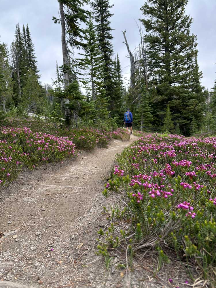
- Widlflowers of any imaginable color adorn the Maxwell Lake Trail, though they are most appreciated on the way down (when you are not fighting off cardiac arrest).
Trade in your igneous rock for marble, your lava fields for glaciated valleys, your crowds for silence. You’re going to the Wallowa Mountains.
At six and a half hours from Bend, nestled in the northeast corner of Oregon between the Blue Mountains and the Snake River, Oregon hides a very remote, recreational gem known as the Eagle Cap Wilderness Area (or the Wallowa-Whitman National Forest — or the Wallowa Mountains. Like the protagonist in Dune, greatness comes with many names.)
Trending
Unlike the formation of isolated peaks that populate our Central Oregon Cascade views, the Wallowas more resemble the Rocky Mountains with their massive wall (so to speak) of granite, slate and quartz. This enormous pile of rock remains after millions of years of magma upwelling between the Late Jurassic and Early Cretaceous periods, followed by a torrent of glaciers and ice-dam breaks that carved breathtaking valleys during the late Pleistocene Era.
Wallowas’ many options
I’m not so egotistical as to assume that these glaciers and eruptions and geological upwellings plied their trade for eons all in service of providing me and a good friend with 4-star camping conditions in the year 2024, but I appreciate it nonetheless.
Mix your cardio with your history on the Santiam Wagon Road
Trending
The hardest part about planning a Wallowas trip, apart from needing a reliable automobile and a decent playlist, is deciding where in the mountains to go. With 535 miles of trails circling the dozens of bare-granite peaks in the area, your options are darn near endless.
For our trip, past experience taught us that the Lostine River valley, just southwest of the small town of Joseph (named after the famous Nez Perce Indian chief), is an ideal base camp for hiking and peak bagging in the area.
The National Forest campgrounds along the Lostine River can be accessed by turning due south off of Oregon Route 82 from the town of Lostine onto Lostine River Road. After about 3 or 4 miles, Lostine River Road turns into a one-lane, unpaved route. After that, it’s a choose-your-own-adventure of primitive campgrounds (or dig-your-own-toilet dispersed camping), most of them thoughtfully adjacent to the ever-babbling Lostine River.
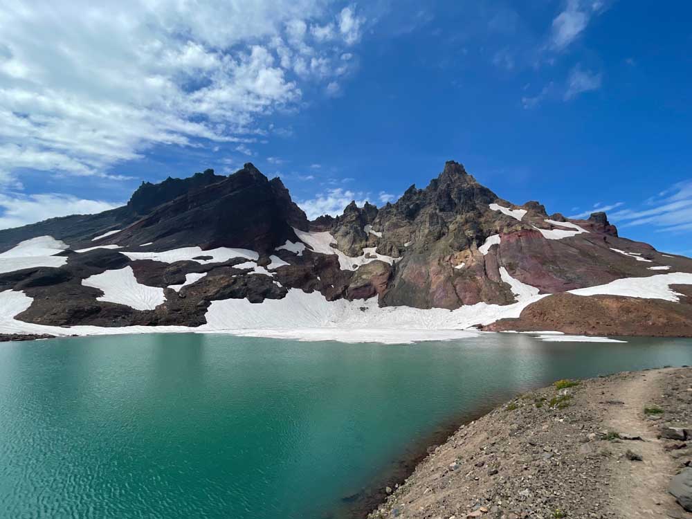
Gorgeous Maxwell Lake
After settling on a campsite, we had to settle on a hike. In 2019, we summited Eagle Cap after a 23-mile out-and-back trek that began from the Two Pan Trailhead, at the southern end of Lostine River Road. From a “biting off more than you can chew” standpoint, that was the equivalent of a 6-foot Subway sandwich.
Nowadays, our post-pandemic knees demand something tamer. That’s where Maxwell Lake comes in. It is a high-mountain tarn (an Old Norse word for “small mountain lake without tributaries”) that sits some 2,300 feet above our already-mile-high campsite. At 8 miles round-trip, you could be fooled into thinking it’s a nice morning jaunt to a gorgeous water feature. You’d be half right.
The Maxwell Lake trail is 3 miles of steady, crisscrossing switchbacks, followed by a mile of “you-made-it-this-far-I-dare-you-to-turn-back” quad burning. For some reason, the trail becomes a straight-ahead assault up the final 1,000 feet of the hillside until you are greeted — chest heaving, feet burning and brow soaked — with one of the comeliest alpine lakes you will ever see.
Spires of 9,000-foot mountain peaks loom over the lake and its two tiny islands as if daring a Pixar movie to materialize in its midst. Granite boulders line the shores, turning every visitor into a nimble bouldering enthusiast (yes, even after that relentless climb). Wildflowers beckoned the teeming insects with purple, orange, yellow, red and blue displays that far-too-perfectly framed the grassy meadows. Towering pines creaked in the wind. This is the kind of stuff that made John Muir weep.
Of course, the beauty of a grueling climb is that it turns into a grueling descent. Be sure to turn your iPhone toward the views during that first mile back down, because I can promise that you were too preoccupied with breathing to have noticed all of the natural wonders on the way up. From the trail, peak-a-boo views of Eagle Cap and Sacajawea Mountains adorn shots of a U-shaped glacier gorge that was tens of thousands of years in the making. Black-tailed deer and even black bears may shyly (and briskly) cross your path.
Eight miles’ worth of “leg day” aren’t the only attractions brought to you by the Eagle Cap Wilderness. South of the town of Joseph is Wallowa Lake, ringed by campgrounds, day use areas, and gift shops for this ever-more-visited natural wonder. A centerpiece for tourists is the Wallowa Lake Tramway, which will carry you to the top of Mount Howard for $50. From there, the true splendor of the Wallowa Mountains (along with three states and multiple other mountain ranges on a clear day) can be viewed without so much as a bead of sweat.
For urban wanderers, the towns of Wallowa, Joseph, Lostine and Enterprise are not wanting for charm. Museums, art galleries, restaurants and gift shops line the quaint boulevards, particularly in Joseph, where the merch is in high demand — and priced accordingly.
IF YOU GO: From Bend, drive north on Highway 97, to 197 to Interstate 84. Take the La Grande/Oregon state highway 82 exit, and head east/southeast toward Enterprise, Lostine and Joseph.
Marketplace
Enter the $5,000 Sweepstakes

-
eEdition

-

-