Central Oregon outdoors and trail conditions
Published 3:30 pm Thursday, May 11, 2023
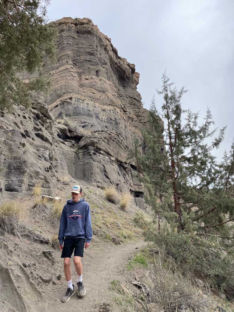
- Bend’s Mason Morical, 14, hikes along interesting rock formations downstream from Steelhead Falls.
We are in a period of transition here in Central Oregon. As the weather continue to warm up some trails and campgrounds are slowly becoming accessible. Trails below 4,000-4,500 feet should to be clear to bike and hike. Most sno-parks are no longer open for winter recreation due to lack of snow and snow recreation is allowed only where there is adequate snow depth.
For a full list of conditions updated regularly, please visit centraloregonexplore.com
Hiking and Day Use Sites
NOTE: Trails above 4,000-4,500 feet are under snow. Most of the trails along seasonally closed highways and Forest Service roads remain open, but can only be accessed by hiking, snowshoeing, cross country skiing or snowmobiling due to snow. See forest websites for more details and restrictions.
See forest websites for more details and restrictions.
Deschutes National Forest
- Bear Valley Trailhead: Open
- Black Butte Trailhead: Open
- Black Crater Trailhead: Open
- Buttes Loop Trailhead: Open; patchy snow
- Cabot Lake Trailhead: Open; snow
- Chush Falls: Open; snow
- Cinder Beach Day Use: Open; snow; operated by the Suttle Lodge
- Cinder Hill Day Use: Open; snow
- Green Ridge Lookout: Opens May 14
- Green Ridge Trail: Open
- Head of Jack Creek Trailhead: Open; possible downfall
- Metolius River Trail: Open
- Jefferson Lake: Open; light downfall with snow above 3,700 feet
- Lake Creek Trail: Open; patchy snow
- Lava Camp Lake Trailhead: Open; deep snow
- Lower Black Butte Trailhead: Open
- Lower Bridge Day Use: Open
- Lower Canyon Creek (West Metolius Trailhead): Open
- Metolius-Windigo: Open
- Millican Crater Trailhead: Open
- Park Meadow: Open
- Pole Creek Trailhead: Open; moderate blowdown between TH and junction with Green Lakes Trail
- Rockpile Lake: Open
- Round Lake Trailhead: Open
- Scott Pass Trailhead: Open
- Scout Lake Day Use: Open
- Sisters Cow Camp: Open
- Sisters Mirror Trailhead: Open; deep snow
- Suttle Lake Day Use: Open; patchy snow
- Whychus Creek Overlook Trailhead: Open; likely snow free
- Whychus Portal (Lower Whychus Trailhead): Open; likely snow free
Ochoco National Forest
- Alder Springs Trailhead: Open
- Cyrus Trailhead: Open
- Fry Trailhead: Open,
- Giddy-Up Go Trailhead: Open
- Gray Butte Trailhead: Open
- Henderson Flat OHV Trail System: Open
- Henderson Flat Staging Area: Open
- Rimrock Springs Trailhead: Open
- Scales Corral Trailhead: Open
- Skull Hollow Trailhead: Open
- Tam-A-Lau Trailhead: Open
- Trail Crossing Corrals Trailhead: Open
Willamette National Forest — Three Sisters Wilderness Area
- Foley Ridge: Open
- McKenzie River Trail: Partially open; closed from Tamolitch Falls Trailhead to Frissell Boat Launch due to fire activity
- Separation Lake Trailhead: Open
- Rainbow Falls Trailhead: Open
- Robinson Lake Trailhead: Open
- Tamolitch Blue Pool: Open
Bureau of Land Management
- Cline Buttes Recreation Area: Open
- Horny Hollow Trail: Open
- Huntington Wagon Road: Open
- Redmond Caves Recreation Site: Open
- Scout Camp Trail: Open
- Steelhead Falls Trail: Open
- Tumalo Reservoir: Open
- Trout Creek Trail: Open
Oregon State Parks
- Cline Falls State Scenic Viewpoint: Open
- Cove Palisades State Park: Open; ABC (Deschutes) Campground, South and Middle Loops of E (Crooked River) are open, Lower Deschutes Day Use open, marina open
- Peter Skene Ogden State Scenic Viewpoint: Open, likely snow-free on lower portion, patchy snow and then deep snow at Paulina Lake
- Smith Rock State Park: Open look for the posted climbing closure signs in the Monument Area due to raptor nesting, park-wide ban on drones for raptor nesting season
- Tumalo State Park: Open
Ski areas and sno-parks
Updated 10 a.m. May 11
- Hoodoo: Closed for season
- Mt. Bachelor: Open; 89-inch base
- Willamette Pass: Open; 55-inch base
Camping
Deschutes National Forest
- Allen Springs Campground: Open
- Allingham Campground: Open
- Big River Campground: Open
- Camp Sherman Campground: Open
- Candle Creek Campground: Open
- China Hat Campground: Open; no campfires
- Cold Springs Campground: Open
- Fall River Guard Station: Open
- Graham Corral Horse Camp: Open; no water
- Indian Ford Campground: Open
- Link Creek Campground: Open
- Lower Bridge Campground: Open
- Lower Canyon Creek Campground: Open
- Pine Mountain Campground: Open; no campfires
- Pine Rest Campground: Open
- Pioneer Ford Campground: Open
- Pringle Falls Campground: Open; no campfires
- Riverside Campground: Open
- Sisters Cow Camp Horse Camp: Open; no campfires
- Smiling River Campground: Open
- South Twin Lake Campground: Open
- West South Twin Campground: Open
- Wyeth Campground: Open; no campfires
BLM — Prineville District
- Barr Road North Staging Area: Open
- Buckhorn Staging Area: Open
- Macks Canyon Recreation Site: Open; no campfires
- Steelhead Falls: Open; no potable water; no campfires
Cycling
Prineville and Ochoco trails
- Prineville Bike Park: Needs new report
- 66 Trails: Riding well
- All other trails under deep snow
Sisters trails
- PRT East, PRT Middle, PRT West, Sisters Tie: Riding well
- Peterson Ridge: Muddy
- All trails rideable snow
Maston complex
- All trails riding well
Redmond trails
- The Saddle: Closed
- Cole Loop: Variable
- All other trails riding well
Madras East Trails
- E-Bikes allowed on all trails
- All trails riding well
Cascade Crest
- All trails under deep snow
McKenzie Region
- McKenzie River trail closed from Tamolitch Trailhead to Fissell Boat Launch due to Knoll Fire
- All trails under deep snow
Fishing
Updated at 10 a.m. May 11
- Lower Deschutes (Pelton Dam to Columbia River): 9,750 cfs; redband trout, steelhead, whitefish; closed to all fishing from Northern boundary of the Warm Springs Reservation upstream to the Pelton Regulation Reservoir dam until April 22
- Middle Deschutes (Benham Falls to Lake Billy Chinook): 4,900 cfs; brown trout, rainbow trout; anglers should use caution on the river margins where shelf ice may be present; open year-round for trout, artificial flies and lures only, no limit on brown trout
- Crooked River (below Opal Springs): 3,850; rainbow trout and mountain whitefish; any trout over 20 inches are considered steelhead and must be released, bull trout must be released unharmed and reported to the USFW at crookedbulltrout@fws.gov, the water is currently low and dirty with plenty of aquatic vegetation in the channel
- Metolius River: 1,600 cfs; bull trout, rainbow trout; good fishing reported; fly fishing only upstream of Bridge 99, artificial lures and flies permitted below; catch and release only; public access to Wizard Falls Hatchery remains closed; the Metolius above Allingham Bridge is closed till May 22
- McKenzie River (at Clear Lake): 879 cfs
- McKenzie River (near Belknap Springs): 584 cfs; rainbow and coastal cutthroat trout; fire cleanup still being conducted in the area, access may be limited; all nonadipose fin-clipped trout must be released; lures and artificial flies only
- Ochoco Reservoir: 56% full; rainbow trout, black crappie, smallmouth bass; reservoir is very low, fishing has been fair near Ochoco Dam with reports of nice size rainbow trout
- Haystack Reservoir: 90% full; rainbow and brown trout, kokanee, largemouth bass, black crappie, bluegill and bullhead catfish; restocked last week of March
- Lake Billy Chinook: Bull, brown and rainbow trout, kokanee, smallmouth bass; anglers in the Deschutes arm are seeing bull, brown and rainbow trout, while a few bull trout are being caught in the Metolius arm; for the remainder of the reservoir, harvest is limited to one bull trout over 24 inches under the daily trout limit; anglers can now keep five kokanee in addition to daily trout limit; no bag or size limits on brown trout and bass
Fire danger is currently listed as Low in the Ochoco National Forests and the Crooked River Grasslands, the Deschutes and the Willamette National Forests.
Industrial Fire Precaution Level has been lowered to 1 as of April. 1 in the Deschutes, Ochoco and the Crooked River Grasslands and the Willamette National Forests.
As of July 22, 2020 Deschutes River access is closed due to safety concerns and to prevent further erosion to the riverbank. The access point will be closed until further notice. For more information visit bendparksandrec.org
• The Monument Area will be closed to climbing beginning January 18th, 2022.
• The Canyon Trail near the Bald Eagle nest is restricted to travel in groups of 4 or less, and noise needs to be kept to a minimum.
• Peregrine and Prairie Falcon climbing closures will go into effect at a later date.
• A park-wide ban on drones is in effect for remainder of nesting season.


Best of the Best of Bend 2025

-
eEdition

-

-
Go! eEdition