For fly anglers and hikers, the cold, pristine Metolius River offers respite from the heat
Published 5:00 am Friday, July 2, 2021
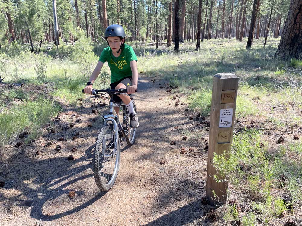
- Bend's Mason Morical bikes along the Camp Sherman Trail on Saturday.
CAMP SHERMAN — It is rarely hot enough in Central Oregon to fish the Metolius River without waders.
But this past weekend, it certainly was, and my son, Mason, and I enjoyed cooling off in the frigid, spring-fed river as we cast for trout in our shorts and sandals.
Trending
Other anglers ditched their waders, as well, as a record-breaking heat wave swept across the Northwest.
The Metolius is not a bad place to be when temperatures soar into the 100s.
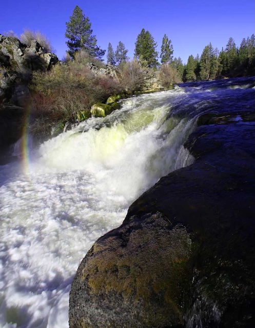
Bursting out of the ground from springs beneath Black Butte, the river stays consistently cold even during extremely hot weather. And, it’s a pretty special place to wet a line.
Limited to fly-fishing (upstream of Bridge 99) and catch-and-release angling, the Metolius is a majestic product of the Cascade mountains. Located northwest of the town of Sisters, it flows 23 miles on a route north and then southeast to Lake Billy Chinook.
The crystal-clear river provides the opportunity to hook native rainbow trout, and bull trout when they migrate upstream from the reservoir in the fall.
For all its untamed splendor, the Metolius is known as a challenging river for anglers.
Trending
But finding a fishing hole on the river is easy, as trails trudged by anglers line the banks.
Mason and I hiked upstream from our campsite at Pine Rest campground to find numerous fishing spots.
In the early morning or evenings when the fish are rising to the surface, dry-fly fishing with PMD or caddis patterns can be productive on the Metolius.
We just missed the fabled Green Drake hatch that runs from late May to mid-June, but there was a flurry of mayfly and caddis activity in the evenings. The Golden Stone hatch is also starting, and we saw several of those larger bugs.
Hiking
For those not necessarily seeking the challenge of fly-fishing the Metolius, hiking the shady trails along the river is an ideal way to take in the beauty of the area.
In many places, trails line both banks of the river, cutting through meadows, pines, firs, bushes and colorful wildflowers.
Hikers can walk trails all the way from the head of the Metolius on the river’s south end to Candle Creek Campground to the north. Trail signs are posted at most campgrounds, and an official trailhead is at Canyon Creek Campground.
The trails cut through about 10 campgrounds along the river, making the Metolius an ideal camping/hiking/fishing destination.
Mason and I hiked downstream from Pine Rest for a few miles, past the Gorge campground, where the river narrows into a canyon and flows mightily through the pristine forest. There, the Metolius alternates between surging white rapids and deep, blue pools.
The Metolius can easily be considered a hiking destination as well as a fly-fishing destination.
Biking
Because many of the trails that line the Metolius are open only to pedestrians, cyclists need to get a little creative to find their routes.
But the area is a gravel rider’s paradise, with countless gravel and dirt roads that branch out west from the river toward the Cascade Range.
For those seeking more of a mountain biking adventure, there is the 11-mile Lower Butte Loop and the 13-mile Upper Butte Loop around Black Butte, as well as the 12-mile Green Ridge trail, which runs along the ridgeline just east of the Metolius.
A tamer trail, and one that Mason and I decided on, is the Camp Sherman trail. This is an easy, flat trail that runs for a few miles through the tiny, quaint town of Camp Sherman and connects to paved Forest Road 14.
From Pine Rest campground, we road paved roads along the river into Camp Sherman, then connected to the trail. We turned around when we reached Road 14, making for a 10-mile, out-and-back ride. We rode early in the morning to avoid the heat.
As temperatures are expected to reach the high 90s this weekend, the cold, clear water of the Metolius and the shady forest that surrounds it provide the perfect respite from the scorching conditions.
Marketplace


Enter the $5,000 Sweepstakes

-
eEdition

-

-