Column: Biking within Bend on Townie
Published 1:00 am Friday, May 14, 2021
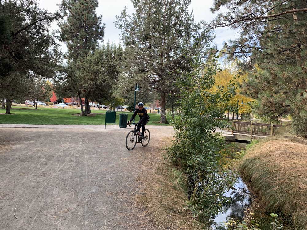
- The Townie trail is a route that helps cyclists stay out of traffic while riding around town.
Here’s a bike adventure with one simple purpose: help cyclists in Bend stay out of traffic when they are riding around town. Think of it as a tour that takes you here, there and everywhere. By the end of it, you’ll rethink how to commute across town on a bike. We call this route Townie.
Townie was patched together by your pals from Dirty Freehub. Normally, Dirty Freehub is all about helping cyclists ride in remote areas on gravel bike routes; we have over 8,000 miles of free, curated gravel bike route reviews across Oregon, Arizona and the rest of the western U.S. But the Townie route is different because it’s not about escaping the town we live in, but rather about riding within it.
Trending
Besides learning about commuting options, we also use Townie for bad weather days (easy to cut it short or find protection from the elements) or when we don’t have a lot of time (it’s not steep or long). The places to ride within Bend are amazing — thanks to Bend Park & Recreation District for constantly adding more and more bike paths — Bend is loaded with secret paths that you might not even know exist.
We also use this route to test navigation skills. It’s one thing to get lost in the middle of the Ochoco National Forest where you haven’t seen a soul all day and another when you can flip to Google maps and type in the speedy way to get back to the start. So why not use this route to gain experience with navigating using technology?
What does the route include? You’ll buzz through the Old Mill, ride along a variety of canal trails and follow along the Deschutes River. You’ll find the super-secret Larkspur Trail and get to see the new jazzy Larkspur Community Center. We’ve tossed in Pilot Butte and the cool tunnel that lets you zip under U.S. Highway 20. Of course, we had to include Drake Park and a stop at the Bend Whitewater Park.
What types of surfaces can you expect? It’s a mixed bag: paved bike trails, gravel bike trails and roads. The free downloadable map is color-coded so you know what to expect. There are also sections where e-bikes are not allowed.
The whole route is only 13 miles with 400 feet of climbing, but if this isn’t quite enough riding, you can catch the Westside Tour route at mile 10. This will jump your mileage up to 34 miles by including Awbrey Butte, Discovery Park, Shevlin Park and Phil’s Trailhead.
How do you use these routes? Lots of cyclists download the routes on bike computers. But you can also use the route on RidewithGPS.com on a smartphone. You’ll find all the route details at https://dirtyfreehub.com/adventure/oregon-x/townie/.
Trending
Why does Dirty Freehub provide these routes? While we are an online guide for gravel bike routes, we also have the sneaky objective of connecting cyclists to the places that they ride. We want you to know the history, understand bits about the environment and, more importantly, feel inspired to maybe volunteer or donate to some of the awesome organizations that have worked hard to provide you places to ride. The 8,000+ miles of curated bike route reviews across Oregon, Northern California and Arizona mainly take you to places you probably would have never found on your own. We love riding bikes on gravel roads, pavement, single track — it’s all about seeing cool places.
Marketplace


Enter the $5,000 Sweepstakes

-
eEdition

-

-