Conditions report: open trails and sites near or leading to lakes
Published 12:00 am Friday, June 19, 2020
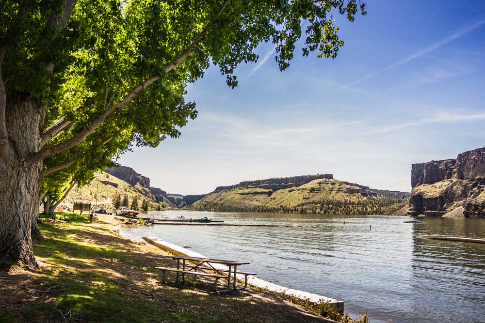
- Lake Billy Chinook
Hiking, walking or going for a run on a trail can be exhilarating and relaxing, combining a trail excursion with the serenity of a beautiful lake makes the adventure a twofer. The following list features conditions of open trails and sites near or leading to lakes.
For a full list of conditions updated regularly, please visit centraloregonexplore.com
Hiking and Day Use Sites
Deschutes National Forest
• Beach Day Use: Open — no services
• Bear Valley Trailhead: Open — no services
• Big Obsidian Flow Trailhead: Open — no services; patches of snow on trail
• Browns Mt. Viewpoint: Open — no services
• Cabot Lake Trailhead: Open — no services
• Cinder Hill Day Use: Open
• Crane Prairie Picnic Area: Open — no services
• Crater Butte Trailhead: Open — no services
• Crater Rim Trailhead: Open
• Cultus Lake Picnic Area: Open — no services
• Deer Lake Trailhead: Closed; hazard trees
• Elk Lake Day Use: Open
• Elk Lake Trailhead: Open — no services
• Jack Lake Trailhead: Open — no services
• Lava Camp Lake Trailhead: Open
• Lava Lake Day Use: Open — no services
• Little Crater Day Use: Open — no services
• Little Fawn Day Use: Open
• Lucky Lake Trailhead: Open — no services
• Millican Crater Trailhead: Open — no services
• Osprey Point Day Use: Open — no services
• Paulina Lake Day Use: Open — no services
• Rosary Lakes Trailhead: Open — no services
• Round Lake Trailhead: Open — no services
• Scott Pass Trailhead: Open — no services
• Scout Lake Day Use: Open — no services
• Simax North and South Beach area: Open — no services
• Six Lakes Trailhead: Open; snow free as far as Doris Lake with moderate blowdown
• South Twin Day Use — Launch: Open — no services
• Sparks Lake Trailhead: Closed; hazard trees
• Sunset View Day Use: Open — no services
• Suttle Lake Day Use: Open — no services
• Ten Mile Trailhead: Open — no services
• Todd Creek Horse Camp: Closed; snow
• Tranquil Cove Day Use: Open — no services
• Winopee Trailhead: Open — no services
Ochoco National Forest
• Antelope Flat Reservoir: Open — limited services; campground remains closed
• Rimrock Springs Trailhead: Open — limited services
• Tam-A-Lau Trailhead: Open — limited services
• Walton Lake Trailhead: Open — limited services
Oregon State Parks
• Cove Palisades State Park: Open with reduced services.
• Jasper Point — Prineville Reservoir: Open with reduced services, camping is first-come, first-served. Boat ramp to close at the end of June due to low water.
• Prineville Reservoir State Park: Open with reduced services.
Camping
Deschutes National Forest
• Big Cove Boat-in Campground: Open, no water
• Blue Bay Campground: Open, water coming soon
• Cinder Hill Campground: Open
• Contorta Flat Campground: Open, group camp remains closed
• Crane Prairie Campground: Open
• Crescent Creek Campground: Open
• Cultus Lake Campground: Open
• East Davis Lake Campground: Open
• East Lake Campground: Open
• Elk Lake Campground: Open; no water, group camp remains closed
• Gull Point Campground: Open
• Lava Camp Lake Campground: Open
• Lava Lake Campground: Open
• Link Creek Campground: Open
• Little Crater Campground: Open
• Little Cultus Campground: Open; no water; group camp remains closed
• Little Fawn Campground: Open; no water, group camp remains closed
• Little Lava Lake: Campground: Open
• Mallard Marsh Campground: Open; no water
• North Twin Lake Campground: Open
• Paulina Lake Campground: Open
• Perry South Campground: Open
• Point Campground: Open; no water
• Princess Creek Campground: Open; no water
• Rock Creek Campground: Partially open; no water
• South Campground: Open; no water
• South Shore Campground: Open
• South Twin Lake Campground: Open
• Spring Campground: Open
• Sunset Cove Campground: Open
• Trapper Creek Campground: Open
• West South Twin Campground: Open
Ochoco National Forest and Crooked River National Grassland
• Haystack Reservoir Campground and Day Use Area: Open; group site closed
• Haystack West Shore Campground and Day Use Area: Open
• Walton Lake Campground: Open; group site closed
Cycling
East of Bend trails
• Dry River Canyon: Closed to protect nesting raptors
• Horse Butte Loop: Sandy and loose
• All other trails riding well
Phil’s Trail Complex
• Phil’s Trail: Riding well; reported deadfall
• Upper Storm King and C.O.D.: Riding well; reported deadfall
• All other trails are riding well
Wanoga Trail Complex
• Deschutes River: Riding well; reported deadfall
• Dinah Moe Humm: Riding well; reported deadfall
• Tyler’s Traverse: Sandy and loose
• All other trails are riding well
North of Skyliner trails
• Met-Win — Happy Valley to Mrazek: Rideable snow
• All other trails are riding well
Swampy Lakes trails
• Flagline Access: Deep Snow
• Flagline Tie: Patches of rideable snow
• Lower Flagline: Riding well, deadfall reported
• Met-Win — Flagline to Happy Valley: Deep Snow
• Middle Flagline: Closed
• Southfork: Muddy
• Swampy Lakes Loop: Riding well, deadfall reported
• Swampy-Dutchman: Snow
• Upper Flagline: Snow, deadfall reported
• Vista Butte: Riding well, deadfall reported
• All other trails are riding well
Cascade Lakes trails
• Metolius-Windigo (Todd Lake): Snow
• All other trails are riding well
Sunriver area trails
• La Pine State Park: Sandy and loose
• All other trails riding well
Prineville and Ochoco trails
• 66 Trails: Riding well; reported deadfall
• All other trails riding well
Sisters trails
• Green Ridge: Riding well; reported deadfall
• Metolius-Windigo (Black Butte): Riding well; reported deadfall
• Metolius-Windigo (99): Riding well; reported deadfall
• All trails riding well
Maston complex
• All trails reporting sandy and loose conditions
Redmond trails
• Dry Canyon: Riding well; reported deadfall
• All trails riding well
Fishing
Updated at 9 a.m. June 18
• Crane Prairie Reservoir: 84% full; brook trout, kokanee, largemouth bass, rainbow trout; current hatches — baitfish, leech, callibaetis, damsel, chironomid
• Wickiup Reservoir: 44% full; kokanee, coho salmon, rainbow and brook trout, whitefish, chub
• Prineville Reservoir: 63% full; rainbow trout, small and largemouth bass, catfish, crappie, crayfish. Roberts Bay and Ochoco Viewpoint closed
• East Lake: Brown trout, kokanee, rainbow trout; current hatches — midge, pale morning dun, baitfish, leech, ant, flying ant, beetle, callibaetis, chironomids
• Paulina Lake: Kokanee, rainbow and brown trout; fishing is fair for kokanee and browns. Recommended still-fishing, trolling, fly fishing and jigging.
• Ochoco Reservoir: 47% full; rainbow trout, black crappie, smallmouth bass; fishing is fair to good
• Haystack Reservoir: 97% full; rainbow and brown trout, kokanee, largemouth bass, black crappie, bluegill and bullhead catfish; fishing for rainbow trout is fair on bait, troll and flies. Warm water species picking up
• North Twin Lake: Rainbow trout; fishing is fair on powerbait, crawlers and trolled flies
• South Twin Lake: Rainbow trout; fishing is fair on powerbait, crawlers, lures and flies
• Davis Lake: Water level is low; rainbow trout and largemouth bass. Fly fishing only
• Lava Lake: Rainbow trout; Still and fly fishing with casting lures toward the bank; fishing is good
• Little Lava Lake: Rainbow trout, brook trout and whitefish; bait, lures and flies are best with still-fishing or trolled
• Cultus Lake: Mackinaw, rainbow and brook trout; troll the depths for mackinaw and shallows for rainbow
• Hosmer Lake: Brook, cutthroat and rainbow trout
• Elk Lake: Brook trout and kokanee; jigging, still-fishing and trolling from a boat or fly fishing are best
• Crescent Lake: 55% full; kokanee, mackinaw, rainbow and brown trout, whitefish and chub; fair to good fishing for rainbow trout and kokanee
Misery Ridge remains closed.
The following climbing routes at the park closed for nesting raptor protection: Cajun Cliff, Victoria Tower, Little Three Fingered Jack, Puddy’s Tower, The Monument, Anglin’s Buttress, French Tent Rock, Driveway Gravel (P2, P3), Teddy Bear’s Picnic (P2-P5), Five Easy Pieces (P2-P5), Free Lunch (P2-P5), First Kiss (41-47), King Line, Smith Rock Group (above 100 feet).
The following restrictions apply to BLM-adminstered lands:
- Within one-half mile of the Crooked River’s Edge from the U.S. Highway 97 bridge to Lake Billy Chinook.
- Within one-half mile of the Deschutes River’s edge from the U.S. Highway 20 bridge to Lake Billy Chinook.
- Within one-half mile of Lake Simtustus.
- Within the Lower Deschutes National Wild and Scenic River Corridor from Pelton Dam to the Columbia River.
- Within one-half mile of Lake Billy Chinook.
- Within one-half mile of the White River’s edge from it’s confluence with the Deschutes River to the Mt. Hood National Forest.
- Along the John Day River from Tumwater Falls to Kimberly.
For more information visit centraloregonfire.org


Best of the Best of Bend 2025

-
eEdition

-

-
Go! eEdition