Celebrate Earth Day and public lands protections with these Central Oregon hikes
Published 2:30 pm Thursday, April 18, 2024
- Four major tributaries of the Metolius (Jack Creek, Canyon Creek, Brush Creek, and Candle Creek) stand to gain further protections from the River Democracy Act, which Oregon U.S. Sen. Ron Wyden has been working for several years to pass.
Living in Central Oregon for most of my life, there have been times when I have taken protected public lands for granted. With multiple wilderness areas, Wild & Scenic Rivers, a national monument and swaths of forest, mountains and deserts all within an hour’s drive of Bend, sometimes it is easy to forget how lucky we are to have such incredible access to public lands and all the benefits they provide.
It’s also easy to forget that it took a lot of people, a lot of work and a lot of time to gain permanent protections for these natural treasures. Without these efforts, and the various environmental laws used to protect public lands, many of our favorite outdoor destinations in Central Oregon would have been lost to development and extractive industries.
This Earth Day, celebrate our protected public lands in Oregon and the people who helped permanently protect them with these five hikes. While you’re at it, learn about current efforts to add additional safeguards for public lands throughout the state.
Upper Deschutes Wild & Scenic River and State Scenic Waterway
In 1987, thanks to the advocacy work of passionate locals, the Upper Deschutes River from Wickiup Reservoir to the south end of Bend was designated as a State Scenic Waterway. This protected the river from dam construction and unchecked development. With the help of environmental groups like Oregon Wild (then the Oregon Natural Resources Council), the Upper Deschutes was designated as a National Wild & Scenic River the next year under the 1988 Oregon Omnibus Wild & Scenic Rivers Act. This provided federal protections for fish and wildlife habitat, water quality, outdoor recreation and other important river values.
Over the last several years, Sen. Ron Wyden has been working to pass his River Democracy Act, which would add Wild & Scenic segments to the Upper Deschutes River. When passed, the headwaters of the Deschutes from Little Lava Lake to Crane Prairie, Paulina Creek, the Fall River and Tumalo Creek will be designated, providing much needed additional protections to the watershed.
Where to hike: Deschutes River Trail, Dillon Falls to Benham Falls
Distance: 6.5 miles round-trip
Parking: Dillon Falls Day Use Area
Passes/permits: Northwest Forest Pass or Recreation Day Pass
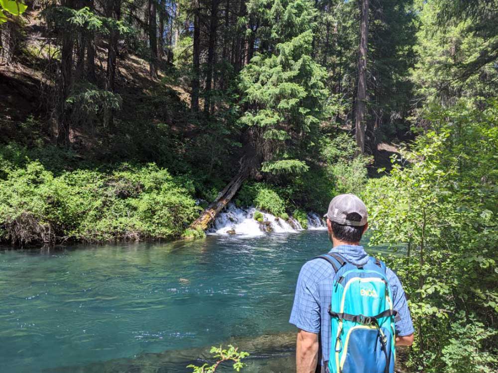
Metolius Wild & Scenic River
The famed Metolius River was also designated a National Wild & Scenic River under the 1988 Act. In the 1980s, with the help of Rep. Peter DeFazio and his staff, local activists prevented a Forest Service plan to develop the Metolius corridor that would have cut numerous old-growth trees along its banks. Wild & Scenic designation further cemented protections for the forests, fish, wildlife, and water quality of the Metolius.
In 2009, the Metolius Basin received another environmental win when it was designated as Oregon’s first, and only, “Area of Critical State Concern.” This designation, which took decades of activism from community members, local environmental groups and tribes, stopped the threat of proposed destination resorts along the Metolius River.
Four major tributaries of the Metolius (Jack Creek, Canyon Creek, Brush Creek, and Candle Creek) stand to gain further protections from the River Democracy Act.
Where to Hike: West Metolius River Trail, Wizard Falls Hatchery to Lower Canyon Creek Campground
Distance: 5.5 miles round-trip
Parking: Wizard Falls Hatchery, 7500 Forest Road 14, Camp Sherman
Fees/Permits: None
Oregon Badlands Wilderness
Located just 15 miles east of Bend, the Badlands is Bend’s closest designated Wilderness Area. Visitors to this desert wilderness will enjoy unique lava formations, ancient juniper trees (some over 1,000 years old) and an abundance of native shrubs and wildflowers. Efforts to protect Bend’s “Backyard Wilderness” were spearheaded by the founding members and friends of the Oregon Natural Desert Association in the 1980s. Decades later, those efforts finally paid off on March 30, 2009, when President Obama signed the Omnibus Public Lands Management Act of 2009 into law. This Act also designated other new wilderness areas across Oregon including Copper Salmon, Soda Mountain, Spring Basin and 127,000 acres of wilderness around Mount Hood (Happy 15th Anniversary to the Badlands and these other wilderness areas!).
While Oregonians are fortunate to have several incredible wilderness areas in the state, only 4% of Oregon’s land is designated as protected wilderness. This lags far behind our neighboring states of Washington (10%), California (15%), and Idaho (10%). Jewels such as Crater Lake, Hardesty Mountain, half of the Wild Rogue, the Owyhee Canyonlands, and thousands of acres of ponderosa forests in eastern Oregon are just a few examples of our stunning yet unprotected wild lands.
Where to Hike: Flatiron Rock Trail
Distance: 5 miles round-trip
Parking: Flatiron Rock Trailhead
Permit/Fees: None
Newberry National Volcanic Monument
Back in the 1980s, the area south of Bend that we now know as the Newberry National Volcanic Monument was drawing attention for another reason: geothermal energy. Dozens of exploratory wells had already been drilled and there was interest in further development of the resource. A group of concerned locals launched a campaign to protect the caldera and surrounding areas as a national monument for its unique and spectacular geology and natural features. Thanks to those efforts, the Newberry National Volcanic Monument was established by Congress in 1990, and this gem which includes East and Paulina Lakes, Paulina Peak, the Big Obsidian Flow, Lava River Cave, Paulina Falls and Lava Butte was protected from energy development and extraction.
Even though Paulina Falls is located within the National Monument boundary, most of Paulina Creek falls outside the boundary and lacks safeguards. The River Democracy Act would protect nine miles of Paulina Creek from its source at Paulina Lake to near its confluence with the Little Deschutes River.
Where to Hike: Ponderosa Rim Trail to Paulina View Trail loop (Disclaimer: Until the snow melts, this is a snowshoe hike or cross-country ski)
Distance: 7-mile loop
Parking: 10-Mile Sno-park
Permit/Fees: Sno-park pass (until April 30)
Steins Pillar (Ochoco National Forest)
The main draw of this hike is the magnificent Steins Pillar (the trail’s namesake), a 350-tall column of volcanic rock that juts out of the forest like a giant thumb. The trail takes you straight to the base of the monstrous rock formation. Not to be outdone by giant rocks, the giant trees are a sight to behold as well. Mature and old-growth ponderosa pine trees tower over the trail, but still provide an opening in the forest canopy every now and then to allow for views of the Cascade mountains to the west.
In the mid-1990s the Eastside Screens rule was put in place to protect large trees (over 21” in diameter at breast height) in Eastern Oregon and Washington National Forests. These large trees–vital for wildlife habitat and carbon storage–were becoming increasingly rare due to decades of unsustainable logging and mismanagement.
In the final days of the Trump Administration, the U.S. Forest Service attempted to eliminate the Screens protections for large trees, putting old and mature Ponderosa pine trees in the Deschutes and Ochoco National Forests at risk of logging. Environmental groups and tribes sued the Forest Service, resulting in a ruling that this move by the Forest Service broke the law. In early April, a federal judge upheld that ruling and fully reinstated the Screens protections.
Where to Hike: Steins Pillar Trail
Distance: 4 miles round trip
Parking: Steins Pillar Trailhead
Permit/Fees: None


