Hot spot of the Cascades
Published 5:00 am Sunday, August 5, 2007
- Hot spot of the Cascades
By John Gottberg Anderson
For The Bulletin
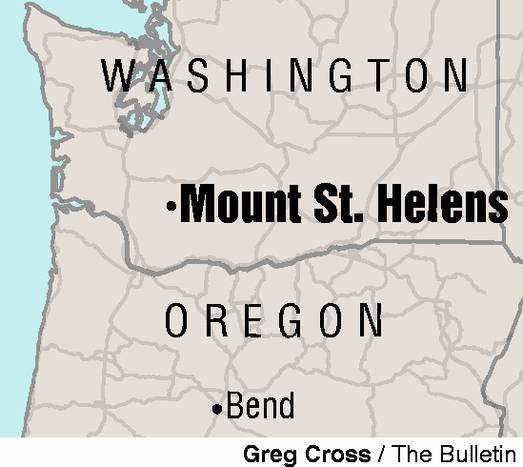
CASTLE ROCK, Wash. — Mount St. Helens was once a vision of tranquility. So symmetrical was the snow-covered 9,677-foot cone, it was known as American’s Fujiyama. It stood above fairytale-like Spirit Lake, old-growth fir forests thriving on its shoreline, summer camps nestled beside the water, canoeists silently launching their vessels for gentle paddles from the Spirit Lake Lodge.
If you were old enough at the time to read a newspaper or watch television news, you know that everything changed dramatically in a matter of a few minutes in May 1980.
After weeks of threatening earthquakes, steam and ash eruptions, and as an enormous bulge grew on the north face of the mountain, Washington’s Mount St. Helens blew itself open with the force of a 24-megaton atomic bomb. Just after 8:30 on the morning of May 18, a magnitude-5.1 quake set off an avalanche — the largest in recorded history — and more than half a cubic mile of rock and ice slid off the slope toward Spirit Lake. That was like sliding the lid off an overheated pressure cooker.
In moments, hot ground water flashed to steam and the gases in the magma at the volcano’s heart exploded outward. A lateral blast of superheated gas and rock fragments raced north and northeast at more than 200 miles per hour, destroying 230 square miles of forest and killing nearly everything in its path: trees, animals, unlucky people caught in the wrong place at the wrong time.
The landslide, hundreds of feet thick, slammed into Spirit Lake at about the same time it was overtaken by the blast. Waves as high as 850 feet crested the adjacent ridge and washed the newly scorched timber back into the lake.
Within about five minutes, the main event had come to an end. But for the next nine hours, the magma cloud continued to unleash its energy skyward, 12 miles into the atmosphere. The resultant clouds of ash turned day into night across most of eastern Washington, northern Idaho and western Montana, and in a few days circled the globe.
The western and southern slopes of St. Helens were not spared their own brand of destruction. Floods of water from Spirit Lake and instantly melted glaciers, laden with volcanic ash and silt, rushed down rivers and streams, sweeping away bridges, roads and homes. So much mud was carried to the Columbia River that the depth of the ocean-going shipping lane was reduced from 40 feet to 15 feet. It took six months of dredging to clear.
When all was said and done, 57 people had died as a direct result of the eruption. Property damage was estimated at $1.5 billion dollars.
And now Mount St. Helens, standing 8,363 feet after losing more than 1,200 feet of elevation, is a tourist attraction.
Different perspectives
More than 27 years have now past since the cataclysmic eruption. Mount St. Helens immediately became a premier research area for geologists, volcanologists and other scientists from all over the world, many of them studying the regeneration of life from a blank slate. The national monument was established in 1982 and placed under the jurisdiction of the National Forest Service (as is Central Oregon’s Newberry National Volcanic Monument).
A beautiful new road, the Spirit Lake Memorial Highway (Washington Route 504), which runs 52 miles east from Interstate 5 at Castle Rock, was completed in 1995. En route, drivers pass no fewer than five visitors centers: one of them run by Oregon State Parks, two by private concerns and the final two by the Forest Service. At the end of the road is the Johnston Ridge Observatory, named for geologist David Johnston, who gave his life monitoring St. Helens’s volcanic activity from his post at this point (5 1/2 miles from the lava dome) in 1980.
You’ll get a different perspective of Mount St. Helens from its northeast slope. Here, paved Forest Road 99 winds through the volcano’s blast zone to the Windy Ridge Viewpoint, the nearest point to the crater accessible by road. The route follows the crest of the ridge line overlooking Spirit Lake.
A third entrance to the national volcanic monument is from the south side of the mountain, but this is not a crater-view destination. This route provides access to such features as the large lava-tube cave known as Ape Cave and to the Climbers’ Bivouac area from which most ascents of Mount St. Helens begin.
Visiting the volcano
As one who grew up in the Northwest, I remember making a family visit to Spirit Lake when I was about 11 years old. I returned to St. Helens in 1986 to do a piece on its recovery, but this was my first visit in more than 20 years.
I drove about 4 1/2 hours northwest from Bend, via Portland, to Castle Rock, 10 miles north of Kelso on Interstate 5. There I enjoyed a quiet dinner, spent the night in a local motel, and the next morning headed up the mountain.
My first stop — at 9 a.m. sharp, as it opened — was the Mount St. Helens Volcanic National Monument Visitor Center, opposite Seaquest State Park five miles east of the interstate. Set in old-growth conifer forest, this structure of timber and stone features two excellent movies documenting the 1980 eruption; be sure to catch at least one of them before continuing your drive. Interpretive exhibits describe the volcanic process, using a model volcano and a topographic model of St. Helens itself, comparing it to other volcanoes around the world. On clear days, you can see St. Helens 30 miles away, across Silver Lake, from the terrace in front of the visitor center.
From Silver Lake, I drove directly to the mountain, 47 miles distant, leaving other points of interest for the return drive. Highway 504 veers to the east just past the hamlet of Toutle and follows the North Fork of the Toutle River, which is fed both by snow runoff from the mountain and by Coldwater Creek. As you drive, you can’t miss the mud flows — witnesses described them as having the consistency of warm concrete — that swept down this valley throughout the afternoon of May 18, 1980.
They reached heights of 30 feet above normal river level and destroyed 200 homes, either burying them or carrying them away.
Still smoldering
The Spirit Lake Memorial Highway ends at the Johnston Ridge Observatory, which looks directly into the crater from an elevation of 4,314 feet. It’s clearly an international phenomenon: On the platform here, I met a family from India, a quartet of saffron-robed Burmese monks and a pair of travelers from Germany, and I must have heard at least a half-dozen other languages spoken. Cameras were clicking one after another. Many visitors climbed a short trail to a higher viewpoint, and a handful wandered on short hikes to adjacent ridge lines.
To me, the true spectacle here was the view of Mount St. Helens’ ever-smoldering lava dome. After 18 years of quiet, the volcano suddenly erupted in October 2004, and it hasn’t stopped since. Lava extrusions from the crater floor have built a series of seven lava spines reaching 1,300 feet in height: taller than New York’s Empire State Building. Government scientists carefully monitor the volcano, depositing remote instrument packages in and out of the crater by helicopter. Posted signs warn visitors of the dangers of volcanic ash fall, addressing precautions should an ash fall occur during their visit.
There are two particularly interesting displays within the visitor center at Johnston Ridge (open 10 a.m. to 6 p.m., mid-May through October). Three seismographs, linked directly to seismometers on the mountain, show ground movement occurring upon and beneath the surface at different locations. Interpretive text explains how scientists differentiate between such activity as earthquakes, magma intrusions and small avalanches.
There’s also a broad topographic model of the greater Mount St. Helens area, with colored lights to indicate the component events of the 1980 eruption. The graphic provides a clearer understanding of the geographical scope of the eruption — the extent of the blast zone and mud slides, for instance — than can be provided by photos or words.
Other viewpoints
Nine miles back down the road to Castle Rock is the Coldwater Ridge Visitor Center. Sadly, lack of funding will force the National Forest Service to permanently close this facility on Nov. 5. In the meantime, its exhibits — on the recovery of animals and plants in the volcanic national monument — are well worth seeing. The speed with which vegetation and wildlife have returned to the devastated area has impressed everyone. Only five years after the 1980 eruption, for instance, the numbers of elk and deer on Mount St. Helens were back to normal.
Appropriately, Coldwater Ridge overlooks Coldwater Lake, a prime example of nature’s resilience. Created when debris from the initial avalanche dammed Coldwater Creek, the lake is today again surrounded by lush foliage. Native cutthroat trout, which survived the eruption, have cross-bred with rainbow trout, planted later, to create a new subspecies known as “cutbow” trout. Fishermen with barbless hooks and Washington state fishing licenses are welcome, but they can’t keep anything smaller than 14 inches.
Ten miles west of Coldwater Ridge, outside the boundary of the national monument, is the Forest Learning Center. A collaboration of the Weyerhaeuser Co., the Rocky Mountain Elk Foundation and the Washington State Department of Transportation, it has excellent displays on the evergreen forest before and after the eruption, with emphasis on salvage, recovery and reforestation. Here you’re in the heart of Weyerhaeuser’s replanting district, and wherever you look you’ll see dense stands of Douglas fir and other conifers. The Learning Center has the best gift shop on the highway, as well as telescopes that look into the Toutle River valley for close-ups of elk herds.
The private Hoffstadt Bluffs Visitor Center is seven miles farther west, 20 miles east of Silver Lake. If you must skip one of the five visitor centers along the route, this is the one to miss. Its main value is as the takeoff point for hourly helicopter tours of Mount St. Helens in summer. Hoffstadt has a good little restaurant. Its Memorial Grove has a plaque listing the names of those who died in, or as a direct result of, the eruption.
A trip to Windy Ridge
By now, you’ve had a full day on Mount St. Helens. But if you’ve got a full weekend of touring set aside, you’ll want to devote the next day to the east side of the mountain. Return to I-5 at Castle Rock, turn north to Exit 68 (about 19 miles), then follow U.S. Highway 12 east 31 miles to Morton, where there are a couple of comfortable motels and restaurants.
The next morning, you’ll have an hour’s jump-start on other drivers. Take Highway 12 east, 17 miles to Randle, then turn south on Forest Road 25. This paved route winds uphill through Gifford Pinchot National Forest; construction work is going on this summer and fall, so the 20 miles to the junction of Forest Road 99 could be slow going. The road for the final 17-mile climb to Windy Ridge is in better condition. (After visiting Windy Ridge, you can return to this junction, then proceed south on paved Forest Roads 25 and 30 to the Columbia River Gorge at Carson, Wash.)
The Blast Edge Viewpoint, about six miles up Road 99, marks the boundary of the national monument. Here, at the edge of the blast zone, trees were scorched and killed but not toppled. As you drive farther, you’ll see thousands of trees downed like dominoes. Nearer St. Helens, every tree points directly away from the crater; a few miles away from the mountain, the blast cloud swirled and the tree pattern is different.
Other sights along this road include the half-buried vehicle of a family of miners killed in the blast, and Meta Lake, whose cover of ice and snow enabled fish, amphibians and insect larvae to survive the eruption. And there are several views of Spirit Lake. Best of the bunch is the Harmony Viewpoint, from where a one-mile trail leads steeply downhill to the lake shore. Prior to 1980, this was the site of the Harmony Falls Resort, accessible only by boat.
The Windy Ridge Viewpoint is the end of the road. There’s no visitor center here; the only structure is a rest house with swallows living in its rafters. And although it wasn’t windy on the day of my visit, I can imagine that without trees to act as windbreaks, it can get downright blustery.
I climbed 440-odd steps to the summit of the ridge, where I was rewarded with a vast panorama across the pumice plain at the foot of Mount St. Helens. Below to my right, a ghostly mat of logs covered half of Spirit Lake. To my left, I saw where the volcanic debris deposited by the avalanche slid to the lake shore. Rising behind Spirit Lake I saw Harry’s Ridge, named for cantankerous Harry Truman, the keeper of the Spirit Lake Lodge, who died after refusing to vacate his home even as the volcano threatened its explosion. Behind Harry’s Ridge was Johnston Ridge, where I had spent hours the day before.
In Native American legend, Mount St. Helens was known as Loowit, the lady of fire. She could transform herself from beauty to beast and back to beauty. Before the current volcanic cycle, she had been a beast once before in historic times: an eruption in 1857. Now, apparently, she is returning to beauty. But it’s only a matter of time before the beast rears its head again.
CASTLE ROCK, Wash. — Mount St. Helens was once a vision of tranquility. So symmetrical was the snow-covered 9,677-foot cone, it was known as American’s Fujiyama. It stood above fairytale-like Spirit Lake, old-growth fir forests thriving on its shoreline, summer camps nestled beside the water, canoeists silently launching their vessels for gentle paddles from the Spirit Lake Lodge.
If you were old enough at the time to read a newspaper or watch television news, you know that everything changed dramatically in a matter of a few minutes in May 1980.
After weeks of threatening earthquakes, steam and ash eruptions, and as an enormous bulge grew on the north face of the mountain, Washington’s Mount St. Helens blew itself open with the force of a 24-megaton atomic bomb.
Just after 8:30 on the morning of May 18, a magnitude 5.1 quake set off an avalanche — the largest in recorded history — and more than half a cubic mile of rock and ice slid off the slope toward Spirit Lake. That was like sliding the lid off an overheated pressure cooker.
In moments, hot ground water flashed to steam and the gases in the magma at the volcano’s heart exploded outward.
A lateral blast of superheated gas and rock fragments raced north and northeast at more than 200 miles per hour, destroying 230 square miles of forest and killing nearly everything in its path: trees, animals, unlucky people caught in the wrong place at the wrong time.
The landslide, hundreds of feet thick, slammed into Spirit Lake at about the same time it was overtaken by the blast. Waves as high as 850 feet crested the adjacent ridge and washed the newly scorched timber back into the lake.
Within about five minutes, the main event had come to an end. But for the next nine hours, the magma cloud continued to unleash its energy skyward, 12 miles into the atmosphere. The resultant clouds of ash turned day into night across most of eastern Washington, northern Idaho and western Montana, and in a few days circled the globe.
The western and southern slopes of St. Helens were not spared their own brand of destruction. Floods of water from Spirit Lake and instantly melted glaciers, laden with volcanic ash and silt, rushed down rivers and streams, sweeping away bridges, roads and homes. So much mud was carried to the Columbia River that the depth of the ocean-going shipping lane was reduced from 40 feet to 15 feet. It took six months of dredging to clear.
When all was said and done, 57 people had died as a direct result of the eruption. Property damage was estimated at $1.5 billion dollars.
And now Mount St. Helens, standing 8,363 feet after losing more than 1,200 feet of elevation, is a tourist attraction.
Different perspectives
More than 27 years have now past since the cataclysmic eruption. Mount St. Helens immediately became a premier research area for geologists, volcanologists and other scientists from all over the world, many of them studying the regeneration of life from a blank slate. The national monument was established in 1982 and placed under the jurisdiction of the National Forest Service (as is Central Oregon’s Newberry National Volcanic Monument).
A beautiful new road, the Spirit Lake Memorial Highway (Washington Route 504), which runs 52 miles east from Interstate 5 at Castle Rock, was completed in 1995. En route, drivers pass no fewer than five visitors centers: one of them run by Oregon State Parks, two by private concerns and the final two by the Forest Service. At the end of the road is the Johnston Ridge Observatory, named for geologist David Johnston, who gave his life monitoring St. Helens’ volcanic activity from his post at this point (5 1/2 miles from the lava dome) in 1980.
You’ll get a different perspective of Mount St. Helens from its northeast slope. Here, paved Forest Road 99 winds through the volcano’s blast zone to the Windy Ridge Viewpoint, the nearest point to the crater accessible by road. The route follows the crest of the ridgeline overlooking Spirit Lake.
A third entrance to the national volcanic monument is from the south side of the mountain, but this is not a crater-view destination. This route provides access to such features as the large lava-tube cave known as Ape Cave and to the Climbers’ Bivouac area from which most ascents of Mount St. Helens begin.
Visiting the volcano
As one who grew up in the Northwest, I remember making a family visit to Spirit Lake when I was about 11 years old. I returned to St. Helens in 1986 to do a piece on its recovery, but this was my first visit in more than 20 years.
I drove about 4 1/2 hours northwest from Bend, via Portland, to Castle Rock, 10 miles north of Kelso on Interstate 5. There I enjoyed a quiet dinner, spent the night in a local motel, and the next morning headed up the mountain.
My first stop — at 9 a.m. sharp, as it opened — was the Mount St. Helens Volcanic National Monument Visitor Center, opposite Seaquest State Park five miles east of the interstate. Set in old-growth conifer forest, this structure of timber and stone features two excellent movies documenting the 1980 eruption; be sure to catch at least one of them before continuing your drive. Interpretive exhibits describe the volcanic process, using a model volcano and a topographic model of St. Helens itself, comparing it to other volcanoes around the world. On clear days, you can see St. Helens 30 miles away, across Silver Lake, from the terrace in front of the visitor center.
From Silver Lake, I drove directly to the mountain, 47 miles distant, leaving other points of interest for the return drive. Highway 504 veers to the east just past the hamlet of Toutle and follows the North Fork of the Toutle River, which is fed both by snow runoff from the mountain and by Coldwater Creek. As you drive, you can’t miss the mudflows — witnesses described them as having the consistency of warm concrete — that swept down this valley throughout the afternoon of May 18, 1980.
They reached heights of 30 feet above normal river level and destroyed 200 homes, either burying them or carrying them away.
Still smoldering
The Spirit Lake Memorial Highway ends at the Johnston Ridge Observatory, which looks directly into the crater from an elevation of 4,314 feet. It’s clearly an international phenomenon: On the platform here, I met a family from India, a quartet of saffron-robed Burmese monks and a pair of travelers from Germany, and I must have heard at least a half-dozen other languages spoken. Cameras were clicking one after another. Many visitors climbed a short trail to a higher viewpoint, and a handful wandered on short hikes to adjacent ridgelines.
To me, the true spectacle here was the view of Mount St. Helens’ ever-smoldering lava dome. After 18 years of quiet, the volcano suddenly erupted in October 2004, and it hasn’t stopped since. Lava extrusions from the crater floor have built a series of seven lava spines reaching 1,300 feet in height: taller than New York’s Empire State Building. Government scientists carefully monitor the volcano, depositing remote instrument packages in and out of the crater by helicopter. Posted signs warn visitors of the dangers of volcanic ash fall, addressing precautions should an ash fall occur during their visit.
There are two particularly interesting displays within the visitor center at Johnston Ridge (open 10 a.m. to 6 p.m., mid-May through October). Three seismographs, linked directly to seismometers on the mountain, show ground movement occurring upon and beneath the surface at different locations. Interpretive text explains how scientists differentiate between such activity as earthquakes, magma intrusions and small avalanches.
There’s also a broad topographic model of the greater Mount St. Helens area, with colored lights to indicate the component events of the 1980 eruption. The graphic provides a clearer understanding of the geographical scope of the eruption — the extent of the blast zone and mudslides, for instance — than can be provided by photos or words.
Other viewpoints
Nine miles back down the road to Castle Rock is the Coldwater Ridge Visitor Center. Sadly, lack of funding will force the National Forest Service to permanently close this facility Nov. 5. In the meantime, its exhibits — on the recovery of animals and plants in the volcanic national monument — are well worth seeing. The speed with which vegetation and wildlife have returned to the devastated area has impressed everyone. Only five years after the 1980 eruption, for instance, the numbers of elk and deer on Mount St. Helens were back to normal.
Appropriately, Coldwater Ridge overlooks Coldwater Lake, a prime example of nature’s resilience. Created when debris from the initial avalanche dammed Coldwater Creek, the lake is today again surrounded by lush foliage. Native cutthroat trout, which survived the eruption, have cross-bred with rainbow trout, planted later, to create a new subspecies known as “cutbow” trout. Fishermen with barbless hooks and Washington state fishing licenses are welcome, but they can’t keep anything smaller than 14 inches.
Ten miles west of Coldwater Ridge, outside the boundary of the national monument, is the Forest Learning Center.
A collaboration of the Weyerhaeuser Co., the Rocky Mountain Elk Foundation and the Washington State Department of Transportation, it has excellent displays on the evergreen forest before and after the eruption, with emphasis on salvage, recovery and reforestation. Here you’re in the heart of Weyerhaeuser’s replanting district, and wherever you look you’ll see dense stands of Douglas fir and other conifers. The Learning Center has the best gift shop on the highway, as well as telescopes that look into the Toutle River valley for close-ups of elk herds.
The private Hoffstadt Bluffs Visitor Center is seven miles farther west, 20 miles east of Silver Lake. If you must skip one of the five visitor centers along the route, this is the one to miss. Its main value is as the takeoff point for hourly helicopter tours of Mount St. Helens in summer. Hoffstadt has a good little restaurant. Its Memorial Grove has a plaque listing the names of those who died in, or as a direct result of, the eruption.
A trip to Windy Ridge
By now, you’ve had a full day on Mount St. Helens. But if you’ve got a full weekend of touring set aside, you’ll want to devote the next day to the east side of the mountain. Return to I-5 at Castle Rock, turn north to Exit 68 (about 19 miles), then follow U.S. Highway 12 east 31 miles to Morton, where there are a couple of comfortable motels and restaurants.
The next morning, you’ll have an hour’s jump-start on other drivers. Take Highway 12 east, 17 miles to Randle, then turn south on Forest Road 25. This paved route winds uphill through Gifford Pinchot National Forest; construction work is going on this summer and fall, so the 20 miles to the junction of Forest Road 99 could be slow going. The road for the final 17-mile climb to Windy Ridge is in better condition. (After visiting Windy Ridge, you can return to this junction, then proceed south on paved Forest Roads 25 and 30 to the Columbia River Gorge at Carson, Wash.)
The Blast Edge Viewpoint, about six miles up Road 99, marks the boundary of the national monument. Here, at the edge of the blast zone, trees were scorched and killed but not toppled. As you drive farther, you’ll see thousands of trees downed like dominoes. Nearer St. Helens, every tree points directly away from the crater; a few miles away from the mountain, the blast cloud swirled and the tree pattern is different.
Other sights along this road include the half-buried vehicle of a family of miners killed in the blast, and Meta Lake, whose cover of ice and snow enabled fish, amphibians and insect larvae to survive the eruption. And there are several views of Spirit Lake. Best of the bunch is the Harmony Viewpoint, from where a one-mile trail leads steeply downhill to the lake shore. Prior to 1980, this was the site of the Harmony Falls Resort, accessible only by boat.
The Windy Ridge Viewpoint is the end of the road. There’s no visitor center here; the only structure is a rest house with swallows living in its rafters. And although it wasn’t windy on the day of my visit, I can imagine that without trees to act as windbreaks, it can get downright blustery.
I climbed 440-odd steps to the summit of the ridge, where I was rewarded with a vast panorama across the pumice plain at the foot of Mount St. Helens. Below to my right, a ghostly mat of logs covered half of Spirit Lake. To my left, I saw where the volcanic debris deposited by the avalanche slid to the lake shore. Rising behind Spirit Lake I saw Harry’s Ridge, named for cantankerous Harry Truman, the keeper of the Spirit Lake Lodge, who died after refusing to vacate his home even as the volcano threatened its explosion. Behind Harry’s Ridge was Johnston Ridge, where I had spent hours the day before.
In American Indian legend, Mount St. Helens was known as Loowit, the lady of fire. She could transform herself from beauty to beast and back to beauty. Before the current volcanic cycle, she had been a beast once before in historic times: an eruption in 1857. Now, apparently, she is returning to beauty. But it’s only a matter of time before the beast rears its head again.
VISITING MOUNT ST. HELENS
EXPENSES
Gas (642 miles @ $2.90/gallon) $74.47
Dinner, Hattie’s, Castle Rock $15.98
Lodging, Mt. St. Helens Motel, Castle Rock $67.95
Admission, Mount St. Helens Visitor Center $3
Volcanic national monument fee $8
Lunch, Johnston Ridge $ 7.50
Dinner, Plaza Jalisco, Morton $18.50
Lodging, Seasons Motel, Morton $87.62
Lunch, Mt. St. Helens Concessions $6.75
Dinner, Nora’s Fish House, Hood River $35
TOTAL $324.77
IF YOU GO
INFORMATION
Mount St. Helens Volcanic National Monument: State Highway 503, Amboy, Wash.; 360-449-7800, www.fs.fed.us/gpnf/mshnvm
Gifford Pinchot National Forest: 10600 N.E. 51st Circle, Vancouver, Wash.; 360-891-5000, www.fs.fed.us/gpnf/
Washington State Tourism: Olympia, Wash.; 800-544-1800, www.experiencewashington.com
LODGING
Best Western Aladdin Motor Inn: 310 Long Ave., Kelso, Wash.; 360-425-9660, www.bestwestern.com/ aladdinmotorinnkelso. Rates from $81.
Mt. St. Helens Motel: 1340 Mt. St. Helens Way, Castle Rock, Wash.; 360-274-7721, www.mtsthelensmotel.com. Rates from $62.
Seasons Motel: 200 Westlake Ave., Morton, Wash.; 360-496-6835, www.whitepasstravel.com. Rates from $80.
Skamania Lodge: 1131 S.W. Skamania Lodge Way, Stevenson, Wash.; 509-427-7700, 800-447-6310, www.skamania.com. Rates from $189.
RESTAURANTS
Hattie’s: 51 Cowlitz St. W., Castle Rock, Wash.; 360-274-7019
Nora’s Fish House: 110 Fifth St., Hood River, Ore.; 541-387-4000
Plaza Jalisco: 200 Westlake Ave., Morton, Wash.; 360-496-6660
ATTRACTIONS
Mount St. Helens Visitor Center: Seaquest State Park, Milepost 5, Spirit Lake Highway, Silver Lake, Wash.; 360-274-0962 or 360-274-2127, www.nwpubliclands.org
Hoffstadt Bluffs Visitor Center: Milepost 27, Spirit Lake Highway; 360-274-7750, www.mt-st-helens.com
Forest Learning Center: Milepost 33.5, Spirit Lake Highway; 360-414-3439, www.theforestreturns.com
Coldwater Ridge Visitor Center: Milepost 43, Spirit Lake Highway; 360-274-2114
Johnston Ridge Observatory: Milepost 52, Spirit Lake Highway; 360-274-2140
Gas (642 miles @ $2.90/gallon) $74.47
Dinner, Hattie’s, Castle Rock $15.98
Lodging, Mt. St. Helens Motel, Castle Rock $67.95
Admission, Mount St. Helens Visitor Center $3
Volcanic national monument fee $8
Lunch, Johnston Ridge $7.50
Dinner, Plaza Jalisco, Morton $18.50
Lodging, Seasons Motel, Morton $87.62
Lunch, Mt. St. Helens Concessions $6.75
Dinner, Nora’s Fish House, Hood River $35
TOTAL $324.77
Mount St. Helens Volcanic National Monument: State Highway 503, Amboy, Wash.; 360-449-7800, www.fs.fed.us/gpnf/mshnvm
Gifford Pinchot National Forest: 10600 N.E. 51st Circle, Vancouver, Wash.; 360-891-5000, www.fs.fed.us/gpnf/
Washington State Tourism: Olympia, Wash.; 800-544-1800, www.experiencewashington.com
Best Western Aladdin Motor Inn: 310 Long Ave., Kelso, Wash.; 360-425-9660, www.bestwestern.com/ aladdinmotorinnkelso. Rates from $81.
Mt. St. Helens Motel: 1340 Mt. St. Helens Way, Castle Rock, Wash.; 360-274-7721, www.mtsthelensmotel.com. Rates from $62.
Seasons Motel: 200 Westlake Ave., Morton, Wash.; 360-496-6835, www.whitepasstravel.com. Rates from $80.
Skamania Lodge: 1131 S.W. Skamania Lodge Way, Stevenson, Wash.; 509-427-7700, 800-447-6310, www.skamania.com. Rates from $189.
Hattie’s: 51 Cowlitz St. W., Castle Rock, Wash.; 360-274-7019
Nora’s Fish House: 110 Fifth St., Hood River, Ore.; 387-4000
Plaza Jalisco: 200 Westlake Ave., Morton, Wash.; 360-496-6660
Mount St. Helens Visitor Center: Seaquest State Park, Milepost 5, Spirit Lake Highway, Silver Lake, Wash.; 360-274-0962 or 360-274-2127, www.nwpubliclands.org
Hoffstadt Bluffs Visitor Center: Milepost 27, Spirit Lake Highway; 360-274-7750, www.mt-st-helens.com
Forest Learning Center: Milepost 33.5, Spirit Lake Highway; 360-414-3439, www.theforestreturns.com
Coldwater Ridge Visitor Center: Milepost 43, Spirit Lake Highway; 360-274-2114
Johnston Ridge Observatory: Milepost 52, Spirit Lake Highway; 360-274-2140


