Interesting geology and a short, scenic climb await at Wake Butte
Published 3:30 am Friday, August 25, 2023
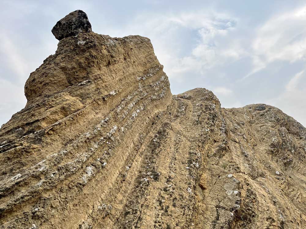
- Stratified rock along the trail on Wake Butte near Sunriver.
Wake Butte, 10 miles west of Sunriver, isn’t like most buttes in Central Oregon. It’s not a cinder cone, a shield volcano or a strato volcano.
The 0.9-mile out-and-back climbs the shoulder of Wake Butte with up-close views of stratified yellow rock. Along the way, it offers sweeping views of the forest, including Mount Bachelor and Broken Top. It’s also likely you’ll have the hike to yourself.
Earlier this week, my dog Juno and I climbed the butte during a brief respite from wildfire smoke. However, neither Mount Bachelor nor Broken Top was visible. The smoke cloaked the hills, bestowing a different, sinister beauty.
Author Scott Cook likens the distinctly Southwest geology of Wake Butte to Fort Rock in the second edition of his book “Bend, Overall (Hiking and Exploring Central Oregon).” According to Cook, both were formed by palagonite tuff, a result of upwelling magma encountering groundwater on its way to the Earth’s surface.
The angled layering of the rock formations is remarkably different from Central Oregon’s typical geology. And the hike has significant elevation for its short distance, at 311 feet, according to AllTrails.
Explore more: Hike to one of the Cascades lakes
Other than the brown sign pointing to the turn-off for the parking lot on Forest Road 40, the trail is neither well-marked nor well-maintained. I depended on a downloaded map with GPS from AllTrails to point me in the right direction during several occasions when it was unclear which way to go.
Juno confidently led me toward the last 20 feet of the trail, which wasn’t remarkably different from what we had seen up until that point. Another well-trodden path continued up the butte, which I was convinced was the correct course, so I guided us further upward.
Ten minutes later, I came across another junction at which the best path forward was unclear. It was at that point that I checked the map and realized I had overshot the trail’s conclusion.
My lesson learned, I trusted Juno’s canine intuition on the way back.
Ray Atkeson Memorial Trail ‘has a beauty all its own’
Head to Sunriver on Highway 97. Take Exit 153 and then the second exit at the roundabout to stay on Century Drive. Go through the stoplight and continue straight for about four miles. The road becomes Forest Road 40 and there will be a sign indicating the turn-off for the parking lot.


Best of the Best of Bend 2025

-
-
-