Mountain biking at Sandy Ridge
Published 5:56 am Thursday, April 20, 2017
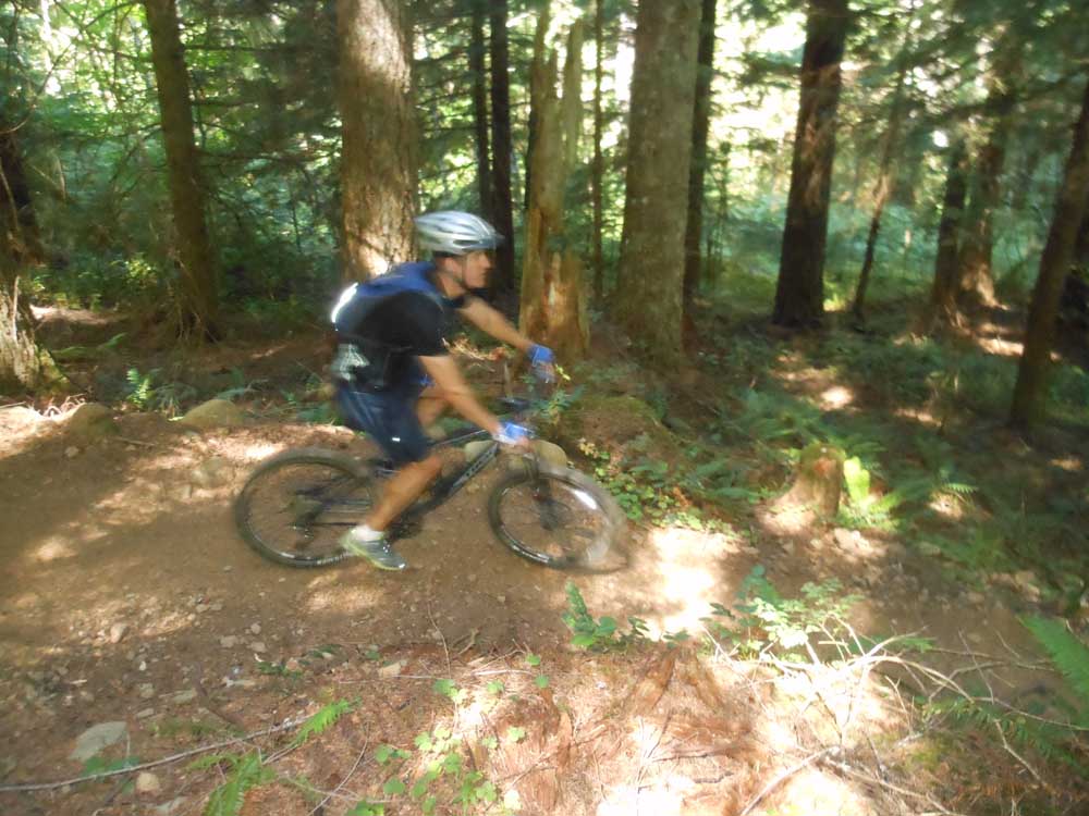
- A mountain biker descends a trail at Sandy Ridge.
The popular Sandy Ridge Trail System east of Portland was built with a distinctive downhill/freeride flavor. The 3½-mile climb to the upper trailhead at Sandy Ridge is well worth the time and effort, as numerous singletrack loop options give mountain bikers a chance to enjoy a variety of trails before letting gravity completely take over on a 1,300-foot descent. Located 12 miles east of Sandy just off U.S. Highway 26 — about 125 miles from Bend — the Sandy Ridge Trail System is a joint project among the Bureau of Land Management, the International Mountain Bicycling Association and the Northwest Trail Alliance. Those groups have worked since 2007 to design and build the network to meet the growing demand for mountain biking opportunities near the Portland area.
— Mark Morical, The Bulletin
Trending
Directions: From Bend, take U.S. Highways 97 and 26 north and northwest toward Portland. Just past the unincorporated community of Brightwood, make a turn right onto Sleepy Hollow Drive. After a third of a mile, make another right on Barlow Trail Road. After about a mile, the sign for the Sandy Ridge Trailhead is on the left (about a 2½-hour drive from Bend).
Distance: Ten trails of varying difficulties total about 15 miles.
Rating: Aerobically moderate to strenuous and technically intermediate to advanced. (Easy trails are accessible at the bottom trailhead.)
Marketplace
Enter the $5,000 Sweepstakes

-
eEdition

-

-